


You also want an ePaper? Increase the reach of your titles
YUMPU automatically turns print PDFs into web optimized ePapers that Google loves.
102 Chapter 6: Middleton Fell<br />
Barbon Beck<br />
Barbon Beck flows for 10km through <strong>the</strong> magnificent<br />
valley <strong>of</strong> Barbondale, with <strong>the</strong> steep scree and grass<br />
slopes below Calf Top to <strong>the</strong> west and <strong>the</strong> less steep,<br />
peaty moorland below Crag Hill (682m) to <strong>the</strong> east. <strong>The</strong><br />
beginnings <strong>of</strong> Barbon Beck are interesting to explore<br />
although what exactly is seen depends upon <strong>the</strong> amount<br />
<strong>of</strong> recent rain. Normally, <strong>the</strong> beck appears to arise<br />
hesitantly as Barkin Beck, 3km within <strong>the</strong> Yorkshire<br />
Dales boundary, beside <strong>the</strong> road to Dentdale. Before<br />
reaching <strong>the</strong> boundary it usually disappears and restarts<br />
a few times. Our suspected explanation for this is<br />
confirmed by an examination <strong>of</strong> <strong>the</strong> Short Gill tributary,<br />
which forms <strong>the</strong> Dales boundary from Crag Hill.<br />
Short Gill runs contentedly in a deep gorge <strong>of</strong> grey<br />
slate, stained brown with peat, over a series <strong>of</strong> waterfalls<br />
until, 100m above Barkin Beck, it crosses a clear ridge<br />
<strong>of</strong> limestone and enters a canyon that is eerily silent. All<br />
<strong>the</strong> water disappears through <strong>the</strong> limestone. <strong>The</strong> line <strong>of</strong><br />
limestone continues on <strong>the</strong> eastern slopes <strong>of</strong> Barbondale<br />
but <strong>the</strong>re is no limestone to be seen on <strong>the</strong> western slopes,<br />
<strong>the</strong> grey scree being <strong>of</strong> <strong>the</strong> Silurian slate that we saw in<br />
<strong>the</strong> Howgills. <strong>The</strong> transition from limestone to slate can<br />
be clearly seen in <strong>the</strong> walls by <strong>the</strong> roadside, from <strong>the</strong><br />
white-grey limestone to <strong>the</strong> north to <strong>the</strong> dark-grey slate<br />
to <strong>the</strong> south.<br />
We are on <strong>the</strong> continuation <strong>of</strong> <strong>the</strong> Dent Fault, as you<br />
may have anticipated. Here, <strong>the</strong> upheavals <strong>of</strong> 300m years<br />
ago turned <strong>the</strong> limestone beds into a roughly vertical<br />
position and today Short Gill provides <strong>the</strong> best examples<br />
in England <strong>of</strong> caves formed in vertical limestone. About<br />
200m south <strong>of</strong> Short Gill Bridge, a large resurgence<br />
from under a limestone outcrop joins Barkin Beck,<br />
which is usually dry at this point. This I assume to be<br />
<strong>the</strong> lost waters <strong>of</strong> Short Gill, which <strong>the</strong>refore ought to be<br />
regarded as <strong>the</strong> major source <strong>of</strong> Barbon Beck, which is<br />
at last properly established.<br />
<strong>The</strong> beck here is a favourite haunt <strong>of</strong> <strong>the</strong> wren, which<br />
we tend to think <strong>of</strong> as a bird <strong>of</strong> <strong>the</strong> garden and woodland.<br />
<strong>The</strong>y delight in flitting in and out <strong>of</strong> <strong>the</strong> crevices and<br />
Right: Barbondale from Barbon Low Fell.<br />
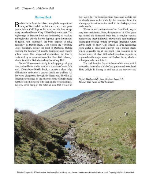
Below: <strong>The</strong> head <strong>of</strong> Barbondale.<br />
This is Chapter 6 <strong>of</strong> <strong>The</strong> <strong>Land</strong> <strong>of</strong> <strong>the</strong> <strong>Lune</strong> (2nd edition), http://www.drakkar.co.uk/land<strong>of</strong><strong>the</strong>lune.html, Copyright © 2010 John Self

