


You also want an ePaper? Increase the reach of your titles
YUMPU automatically turns print PDFs into web optimized ePapers that Google loves.
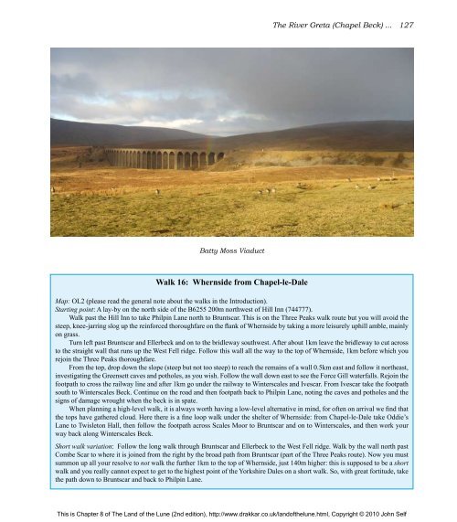
Batty Moss Viaduct<br />
Walk 16: Whernside from Chapel-le-Dale<br />
<strong>The</strong> River Greta (Chapel Beck) ... 127<br />
Map: OL2 (please read <strong>the</strong> general note about <strong>the</strong> walks in <strong>the</strong> Introduction).<br />
Starting point: A lay-by on <strong>the</strong> north side <strong>of</strong> <strong>the</strong> B6255 200m northwest <strong>of</strong> Hill Inn (744777).<br />
Walk past <strong>the</strong> Hill Inn to take Philpin Lane north to Bruntscar. This is on <strong>the</strong> Three Peaks walk route but you will avoid <strong>the</strong><br />
steep, knee-jarring slog up <strong>the</strong> reinforced thoroughfare on <strong>the</strong> flank <strong>of</strong> Whernside by taking a more leisurely uphill amble, mainly<br />
on grass.<br />
Turn left past Bruntscar and Ellerbeck and on to <strong>the</strong> bridleway southwest. After about 1km leave <strong>the</strong> bridleway to cut across<br />
to <strong>the</strong> straight wall that runs up <strong>the</strong> West Fell ridge. Follow this wall all <strong>the</strong> way to <strong>the</strong> top <strong>of</strong> Whernside, 1km before which you<br />
rejoin <strong>the</strong> Three Peaks thoroughfare.<br />
From <strong>the</strong> top, drop down <strong>the</strong> slope (steep but not too steep) to reach <strong>the</strong> remains <strong>of</strong> a wall 0.5km east and follow it nor<strong>the</strong>ast,<br />
investigating <strong>the</strong> Greensett caves and potholes, as you wish. Follow <strong>the</strong> wall down east to see <strong>the</strong> Force Gill waterfalls. Rejoin <strong>the</strong><br />
footpath to cross <strong>the</strong> railway line and after 1km go under <strong>the</strong> railway to Winterscales and Ivescar. From Ivescar take <strong>the</strong> footpath<br />
south to Winterscales Beck. Continue on <strong>the</strong> road and <strong>the</strong>n footpath back to Philpin Lane, noting <strong>the</strong> caves and potholes and <strong>the</strong><br />
signs <strong>of</strong> damage wrought when <strong>the</strong> beck is in spate.<br />
When planning a high-level walk, it is always worth having a low-level alternative in mind, for <strong>of</strong>ten on arrival we find that<br />
<strong>the</strong> tops have ga<strong>the</strong>red cloud. Here <strong>the</strong>re is a fine loop walk under <strong>the</strong> shelter <strong>of</strong> Whernside: from Chapel-le-Dale take Oddie’s<br />
Lane to Twisleton Hall, <strong>the</strong>n follow <strong>the</strong> footpath across Scales Moor to Bruntscar and on to Winterscales, and <strong>the</strong>n work your<br />
way back along Winterscales Beck.<br />
Short walk variation: Follow <strong>the</strong> long walk through Bruntscar and Ellerbeck to <strong>the</strong> West Fell ridge. Walk by <strong>the</strong> wall north past<br />
Combe Scar to where it is joined from <strong>the</strong> right by <strong>the</strong> broad path from Bruntscar (part <strong>of</strong> <strong>the</strong> Three Peaks route). Now you must<br />
summon up all your resolve to not walk <strong>the</strong> fur<strong>the</strong>r 1km to <strong>the</strong> top <strong>of</strong> Whernside, just 140m higher: this is supposed to be a short<br />
walk and you really cannot expect to get to <strong>the</strong> highest point <strong>of</strong> <strong>the</strong> Yorkshire Dales on a short walk. So, with great fortitude, take<br />
<strong>the</strong> path down to Bruntscar and back to Philpin Lane.<br />
This is Chapter 8 <strong>of</strong> <strong>The</strong> <strong>Land</strong> <strong>of</strong> <strong>the</strong> <strong>Lune</strong> (2nd edition), http://www.drakkar.co.uk/land<strong>of</strong><strong>the</strong>lune.html, Copyright © 2010 John Self

