


You also want an ePaper? Increase the reach of your titles
YUMPU automatically turns print PDFs into web optimized ePapers that Google loves.
242 Chapter 15: Into Morecambe Bay<br />
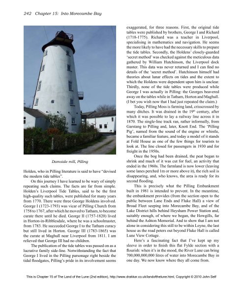
Damside mill, Pilling<br />
Holden, who in Pilling literature is said to have “devised<br />
<strong>the</strong> modern tide tables”.<br />
On this journey I have learned to be wary <strong>of</strong> simply<br />
repeating such claims. <strong>The</strong> facts are far from simple.<br />
Holden’s Liverpool Tide Tables, said to be <strong>the</strong> first<br />
high-quality such tables, were published for many years<br />
from 1770. <strong>The</strong>re were three George Holdens involved.<br />
George I (1723-1793) was vicar <strong>of</strong> Pilling Church from<br />
1758 to 1767, after which he moved to Tatham, to become<br />
curate <strong>the</strong>re until he died. George II (1757-1820) lived<br />
in Horton-in-Ribblesdale, where he was a schoolmaster,<br />
from 1783. He succeeded George I to <strong>the</strong> Tatham curacy<br />
but still lived in Horton. George III (1783-1865) was<br />
<strong>the</strong> curate at Maghull near Liverpool from 1811. I am<br />
relieved that George III had no children.<br />
<strong>The</strong> publication <strong>of</strong> <strong>the</strong> tide tables was passed on as a<br />
lucrative family side-line. Notwithstanding <strong>the</strong> fact that<br />
George I lived in <strong>the</strong> Pilling parsonage right beside <strong>the</strong><br />
tidal floodgates, Pilling’s pride in its involvement seems<br />
exaggerated, for three reasons. First, <strong>the</strong> original tide<br />
tables were published by bro<strong>the</strong>rs, George I and Richard<br />
(1718-1775). Richard was a teacher in Liverpool,<br />
specialising in ma<strong>the</strong>matics and navigation. He seems<br />
<strong>the</strong> more likely to have had <strong>the</strong> necessary skills to prepare<br />
<strong>the</strong> tide tables. Secondly, <strong>the</strong> Holdens’ closely-guarded<br />
‘secret method’ was checked against <strong>the</strong> meticulous data<br />
ga<strong>the</strong>red by William Hutchinson, <strong>the</strong> Liverpool dock<br />
master. This data was never returned and I can find no<br />
details <strong>of</strong> <strong>the</strong> ‘secret method’. Hutchinson himself had<br />
<strong>the</strong>ories about lunar effects on tides and <strong>the</strong> extent to<br />
which <strong>the</strong> Holdens were dependent upon him is unclear.<br />
Thirdly, none <strong>of</strong> <strong>the</strong> tide tables were produced while<br />
George I was actually in Pilling: <strong>the</strong> Georges beavered<br />
away on <strong>the</strong> tables while in Tatham, Horton and Maghull.<br />
(I bet you wish now that I had just repeated <strong>the</strong> claim.)<br />
Today, Pilling Moss is farming land, crisscrossed by<br />
many ditches. It was drained in <strong>the</strong> 19 th century, after<br />
which it was possible to lay a railway line across it in<br />
1870. <strong>The</strong> single-line track ran, ra<strong>the</strong>r informally, from<br />
Garstang to Pilling and, later, Knott End. <strong>The</strong> ‘Pilling<br />
Pig’, named from <strong>the</strong> sound <strong>of</strong> <strong>the</strong> engine or whistle,<br />
became a familiar feature, and today a model <strong>of</strong> it stands<br />
at Fold House as one <strong>of</strong> <strong>the</strong> few things for tourists to<br />
look at. <strong>The</strong> line closed for passengers in 1930 and for<br />
freight in <strong>the</strong> 1950s.<br />
Once <strong>the</strong> bog had been drained, <strong>the</strong> peat began to<br />
shrink and much <strong>of</strong> it was cut for fuel, an activity that<br />
ended in <strong>the</strong> 1960s. <strong>The</strong> farmland is now lower (leaving<br />
some lanes perched 1m or more above it), <strong>the</strong> rich soil is<br />
disappearing, and, who knows, <strong>the</strong> area is ready for its<br />
second flooding.<br />
This is precisely what <strong>the</strong> Pilling Embankment<br />
built in 1981 is intended to prevent. In <strong>the</strong> meantime,<br />
<strong>the</strong> embankment provides (from <strong>the</strong> section open to <strong>the</strong><br />
public between Lane Ends and Fluke Hall) a view <strong>of</strong><br />
Broad Fleet seeping into Morecambe Bay, and <strong>of</strong> <strong>the</strong><br />
Lake District hills behind Heysham Power Station and,<br />
suitably enough, <strong>of</strong> where we began, <strong>the</strong> Howgills, far<br />
behind <strong>the</strong> Ashton Memorial. And to show that I am not<br />
alone in considering this still to be within Loyne, <strong>the</strong> last<br />
house as <strong>the</strong> road peters out beyond Fluke Hall is called<br />
<strong>Lune</strong> View Cottage.<br />
Here’s a fascinating fact that I’ve kept up my<br />
sleeve in order to finish this flat Fylde section with a<br />
flourish: when it’s in <strong>the</strong> mood, <strong>the</strong> River <strong>Lune</strong> can bring<br />
700,000,000,000 litres <strong>of</strong> water into Morecambe Bay in<br />
one day. We now know where <strong>the</strong>y all come from.<br />
This is Chapter 15 <strong>of</strong> <strong>The</strong> <strong>Land</strong> <strong>of</strong> <strong>the</strong> <strong>Lune</strong> (2nd edition), http://www.drakkar.co.uk/land<strong>of</strong><strong>the</strong>lune.html, Copyright © 2010 John Self

