


Create successful ePaper yourself
Turn your PDF publications into a flip-book with our unique Google optimized e-Paper software.
Furnessford Bridge, although <strong>the</strong> 1847 OS map calls<br />
it Furnaceford Bridge. Below <strong>the</strong> bridge <strong>the</strong>re are no<br />
footpaths by <strong>the</strong> Hindburn, which is a pity as it runs<br />
prettily by steep cliffs over minor waterfalls. I hardly<br />
need to say what Mill Houses used to be but I ought<br />
to mention <strong>the</strong> nearby meadow on <strong>the</strong> footpath from<br />
Clear Beck Bridge. This meadow is too small to have<br />
been affected by modern agriculture and as a result is<br />
a Site <strong>of</strong> Special Scientific Interest for being “one <strong>of</strong><br />
<strong>the</strong> best examples <strong>of</strong> species-rich meadow grassland in<br />
Lancashire”. It is so rich, in fact, that over 130 species<br />
have been recorded.<br />
Clear Beck joins <strong>the</strong> Hindburn after Hindburn<br />
Bridge, running from Clearbeck House, which has<br />
a garden with follies, sculptures, a lake, and views <strong>of</strong><br />
Ingleborough. <strong>The</strong> house is one <strong>of</strong> about twenty studios<br />
on <strong>the</strong> <strong>Lune</strong>sdale Studio Trail, in which local artists open<br />
<strong>the</strong>ir studios each summer to enable visitors to see <strong>the</strong>ir<br />
work in paintings, textiles, prints, sculptures, mosaics,<br />
jewellery, ceramics, drawings and photography.<br />
Below Wray Bridge, <strong>the</strong> River Hindburn and <strong>the</strong><br />
River Roeburn come toge<strong>the</strong>r, as nature intends.<br />
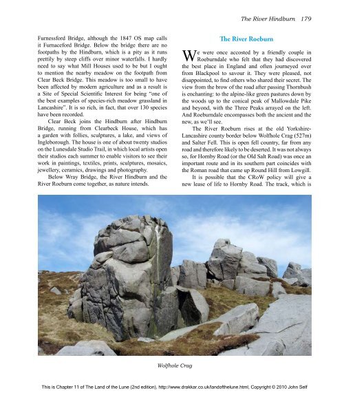
Wolfhole Crag<br />
<strong>The</strong> River Hindburn 179<br />
<strong>The</strong> River Roeburn<br />
We were once accosted by a friendly couple in<br />
Roeburndale who felt that <strong>the</strong>y had discovered<br />
<strong>the</strong> best place in England and <strong>of</strong>ten journeyed over<br />
from Blackpool to savour it. <strong>The</strong>y were pleased, not<br />
disappointed, to find o<strong>the</strong>rs who shared <strong>the</strong>ir secret. <strong>The</strong><br />
view from <strong>the</strong> brow <strong>of</strong> <strong>the</strong> road after passing Thornbush<br />
is enchanting: to <strong>the</strong> alpine-like green pastures down by<br />
<strong>the</strong> woods up to <strong>the</strong> conical peak <strong>of</strong> Mallowdale Pike<br />
and beyond, with <strong>the</strong> Three Peaks arrayed on <strong>the</strong> left.<br />
And Roeburndale encompasses both <strong>the</strong> ancient and <strong>the</strong><br />
new, as we’ll see.<br />
<strong>The</strong> River Roeburn rises at <strong>the</strong> old Yorkshire-<br />
Lancashire county border below Wolfhole Crag (527m)<br />
and Salter Fell. This is open fell country, far from any<br />
road and <strong>the</strong>refore likely to be deserted. It was not always<br />
so, for Hornby Road (or <strong>the</strong> Old Salt Road) was once an<br />
important route and in its sou<strong>the</strong>rn part coincides with<br />
<strong>the</strong> Roman road that came up Round Hill from Lowgill.<br />
It is possible that <strong>the</strong> CRoW policy will give a<br />
new lease <strong>of</strong> life to Hornby Road. <strong>The</strong> track, which is<br />
This is Chapter 11 <strong>of</strong> <strong>The</strong> <strong>Land</strong> <strong>of</strong> <strong>the</strong> <strong>Lune</strong> (2nd edition), http://www.drakkar.co.uk/land<strong>of</strong><strong>the</strong>lune.html, Copyright © 2010 John Self

