


You also want an ePaper? Increase the reach of your titles
YUMPU automatically turns print PDFs into web optimized ePapers that Google loves.
30 Chapter 1: Nor<strong>the</strong>rn Howgills and Orton Fells<br />
At its peak, <strong>the</strong> Loyne railway network consisted <strong>of</strong> eight<br />
lines, plus lines out <strong>of</strong> Loyne to places such as Carlisle,<br />
Kirkby Stephen, Skipton, Preston, Morecambe and<br />
Windermere:<br />
Tebay – Lancaster (1846-)<br />
Wennington – Lancaster (1849-1966)<br />
Clapham – Wennington (1850-)<br />
Newbiggin-on-<strong>Lune</strong> – Tebay (1861-1962)<br />
Lowgill – Clapham (1861-1964)<br />
Wennington – Carnforth (1867-)<br />
Settle – Carlisle (1876-)<br />
Lancaster – Glasson (1883-1930).<br />
We will encounter <strong>the</strong>se lines, derelict or alive, many<br />
times on our journey and some general comments are in<br />
order, not on <strong>the</strong> details that railway enthusiasts are fond <strong>of</strong><br />
but on <strong>the</strong> railways’ impact on Loyne.<br />
<strong>The</strong> building <strong>of</strong> <strong>the</strong> railways brought welcome<br />
employment but <strong>the</strong>y generally harmed local industry.<br />
This was almost entirely small-scale activity to meet local<br />
needs, such as basket-making, pottery, quarrying and coal<br />
mining. It became easier and cheaper to import coal from<br />
where it was plentiful, and while new markets were opened<br />
up for local products <strong>the</strong>y could not compete in terms <strong>of</strong><br />
price or quality with <strong>the</strong> outputs from <strong>the</strong> rapidly-growing<br />
industrial towns. Consequently <strong>the</strong>re was an exodus from<br />
<strong>the</strong> villages to those towns.<br />
<strong>The</strong> railways affected local transport. It was much<br />
cheaper to send beef by train than by ho<strong>of</strong>. <strong>The</strong>refore,<br />
<strong>the</strong> drove roads fell into disuse, along with <strong>the</strong> associated<br />
activities en route. O<strong>the</strong>rwise, most country tracks, used on<br />
foot or on horse, were not much affected until <strong>the</strong> advent<br />
<strong>of</strong> <strong>the</strong> car.<br />
Scenically, <strong>the</strong> railways have now merged into <strong>the</strong><br />
countryside and are fondly regarded. Derelict lines are <strong>of</strong>ten<br />
unnoticeable, except for structures such as <strong>the</strong> Lowgill<br />
Viaduct and Waterside Viaduct, which still impress us.<br />
<strong>The</strong>y must have been awesome in <strong>the</strong> 19 th century.<br />
if not pretty, sight. But Tebay cannot fully escape <strong>the</strong><br />
impact <strong>of</strong> its location in a traffic corridor. <strong>The</strong>re is an<br />
ever-present hum or roar, depending which way <strong>the</strong><br />
wind is blowing, from <strong>the</strong> motorway, broken frequently<br />
by <strong>the</strong> rattle <strong>of</strong> <strong>the</strong> London-Glasgow expresses.<br />
Beyond <strong>the</strong> motorway <strong>the</strong> <strong>Lune</strong> passes a mound that<br />
when glimpsed by motorway drivers might be assumed<br />
to be <strong>the</strong> remains <strong>of</strong> a slagheap. It is in reality what’s left<br />
<strong>of</strong> <strong>the</strong> motte <strong>of</strong> a Norman motte and bailey castle, now<br />
called Castle Howe. Such castles consisted <strong>of</strong> an artificial<br />
mound (<strong>the</strong> motte), with a wooden or stone building on<br />
top, and a larger enclosed yard (<strong>the</strong> bailey) containing<br />
stables, workshops, kitchens and perhaps a chapel. <strong>The</strong><br />
earth from ditches around <strong>the</strong> motte and bailey was used<br />
to create <strong>the</strong> motte.<br />
Castle Howe is <strong>the</strong> first <strong>of</strong> ten such remains that we<br />
will meet on our journey. <strong>The</strong> castles were built soon<br />
after <strong>the</strong> Norman Conquest to provide security against<br />
rebellious nor<strong>the</strong>rners. It seems that Loyne’s locals were<br />
not as obstreperous as elsewhere because its castles were<br />
at <strong>the</strong> smaller end <strong>of</strong> <strong>the</strong> scale <strong>of</strong> over five hundred such<br />
castles built in England. Mottes are typically from 3m to<br />
30m high, with Loyne’s being nearer <strong>the</strong> lower end <strong>of</strong><br />
<strong>the</strong> range. Also, <strong>the</strong>re are no remains <strong>of</strong> stone buildings<br />
on any <strong>of</strong> Loyne’s mottes, indicating that <strong>the</strong> more<br />
vulnerable wood was considered adequate.<br />
<strong>The</strong> Loyne castles were probably for <strong>the</strong> strategic<br />
and administrative use <strong>of</strong> landlords ra<strong>the</strong>r than for<br />
military garrisons. <strong>The</strong>y were built overlooking river<br />
valleys and close to fertile meadows. Castle Howe is<br />
<strong>the</strong> closest to <strong>the</strong> river itself and has lost half its motte<br />
to flood erosion. <strong>The</strong> motorway at least has swerved to<br />
avoid it, if only just. By Castle Howe <strong>the</strong> <strong>Lune</strong>, flowing<br />
west, meets Birk Beck, flowing east.<br />
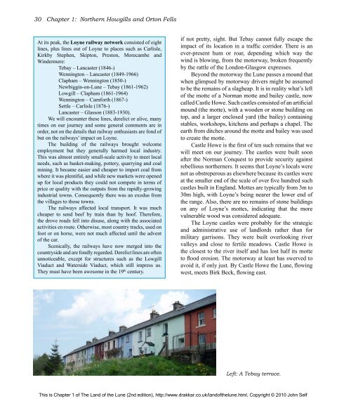
Left: A Tebay terrace.<br />
This is Chapter 1 <strong>of</strong> <strong>The</strong> <strong>Land</strong> <strong>of</strong> <strong>the</strong> <strong>Lune</strong> (2nd edition), http://www.drakkar.co.uk/land<strong>of</strong><strong>the</strong>lune.html, Copyright © 2010 John Self

