


Create successful ePaper yourself
Turn your PDF publications into a flip-book with our unique Google optimized e-Paper software.
150 Chapter 9: Gretadale and a little more <strong>Lune</strong>sdale<br />
difficulties <strong>of</strong> conservation policies. <strong>The</strong> building is a key<br />
part <strong>of</strong> <strong>the</strong> Melling Conservation Area, and <strong>the</strong> Lancaster<br />
District policy is that no pub or hotel will be converted<br />
to residential use unless it can be demonstrated to be no<br />
longer viable, even if, as in this case, it was originally<br />
a residence. No buyer could be found to sustain it as a<br />
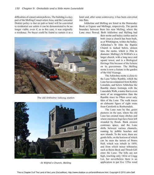
<strong>The</strong> old Arkholme railway station<br />
St Wilfrid’s Church, Melling<br />
hotel and, after some controversy, it has been converted<br />
into flats.<br />
Arkholme and Melling are listed in <strong>the</strong> Domesday<br />
Book as Ergune and Mellinge, respectively. <strong>The</strong> parish<br />
boundary between <strong>the</strong>m lies near Melling, where <strong>the</strong><br />
<strong>Lune</strong> once flowed. Both Arkholme and Melling had<br />
<strong>the</strong>ir motte and bailey castles and in<br />
both cases a church has been built,<br />
as at Whittington, within <strong>the</strong> bailey.<br />
Arkholme’s St John <strong>the</strong> Baptist<br />
Church is tucked below, almost<br />
into, <strong>the</strong> motte, which is 30m in<br />
diameter. Melling’s St Wilfrid’s is a<br />
larger church, with a long nave and<br />
square tower, and is a Biological<br />
Heritage Site because <strong>of</strong> <strong>the</strong> lichens<br />
on its gravestones. <strong>The</strong> Melling<br />
motte is now a feature in <strong>the</strong> garden<br />
<strong>of</strong> <strong>the</strong> Old Vicarage.<br />
<strong>The</strong> Arkholme motte is close to<br />
<strong>the</strong> <strong>Lune</strong> Valley Ramble, which <strong>the</strong><br />
<strong>Lune</strong> has accompanied from Kirkby<br />
Lonsdale, and below Arkholme <strong>the</strong><br />
Ramble shares footsteps with <strong>the</strong><br />
<strong>Lune</strong>sdale Walk, a name that is even<br />
more <strong>of</strong> an exaggeration than <strong>the</strong><br />
Ramble since its 59km cover only<br />
6km <strong>of</strong> <strong>the</strong> <strong>Lune</strong>. <strong>The</strong> walk traces<br />
an elaborate figure <strong>of</strong> eight route<br />
from Carnforth to Roeburndale.<br />
<strong>The</strong> <strong>Lune</strong> runs by flat, green<br />
pastures on <strong>the</strong> east, where <strong>the</strong> old<br />
<strong>Lune</strong> has created many ditches and<br />
where enormous logs have been left<br />
stranded by floods. Bank erosion<br />
continues apace, and <strong>the</strong> <strong>Lune</strong><br />
shifts between various channels,<br />
running by pebble beaches and<br />
new islands. To <strong>the</strong> west, <strong>the</strong>re are<br />
gentle hills, on <strong>the</strong> horizon <strong>of</strong> which<br />
can be seen <strong>the</strong> turrets <strong>of</strong> Storrs<br />
Hall, which was rebuilt in 1850,<br />
and from which minor tributaries<br />
such as Bains Beck and Thrush Gill<br />
enter <strong>the</strong> <strong>Lune</strong>. <strong>The</strong> hills are not<br />
high, reaching only 142m at Cragg<br />
Lot, but never<strong>the</strong>less <strong>the</strong>re is an<br />
application to put five 125m wind<br />
This is Chapter 9 <strong>of</strong> <strong>The</strong> <strong>Land</strong> <strong>of</strong> <strong>the</strong> <strong>Lune</strong> (2nd edition), http://www.drakkar.co.uk/land<strong>of</strong><strong>the</strong>lune.html, Copyright © 2010 John Self

