


Create successful ePaper yourself
Turn your PDF publications into a flip-book with our unique Google optimized e-Paper software.
68 Chapter 4: Upper Raw<strong>the</strong>ydale<br />
<strong>the</strong> Bendrigg Trust, a charity <strong>of</strong>fering outdoor activities<br />
for disabled people. Foggy Hill, however, is a tractor<br />
outlet, judging by <strong>the</strong> score or more shining new in <strong>the</strong><br />
yard. By <strong>the</strong> road <strong>the</strong>re is a paddock with a signpost<br />
announcing “Quaker Burial Ground”. It is completely<br />
empty (on <strong>the</strong> surface). This takes <strong>the</strong> Quaker’s unfussy<br />
approach to burial close to its logical conclusion, which<br />
it would reach if <strong>the</strong> signpost were removed.<br />
A farm name <strong>of</strong> Streetside and one fur<strong>the</strong>r north <strong>of</strong><br />
Street Farm and <strong>the</strong> name <strong>of</strong> Bluecaster will provoke<br />
speculation that this is <strong>the</strong> line <strong>of</strong> a Roman road. As far<br />
as I know, <strong>the</strong>re is no evidence on <strong>the</strong> ground for this, but<br />
on <strong>the</strong> o<strong>the</strong>r hand it is certain that <strong>the</strong> Romans had major<br />
and minor roads, as we do, and it would be surprising if<br />
<strong>the</strong>y did not take a short cut through Raw<strong>the</strong>ydale to get<br />
between <strong>the</strong>ir forts at Brough and Over Burrow.<br />
On <strong>the</strong> fell opposite <strong>the</strong>re’s a rougher track that goes<br />
up to Sprintgill and Murthwaite, home <strong>of</strong> <strong>the</strong> Murthwaite<br />
fell ponies, except that, being semi-wild in <strong>the</strong> Howgills,<br />
<strong>the</strong>y hardly have a home. <strong>The</strong>ir owner, Thomas Capstick,<br />
is a renowned photographer <strong>of</strong> fell ponies.<br />
As Sally Beck makes its way to <strong>the</strong> Raw<strong>the</strong>y we<br />
might pause to reflect on <strong>the</strong> significance <strong>of</strong> what we<br />
have seen on Baugh Fell, Swarth Fell and Wild Boar<br />
Fell. <strong>The</strong> craggy tops differ from <strong>the</strong> rounded hills <strong>of</strong> <strong>the</strong><br />
Howgills. <strong>The</strong>y are <strong>of</strong> millstone grit, below which is a<br />
layer <strong>of</strong> shale and sandstone above a limestone base. <strong>The</strong><br />
limestone gives rise to caves and potholes, which are<br />
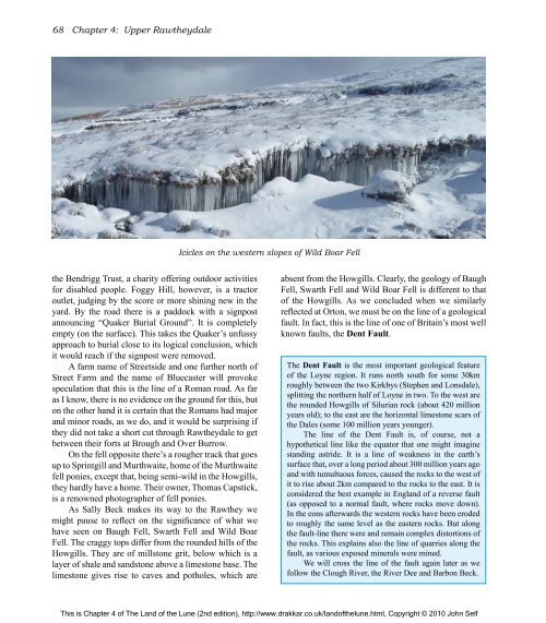
Icicles on <strong>the</strong> western slopes <strong>of</strong> Wild Boar Fell<br />
absent from <strong>the</strong> Howgills. Clearly, <strong>the</strong> geology <strong>of</strong> Baugh<br />
Fell, Swarth Fell and Wild Boar Fell is different to that<br />
<strong>of</strong> <strong>the</strong> Howgills. As we concluded when we similarly<br />
reflected at Orton, we must be on <strong>the</strong> line <strong>of</strong> a geological<br />
fault. In fact, this is <strong>the</strong> line <strong>of</strong> one <strong>of</strong> Britain’s most well<br />
known faults, <strong>the</strong> Dent Fault.<br />
<strong>The</strong> Dent Fault is <strong>the</strong> most important geological feature<br />
<strong>of</strong> <strong>the</strong> Loyne region. It runs north south for some 30km<br />
roughly between <strong>the</strong> two Kirkbys (Stephen and Lonsdale),<br />
splitting <strong>the</strong> nor<strong>the</strong>rn half <strong>of</strong> Loyne in two. To <strong>the</strong> west are<br />
<strong>the</strong> rounded Howgills <strong>of</strong> Silurian rock (about 420 million<br />
years old); to <strong>the</strong> east are <strong>the</strong> horizontal limestone scars <strong>of</strong><br />
<strong>the</strong> Dales (some 100 million years younger).<br />
<strong>The</strong> line <strong>of</strong> <strong>the</strong> Dent Fault is, <strong>of</strong> course, not a<br />
hypo<strong>the</strong>tical line like <strong>the</strong> equator that one might imagine<br />
standing astride. It is a line <strong>of</strong> weakness in <strong>the</strong> earth’s<br />
surface that, over a long period about 300 million years ago<br />
and with tumultuous forces, caused <strong>the</strong> rocks to <strong>the</strong> west <strong>of</strong><br />
it to rise about 2km compared to <strong>the</strong> rocks to <strong>the</strong> east. It is<br />
considered <strong>the</strong> best example in England <strong>of</strong> a reverse fault<br />
(as opposed to a normal fault, where rocks move down).<br />
In <strong>the</strong> eons afterwards <strong>the</strong> western rocks have been eroded<br />
to roughly <strong>the</strong> same level as <strong>the</strong> eastern rocks. But along<br />
<strong>the</strong> fault-line <strong>the</strong>re were and remain complex distortions <strong>of</strong><br />
<strong>the</strong> rocks. This explains also <strong>the</strong> line <strong>of</strong> quarries along <strong>the</strong><br />
fault, as various exposed minerals were mined.<br />
We will cross <strong>the</strong> line <strong>of</strong> <strong>the</strong> fault again later as we<br />
follow <strong>the</strong> Clough River, <strong>the</strong> River Dee and Barbon Beck.<br />
This is Chapter 4 <strong>of</strong> <strong>The</strong> <strong>Land</strong> <strong>of</strong> <strong>the</strong> <strong>Lune</strong> (2nd edition), http://www.drakkar.co.uk/land<strong>of</strong><strong>the</strong>lune.html, Copyright © 2010 John Self

