


Create successful ePaper yourself
Turn your PDF publications into a flip-book with our unique Google optimized e-Paper software.
196 Chapter 12: <strong>The</strong> <strong>Lune</strong> Floodplain and <strong>the</strong> Top <strong>of</strong> Bowland<br />
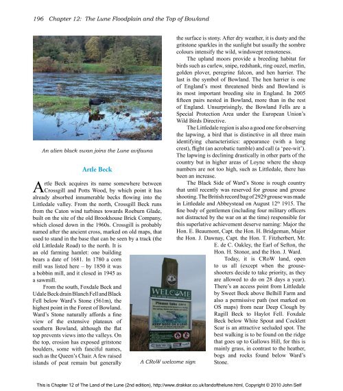
An alien black swan joins <strong>the</strong> <strong>Lune</strong> avifauna<br />
Artle Beck<br />
Artle Beck acquires its name somewhere between<br />
Crossgill and Potts Wood, by which point it has<br />
already absorbed innumerable becks flowing into <strong>the</strong><br />
Littledale valley. From <strong>the</strong> north, Crossgill Beck runs<br />
from <strong>the</strong> Caton wind turbines towards Roeburn Glade,<br />
built on <strong>the</strong> site <strong>of</strong> <strong>the</strong> old Brookhouse Brick Company,<br />
which closed down in <strong>the</strong> 1960s. Crossgill is probably<br />
named after <strong>the</strong> ancient cross, marked on old maps, that<br />
used to stand in <strong>the</strong> base that can be seen by a track (<strong>the</strong><br />
old Littledale Road) to <strong>the</strong> north. It is<br />
an old farming hamlet: one building<br />
bears a date <strong>of</strong> 1681. In 1780 a corn<br />
mill was listed here – by 1850 it was<br />
a bobbin mill, and it closed in 1945 as<br />
a sawmill.<br />
From <strong>the</strong> south, Foxdale Beck and<br />
Udale Beck drain Blanch Fell and Black<br />
Fell below Ward’s Stone (561m), <strong>the</strong><br />
highest point in <strong>the</strong> Forest <strong>of</strong> Bowland.<br />
Ward’s Stone naturally affords a fine<br />
view <strong>of</strong> <strong>the</strong> extensive plateaux <strong>of</strong><br />
sou<strong>the</strong>rn Bowland, although <strong>the</strong> flat<br />
top prevents views into <strong>the</strong> valleys. On<br />
<strong>the</strong> top, erosion has exposed gritstone<br />
boulders, some with fanciful names,<br />
such as <strong>the</strong> Queen’s Chair. A few raised<br />
islands <strong>of</strong> peat remain but generally<br />
A CRoW welcome sign<br />
<strong>the</strong> surface is stony. After dry wea<strong>the</strong>r, it is dusty and <strong>the</strong><br />
gritstone sparkles in <strong>the</strong> sunlight but usually <strong>the</strong> sombre<br />
colours intensify <strong>the</strong> wild, windswept remoteness.<br />
<strong>The</strong> upland moors provide a breeding habitat for<br />
birds such as curlew, snipe, redshank, ring ouzel, merlin,<br />
golden plover, peregrine falcon, and hen harrier. <strong>The</strong><br />
last is <strong>the</strong> symbol <strong>of</strong> Bowland. <strong>The</strong> hen harrier is one<br />
<strong>of</strong> England’s most threatened birds and Bowland is<br />
its most important breeding site in England. In 2005<br />
fifteen pairs nested in Bowland, more than in <strong>the</strong> rest<br />
<strong>of</strong> England. Unsurprisingly, <strong>the</strong> Bowland Fells are a<br />
Special Protection Area under <strong>the</strong> European Union’s<br />
Wild Birds Directive.<br />
<strong>The</strong> Littledale region is also a good one for observing<br />
<strong>the</strong> lapwing, a bird that is distinctive in all three main<br />
identifying characteristics: appearance (with a long<br />
crest), flight (an acrobatic tumble) and call (a ‘pee-wit’).<br />
<strong>The</strong> lapwing is declining drastically in o<strong>the</strong>r parts <strong>of</strong> <strong>the</strong><br />
country but in higher areas <strong>of</strong> Loyne where <strong>the</strong> sheep<br />
numbers are not too high, such as Littledale, <strong>the</strong>re has<br />
been an increase.<br />
<strong>The</strong> Black Side <strong>of</strong> Ward’s Stone is rough country<br />
that until recently was reserved for grouse and grouse<br />
shooting. <strong>The</strong> British record bag <strong>of</strong> 2929 grouse was made<br />
in Littledale and Abbeystead on August 12th 1915. <strong>The</strong><br />
fine body <strong>of</strong> gentlemen (including four military <strong>of</strong>ficers<br />
not distracted by <strong>the</strong> war on at <strong>the</strong> time) responsible for<br />
this superlative achievement deserve naming: Major <strong>the</strong><br />
Hon. E. Beaumont, Capt. <strong>the</strong> Hon. H. Bridgeman, Major<br />
<strong>the</strong> Hon. J. Dawnay, Capt. <strong>the</strong> Hon. T. Fitzherbert, Mr.<br />
E. de C. Oakley, <strong>the</strong> Earl <strong>of</strong> Sefton, <strong>the</strong><br />
Hon. H. Stonor, and <strong>the</strong> Hon. J. Ward.<br />
Today, it is CRoW land, open<br />
to us all (except when <strong>the</strong> grouseshooters<br />
decide to take priority, as <strong>the</strong>y<br />
are allowed to do on 28 days a year).<br />
<strong>The</strong>re’s an access point from Littledale<br />
by Sweet Beck above Belhill Farm and<br />
also a permissive path (not marked on<br />
OS maps) from near Deep Clough by<br />
Ragill Beck to Haylot Fell. Foxdale<br />
Beck below White Spout and Cocklett<br />
Scar is an attractive secluded spot. <strong>The</strong><br />
best walking is to be found on <strong>the</strong> ridge<br />
that goes up to Gallows Hill, for this is<br />
mainly grass, in contrast to <strong>the</strong> hea<strong>the</strong>r,<br />
bogs and rocks found below Ward’s<br />
Stone.<br />
This is Chapter 12 <strong>of</strong> <strong>The</strong> <strong>Land</strong> <strong>of</strong> <strong>the</strong> <strong>Lune</strong> (2nd edition), http://www.drakkar.co.uk/land<strong>of</strong><strong>the</strong>lune.html, Copyright © 2010 John Self

