


Create successful ePaper yourself
Turn your PDF publications into a flip-book with our unique Google optimized e-Paper software.
that <strong>the</strong>re was a large local community to carry out this<br />
arduous work.<br />
This is supported by extensive finds <strong>of</strong> Neolithic<br />
implements and <strong>the</strong> discovery <strong>of</strong> ancient earthworks<br />
around Nateby. Today, <strong>the</strong> gentle undulations in <strong>the</strong><br />
fields appear unremarkable but aerial photographs reveal<br />
various regular shapes, such as a 200m-diameter henge<br />
dated to about 2500 BC. Many Bronze Age remains have<br />
been found north <strong>of</strong> Nateby.<br />
With <strong>the</strong> forest removed, <strong>the</strong> region became<br />
heathland but after <strong>the</strong> climate became damper in about<br />
1400 BC it slowly turned into a bog, a process thought<br />
to have been complete by 800 BC. Old tracks, formed<br />
by laying down tree trunks to cross <strong>the</strong> bog, have been<br />
dated to that time. Over <strong>the</strong> centuries, layers <strong>of</strong> peat were<br />
formed, <strong>the</strong> first 1m or so being <strong>of</strong> rough peat, from <strong>the</strong><br />
heathland vegetation, and <strong>the</strong>n up to 4m <strong>of</strong> s<strong>of</strong>ter peat,<br />
mainly from sphagnum moss. <strong>The</strong> extent <strong>of</strong> <strong>the</strong> bog can<br />
be judged by <strong>the</strong> place names on today’s map: I counted<br />
eight Moss Sides and three Moss Edges surrounding an<br />
area <strong>of</strong> about 25 sq km.<br />
During <strong>the</strong> investigations <strong>of</strong> <strong>the</strong> Nateby earthworks<br />
a Roman road (or by-road) was discovered. It has been<br />
traced to join <strong>the</strong> Roman road that we’ve followed<br />
south from Lancaster and is believed to have continued<br />
west, south <strong>of</strong> Pilling Moss, to meet a port on <strong>the</strong> River<br />
Wyre. In <strong>the</strong> following centuries, habitation was limited<br />
to <strong>the</strong> drumlins raised a metre or two above <strong>the</strong> bog.<br />
Many farmsteads were drolly given a name with ‘hill’<br />
in it. Unsurprisingly, <strong>the</strong>re are few old buildings <strong>of</strong><br />
architectural merit. For example, <strong>the</strong> village <strong>of</strong> Nateby,<br />
mainly a row <strong>of</strong> semi-detached houses today, was little<br />
more than a church a century ago. <strong>The</strong> new buildings in<br />
<strong>the</strong> region are mostly <strong>of</strong> red brick.<br />
Pilling, however, is an old village, being owned by<br />
Cockersand Abbey in <strong>the</strong> 12 th century and passing to <strong>the</strong><br />
Pilling from Lane Ends<br />
Broad Fleet 241<br />
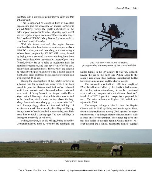
<strong>The</strong> wea<strong>the</strong>r-vane at Island House<br />
(exaggerating <strong>the</strong> steepness <strong>of</strong> <strong>the</strong> island a little)<br />
Dalton family in <strong>the</strong> 16 th century. It was very isolated,<br />
having <strong>the</strong> sea to <strong>the</strong> north and Pilling Moss to <strong>the</strong><br />
south. <strong>The</strong>re are only two buildings that interrupt <strong>the</strong> flat<br />
horizons: Damside mill and <strong>the</strong> church steeple.<br />
<strong>The</strong> windmill was built in 1808 to a height <strong>of</strong><br />
22m, <strong>the</strong> tallest in Fylde. By <strong>the</strong> 1940s it had become<br />
derelict but, ra<strong>the</strong>r miraculously, it has been restored<br />
as a residence, complete with a traditional ‘boat top’,<br />
installed in 2007. It puts into perspective a proposal for<br />
two 125m wind turbines at Eagland Hill, which was<br />
rejected in 2008.<br />
<strong>The</strong> steeple belongs to <strong>the</strong> St John <strong>the</strong> Baptist<br />
Church built in 1887 by Paley and Austin again. Here,<br />
<strong>the</strong>y not only tackled <strong>the</strong> novelty (for Loyne) <strong>of</strong> a steeple<br />
but enlivened it by using different coloured stones, such<br />
as pink ones for <strong>the</strong> parapet. <strong>The</strong> church replaced one<br />
that still stands in <strong>the</strong> field behind, with a date <strong>of</strong> 1717<br />
over <strong>the</strong> door and a sundial bearing <strong>the</strong> name <strong>of</strong> George<br />
This is Chapter 15 <strong>of</strong> <strong>The</strong> <strong>Land</strong> <strong>of</strong> <strong>the</strong> <strong>Lune</strong> (2nd edition), http://www.drakkar.co.uk/land<strong>of</strong><strong>the</strong>lune.html, Copyright © 2010 John Self

