


You also want an ePaper? Increase the reach of your titles
YUMPU automatically turns print PDFs into web optimized ePapers that Google loves.
178 Chapter 11: Wenningdale, Hindburndale and Roeburndale<br />
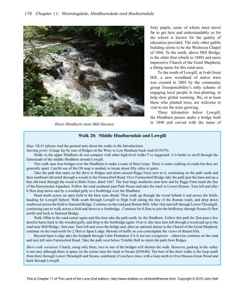
River Hindburn near Mill Houses<br />
Walk 20: Middle Hindburndale and Lowgill<br />
forty pupils, some <strong>of</strong> whom must travel<br />
far to get here and understandably so for<br />
<strong>the</strong> school is known for <strong>the</strong> quality <strong>of</strong><br />
education provided. <strong>The</strong> only o<strong>the</strong>r public<br />
building seems to be <strong>the</strong> Wesleyan Chapel<br />
<strong>of</strong> 1866. To <strong>the</strong> north, above Mill Bridge,<br />
is <strong>the</strong> older (but rebuilt in 1888) and more<br />
impressive Church <strong>of</strong> <strong>the</strong> Good Shepherd,<br />
a fitting name for this rural area.<br />
To <strong>the</strong> south <strong>of</strong> Lowgill, at Ivah Great<br />
Hill, a new woodland <strong>of</strong> native trees<br />
was created in 2003 by <strong>the</strong> community<br />
group Treesponsibility’s nifty scheme <strong>of</strong><br />
engaging local people in tree-planting, to<br />
help slow global warming. We, or at least<br />
those who planted trees, are welcome to<br />
visit to see <strong>the</strong> trees growing.<br />
Three kilometres below Lowgill,<br />
<strong>the</strong> Hindburn passes under a bridge built<br />
in 1840 and carved with <strong>the</strong> name <strong>of</strong><br />
Map: OL41 (please read <strong>the</strong> general note about <strong>the</strong> walks in <strong>the</strong> Introduction).<br />
Starting point: A large lay-by east <strong>of</strong> Ridges on <strong>the</strong> Wray to Low Bentham back road (633679).<br />
Walks in <strong>the</strong> upper Hindburn do not compare with o<strong>the</strong>r high-level walks I’ve suggested: it is better to stroll through <strong>the</strong><br />
farmsteads <strong>of</strong> <strong>the</strong> middle Hindburn around Lowgill.<br />
This walk uses four bridges over <strong>the</strong> Hindburn to make a route <strong>of</strong> three loops. <strong>The</strong>re is some walking on roads but <strong>the</strong>y are<br />
generally quiet. Careful use <strong>of</strong> <strong>the</strong> OS map is needed, to locate about fifty stiles or gates.<br />
Take <strong>the</strong> path that starts on <strong>the</strong> drive to Ridges and skirts around Riggs Farm next to it, continuing on <strong>the</strong> path south and<br />
<strong>the</strong>n sou<strong>the</strong>ast (diverted through a wood) to <strong>the</strong> Furnessford Road. Over Furnessford Bridge take <strong>the</strong> path past <strong>the</strong> barn and up a<br />
fine old track through <strong>the</strong> wood to Birks Farm, dated 1667. <strong>The</strong> four large manholes seen here and by Riggs Farm mark <strong>the</strong> line<br />
<strong>of</strong> <strong>the</strong> Haweswater Aqueduct. Follow <strong>the</strong> road sou<strong>the</strong>ast past Park House and take <strong>the</strong> track to Lower Houses. Turn left and after<br />
0.5km drop down east by a wooded gully to a footbridge over <strong>the</strong> Hindburn.<br />
Head south across an open field to <strong>the</strong> barn seen ahead. <strong>The</strong>n walk up through <strong>the</strong> wood behind it and across <strong>the</strong> fields,<br />
heading for Lowgill School. Walk south through Lowgill to High Ivah (along <strong>the</strong> line <strong>of</strong> <strong>the</strong> Roman road), and drop down<br />
southwest across <strong>the</strong> field to Stairend Bridge. Continue on <strong>the</strong> road past Botton Mill. After 1km turn left through Lower Thrushgill,<br />
continuing east to walk across a field and down to a footbridge. Continue for 0.5km to join <strong>the</strong> bridleway through Swans (0.5km<br />
north) and back to Stairend Bridge.<br />
Walk 100m to <strong>the</strong> road corner again and this time take <strong>the</strong> path north, by <strong>the</strong> Hindburn. Follow this path for 2km past a few<br />
derelict barns back to <strong>the</strong> wooded gully, and drop to <strong>the</strong> footbridge again. Over it, this time turn left through a wood and up to <strong>the</strong><br />
road near Mill Bridge, 1km east. Turn left and cross <strong>the</strong> bridge and, after an optional detour to <strong>the</strong> Church <strong>of</strong> <strong>the</strong> Good Shepherd,<br />
continue on <strong>the</strong> road north for 2.5km to Spen Lodge. Beware <strong>of</strong> traffic as you contemplate <strong>the</strong> views <strong>of</strong> distant hills.<br />
Beyond Spen Lodge take <strong>the</strong> footpath through Little Plantation if it is not too overgrown – o<strong>the</strong>rwise continue on <strong>the</strong> road<br />
and turn left onto Furnessford Road. Take <strong>the</strong> path west below Trimble Hall to rejoin <strong>the</strong> path from Ridges.<br />
Short walk variation: Clearly, using only three, two or one <strong>of</strong> <strong>the</strong> bridges will shorten <strong>the</strong> walk. However, parking in <strong>the</strong> valley<br />
is not easy although <strong>the</strong>re is space on <strong>the</strong> corner near <strong>the</strong> track to Swans (655640). <strong>The</strong> best <strong>of</strong> <strong>the</strong> short walks is <strong>the</strong> loop south<br />
from <strong>the</strong>re through Lower Thrushgill and Swans, combined, if you have time, with a loop north to Over Houses Great Wood and<br />
back through Lowgill.<br />
This is Chapter 11 <strong>of</strong> <strong>The</strong> <strong>Land</strong> <strong>of</strong> <strong>the</strong> <strong>Lune</strong> (2nd edition), http://www.drakkar.co.uk/land<strong>of</strong><strong>the</strong>lune.html, Copyright © 2010 John Self

