


You also want an ePaper? Increase the reach of your titles
YUMPU automatically turns print PDFs into web optimized ePapers that Google loves.
162 Chapter 10: <strong>The</strong> Wenning Headwaters<br />
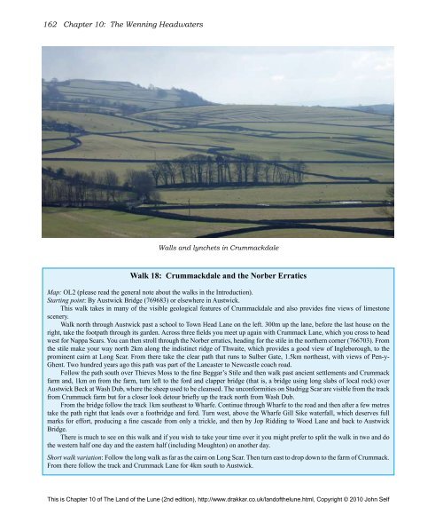
Walls and lynchets in Crummackdale<br />
Walk 18: Crummackdale and <strong>the</strong> Norber Erratics<br />
Map: OL2 (please read <strong>the</strong> general note about <strong>the</strong> walks in <strong>the</strong> Introduction).<br />
Starting point: By Austwick Bridge (769683) or elsewhere in Austwick.<br />
This walk takes in many <strong>of</strong> <strong>the</strong> visible geological features <strong>of</strong> Crummackdale and also provides fine views <strong>of</strong> limestone<br />
scenery.<br />
Walk north through Austwick past a school to Town Head Lane on <strong>the</strong> left. 300m up <strong>the</strong> lane, before <strong>the</strong> last house on <strong>the</strong><br />
right, take <strong>the</strong> footpath through its garden. Across three fields you meet up again with Crummack Lane, which you cross to head<br />
west for Nappa Scars. You can <strong>the</strong>n stroll through <strong>the</strong> Norber erratics, heading for <strong>the</strong> stile in <strong>the</strong> nor<strong>the</strong>rn corner (766703). From<br />
<strong>the</strong> stile make your way north 2km along <strong>the</strong> indistinct ridge <strong>of</strong> Thwaite, which provides a good view <strong>of</strong> Ingleborough, to <strong>the</strong><br />
prominent cairn at Long Scar. From <strong>the</strong>re take <strong>the</strong> clear path that runs to Sulber Gate, 1.5km nor<strong>the</strong>ast, with views <strong>of</strong> Pen-y-<br />
Ghent. Two hundred years ago this path was part <strong>of</strong> <strong>the</strong> Lancaster to Newcastle coach road.<br />
Follow <strong>the</strong> path south over Thieves Moss to <strong>the</strong> fine Beggar’s Stile and <strong>the</strong>n walk past ancient settlements and Crummack<br />
farm and, 1km on from <strong>the</strong> farm, turn left to <strong>the</strong> ford and clapper bridge (that is, a bridge using long slabs <strong>of</strong> local rock) over<br />
Austwick Beck at Wash Dub, where <strong>the</strong> sheep used to be cleansed. <strong>The</strong> unconformities on Studrigg Scar are visible from <strong>the</strong> track<br />
from Crummack farm but for a closer look detour briefly up <strong>the</strong> track north from Wash Dub.<br />
From <strong>the</strong> bridge follow <strong>the</strong> track 1km sou<strong>the</strong>ast to Wharfe. Continue through Wharfe to <strong>the</strong> road and <strong>the</strong>n after a few metres<br />
take <strong>the</strong> path right that leads over a footbridge and ford. Turn west, above <strong>the</strong> Wharfe Gill Sike waterfall, which deserves full<br />
marks for effort, producing a fine cascade from only a trickle, and <strong>the</strong>n by Jop Ridding to Wood Lane and back to Austwick<br />
Bridge.<br />
<strong>The</strong>re is much to see on this walk and if you wish to take your time over it you might prefer to split <strong>the</strong> walk in two and do<br />
<strong>the</strong> western half one day and <strong>the</strong> eastern half (including Moughton) on ano<strong>the</strong>r day.<br />
Short walk variation: Follow <strong>the</strong> long walk as far as <strong>the</strong> cairn on Long Scar. <strong>The</strong>n turn east to drop down to <strong>the</strong> farm <strong>of</strong> Crummack.<br />
From <strong>the</strong>re follow <strong>the</strong> track and Crummack Lane for 4km south to Austwick.<br />
This is Chapter 10 <strong>of</strong> <strong>The</strong> <strong>Land</strong> <strong>of</strong> <strong>the</strong> <strong>Lune</strong> (2nd edition), http://www.drakkar.co.uk/land<strong>of</strong><strong>the</strong>lune.html, Copyright © 2010 John Self

