- Page 1 and 2:
Risk Management SeriesDesign Guidef
- Page 3 and 4:
Any opinions, findings, conclusions
- Page 5 and 6:
ational during and after a major di
- Page 7 and 8:
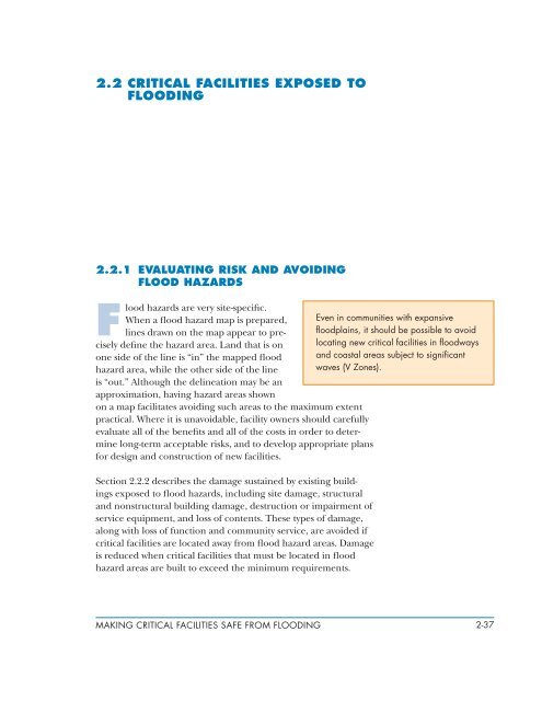
TARGET AUDIENCEThis manual describe
- Page 9 and 10:
Appendix A contains a list of acron
- Page 11 and 12:
Forster, FEMA; David Godschalk, Uni
- Page 13 and 14:
Chapter 2- Making Critical faciliti
- Page 15:
2.4.6 Utility Installations .......
- Page 19 and 20:
4.4.8 Utility Plumbing Systems.....
- Page 21 and 22:
avoid them when feasible. In cases
- Page 23 and 24:
It then crossed Florida into the Gu
- Page 25:
Figure 1-2: Mississippi coast SLOSH
- Page 28 and 29:
isks for the facility at the propos
- Page 30 and 31:
m Appoint a building program manage
- Page 32 and 33: -Figure 1-3: Process flow chart for
- Page 34 and 35: hazards, usually refers to a buildi
- Page 36 and 37: occurrence during a specified time
- Page 38 and 39: ut is moderate overall. Some hazard
- Page 40 and 41: words, the acceptable performance o
- Page 42 and 43: prior to the onset of this level of
- Page 44 and 45: 1.4 REFERENCESAmerican Society of C
- Page 46 and 47: MAKING CRITICAL FACILITIES SAFE FRO
- Page 48 and 49: m Land subsidence, which increases
- Page 50 and 51: valley or the presence of obstructi
- Page 52 and 53: 2.1.1.1 Probability of Occurrence o
- Page 54 and 55: year, a very low probability flood
- Page 56 and 57: m FIRMs and Flood Insurance Studies
- Page 58 and 59: Figure 2-3: Riverine flood hazard z
- Page 60 and 61: have been prepared by the U.S. Army
- Page 62 and 63: ABFEs represent the best estimate o
- Page 64 and 65: The following characteristics that
- Page 66 and 67: Figure 2-7 shows the general relati
- Page 68 and 69: 2.1.2.5 Hydrodynamic LoadsWater flo
- Page 70 and 71: stillwater depth) and that waves pr
- Page 72 and 73: Debris velocity: The velocity of th
- Page 74 and 75: The most convincing evidence of the
- Page 76 and 77: 2.1.3.2 Summary of the NFIP Minimum
- Page 78 and 79: complished through a State permit,
- Page 80 and 81: Developed through a consensus proce
- Page 84 and 85: listed includes health hazards, los
- Page 86 and 87: overview on performance-based desig
- Page 88 and 89: Figure 2-12:Katrina’s storm surge
- Page 90 and 91: Buoyancy and uplift: If below-grade
- Page 92 and 93: acceptable, depending on the type o
- Page 94 and 95: Metal components: Metal structural
- Page 96 and 97: Emergency power generators: Generat
- Page 98 and 99: Office records and police files: Wh
- Page 100 and 101: 2.3 REQUIREMENTS AND BESTPRACTICES
- Page 102 and 103: terior drainage (on the land side);
- Page 104 and 105: Slab-on-grade foundation on structu
- Page 106 and 107: and debris and ice impact loads. Fl
- Page 108 and 109: are capable of withstanding direct
- Page 110 and 111: pressure, hydrodynamic loads, wave
- Page 112 and 113: may significantly reduce the certai
- Page 114 and 115: 2.3.2.1 Elevation ConsiderationsThe
- Page 116 and 117: Figure 2-30:Flood hazard zones inco
- Page 118 and 119: path when designing and specifying
- Page 120 and 121: ular attention to underfloor utilit
- Page 122 and 123: 2.3.5.4 Storage Tank InstallationsA
- Page 124 and 125: 2.4.2 SITE MODIFICATIONSA plan to m
- Page 126 and 127: Mobilized floodwall: This category
- Page 128 and 129: methods used to move other types of
- Page 130 and 131: Even if a facility is unlikely to s
- Page 132 and 133:
Wastewater system components become
- Page 134 and 135:
Emergency barriers are measures of
- Page 136 and 137:
2.5 CHECKLIST FOR BUILDINGVULNERABI
- Page 138 and 139:
Table 2-3: Checklist for Building V
- Page 140 and 141:
Table 2-3: Checklist for Building V
- Page 142 and 143:
Table 2-3: Checklist for Building V
- Page 144 and 145:
Table 2-3: Checklist for Building V
- Page 146 and 147:
FEMA, Protecting Building Utilities
- Page 148 and 149:
MAKING CRITICAL FACILITIES SAFE FRO
- Page 150 and 151:
flow is typically 6,000 to 12,000 f
- Page 152 and 153:
Tornado: This is a violently rotati
- Page 154 and 155:
Figure 3-3: Design wind speeds for
- Page 156 and 157:
Exposure: The characteristics of th
- Page 158 and 159:
Internal pressure (building pressur
- Page 160 and 161:
Figure 3-7:Schematic of internalpre
- Page 162 and 163:
Figure 3-8: Relative roof uplift pr
- Page 164 and 165:
larities will normally be based on
- Page 166 and 167:
spread in both of those storms. Pri
- Page 168 and 169:
and subsequent progressive failure;
- Page 170 and 171:
3.2 CRITICAL FACILITIES EXPOSED TOH
- Page 172 and 173:
Wall coverings, soffits, and large
- Page 174 and 175:
oof panels were applied over metal
- Page 176 and 177:
3.2.2 Evaluating Critical Facilitie
- Page 178 and 179:
Step 2: Perform a field investigati
- Page 180 and 181:
3.3.1.1 SiteWhen selecting land for
- Page 182 and 183:
schools are required to be designed
- Page 184 and 185:
As part of the detailed design effo
- Page 186 and 187:
steel. FEMA Technical Bulletin, Cor
- Page 188 and 189:
a window submittal should show that
- Page 190 and 191:
and limited uplift resistance of de
- Page 192 and 193:
Figure 3-23:View looking down at th
- Page 194 and 195:
m For buildings that have mechanica
- Page 196 and 197:
sionals should also specify the att
- Page 198 and 199:
Figure 3-31:Door sill pan flashing
- Page 200 and 201:
Adjustable jamb/head weatherstrippi
- Page 202 and 203:
E 2112 provides guidance on the des
- Page 204 and 205:
Soffits: Depending on the wind dire
- Page 206 and 207:
mph, those used for hurricane shelt
- Page 208 and 209:
Figure 3-47:These four ties werenev
- Page 210 and 211:
m Install ties as the brick is laid
- Page 212 and 213:
At the hospital shown in Figure 3-5
- Page 214 and 215:
etween the hospital and the medical
- Page 216 and 217:
metal panels were attached with con
- Page 218 and 219:
avoid blow-off. Stainless steel or
- Page 220 and 221:
If the roof system is fully adhered
- Page 222 and 223:
Figure 3-60:View of the underside o
- Page 224 and 225:
ities. For FMG-insured facilities,
- Page 226 and 227:
Figure 3-65:The original modifiedbi
- Page 228 and 229:
Figure 3-66:If mechanically attache
- Page 230 and 231:
Loads and Attachment Methods 9Infor
- Page 232 and 233:
Fan cowling attachment: Fans are fr
- Page 234 and 235:
Condenser attachment: In lieu of pl
- Page 236 and 237:
Boiler and exhaust stack attachment
- Page 238 and 239:
Figure 3-78:Collapsed hospital ligh
- Page 240 and 241:
Figure 3-80:The antenna tower atthi
- Page 242 and 243:
Table 3-3: Risk Reduction Design Me
- Page 244 and 245:
Table 3-3: Risk Reduction Design Me
- Page 246 and 247:
Chapter 4 for information on the pe
- Page 248 and 249:
Figure 3-83:Open walkways donot pro
- Page 250 and 251:
ASTM E 1996 specifies five missile
- Page 252 and 253:
ASCE 7 refers to ASTM E 1996 for mi
- Page 254 and 255:
For interior non-load-bearing mason
- Page 256 and 257:
m For structural metal roofs, it is
- Page 258 and 259:
Mechanically attached and air-press
- Page 260 and 261:
Figure 3-92:To avoid walkway padblo
- Page 262 and 263:
3.4.4.2 Mechanical PenthousesBy pla
- Page 264 and 265:
To enhance the wind performance of
- Page 266 and 267:
Mechanically attached single-ply me
- Page 268 and 269:
to power generation stations and by
- Page 270 and 271:
occupants can have bottled water pr
- Page 272 and 273:
Table 3-4: Recommendations for Desi
- Page 274 and 275:
Strong and violent tornadoes can ge
- Page 276 and 277:
For critical facilities located in
- Page 278 and 279:
Retrofitting a shelter space inside
- Page 280 and 281:
funds are not available for strengt
- Page 282 and 283:
Figure 3-106:The school’s built-u
- Page 284 and 285:
3.6.2 Building EnvelopeThe followin
- Page 286 and 287:
Shutters are typically a more econo
- Page 288 and 289:
semblies with laminated glass assem
- Page 290 and 291:
Figure 3-116:The edge nailer on top
- Page 292 and 293:
Figure 3-118:The antenna at thishos
- Page 294 and 295:
3.7 Checklist for BuildingVulnerabi
- Page 296 and 297:
Table 3-8: Checklist for Building V
- Page 298 and 299:
Table 3-8: Checklist for Building V
- Page 300 and 301:
3.8 References and Sources ofAdditi
- Page 302 and 303:
American Society for Testing and Ma
- Page 304:
FEMA, Attachment of Brick Veneer in
- Page 307 and 308:
accompanied with suggestions on pos
- Page 309 and 310:
Hurricane Katrina emphasized the fa
- Page 311 and 312:
The water supply was interrupted an
- Page 313 and 314:
Hancock Medical Center in Bay St. L
- Page 315 and 316:
Figure 4-4:Penthouse at the WestJef
- Page 317 and 318:
Figure 4-6:Repair of EIFS wallcover
- Page 319 and 320:
The primary cause of window breakag
- Page 321 and 322:
West Jefferson Medical Center lost
- Page 323 and 324:
4.2.8 Mechanical and ElectricalSyst
- Page 325 and 326:
covering the fill cap and all vent
- Page 327 and 328:
emergency communications frequently
- Page 329 and 330:
mary and West Jefferson Medical Cen
- Page 331 and 332:
4.3 EDUCATIONAL FACILITIES4.3.1 Bac
- Page 333 and 334:
4.3.2 Effects of FloodingThe most d
- Page 335 and 336:
Figure 4-17:Broken windows atD’Ib
- Page 337 and 338:
St. Stanislaus High School in Bay S
- Page 339 and 340:
4.3.6 Structural SystemsMost of the
- Page 341 and 342:
The St. Stanislaus High School camp
- Page 343 and 344:
Figure 4-27:Metal roof covering pee
- Page 345 and 346:
ment, especially HVAC systems, was
- Page 347 and 348:
Figure 4-30:Interior damage at Char
- Page 349 and 350:
m Doors should be designed to meet
- Page 351 and 352:
different, most of them require and
- Page 353 and 354:
4.4.3 Effects of High WindsThe high
- Page 355 and 356:
Figure 4-33:Jackson County EOCFigur
- Page 357 and 358:
them experienced significant proble
- Page 359 and 360:
Figure 4-37:Back Bay Fire Company#3
- Page 361 and 362:
Figure 4-39:Gulfport Fire Station #
- Page 363 and 364:
Third District Fire Station in New
- Page 365 and 366:
Figure 4-44:Roof damage at HancockC
- Page 367 and 368:
underground tank for toilets and wa
- Page 369 and 370:
Figure 4-47:Generator mounted atgra
- Page 371 and 372:
Figure 4-49:Broken communicationsma
- Page 373 and 374:
erate without adequate emergency po
- Page 375 and 376:
FISFMAFMGFMRHMGPIBCICCICULPSMEPSMOB
- Page 377 and 378:
Building, enclosed. A building that
- Page 379 and 380:
Floodway. The channel and that port
- Page 381 and 382:
OOpenings. Apertures or holes in th
- Page 383 and 384:
FEMA Mitigation ProgramscFederal fu
- Page 385 and 386:
Table 1: Side-by-Side of FEMA Progr
- Page 387 and 388:
todial care facilities (including t
- Page 389 and 390:
aged windows with impact-resistant
- Page 391:
tions, and wastewater treatment pla