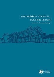
Planning Scheme Provisions (3.9 MB) - Cairns Regional Council
Planning Scheme Provisions (3.9 MB) - Cairns Regional Council
Planning Scheme Provisions (3.9 MB) - Cairns Regional Council
- No tags were found...

You also want an ePaper? Increase the reach of your titles
YUMPU automatically turns print PDFs into web optimized ePapers that Google loves.
- 152-6.14 Compliance with Conditions and Requirements Imposed by <strong>Council</strong>A person shall not contravene nor fail to comply with any condition or requirementimposed by the <strong>Council</strong> in determining an application made under this Section.Any person, who being required to do so, fails to comply fully with any condition withinor during the time for compliance shall be guilty of an offence which shall be taken tocontinue until the condition is complied with.6.15 Register of Existing Lawful Non-Conforminv UsesA person :-(a)(b)claiming to be lawfully using any premises for an existing lawful non-conforminguse; orwho is the owner of premises which he or she claims are being lawfully used foran existing lawful non-conforming use;may make application to the <strong>Council</strong> for the use of those premises to be registered inaccordance with this Sub-section.The <strong>Council</strong> shall cause to be kept a register to be called the "Register of Existing LawfulNon-conforming Uses" wherein shall be kept particulars of uses of premises currentlyregistered under this Sub-section and such register shall be open to inspection.An application made pursuant to (a) or (b) above shall :-(4(b)be made in writing, in the prescribed form;include such particulars and other information relative to the application asrequired by the <strong>Council</strong>;(c) be accompanied by :-an application fee of an amount as determined by the <strong>Council</strong> by resolution;a plan of the site, which :-(i)(ii)is numbered and dated,contains a north point,(iii) is drawn to a metric scale of 1:100, 1:200, 1:500, or such other scaleas may be approved by the City Planner,(iv) shows the boundaries of the land to which the application relates orapplies referred to their lengths in metres and bearings (if possible)and the street or streets to which the land or any part thereof abuts(where the land comprises part of an allotment or part of more thanone allotment or more than one allotment, the boundaries of thatallotment or those allotments shall also be shown),(v)shows details of all buildings or other structures erected on the landand the distance in metres from the nearest point of every suchbuilding or other structure to the boundary of the land,(vi) shows details of any areas other than buildings or other stmctureswhich are used as part of the existing lawful non-conforming use,