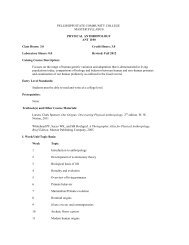
Program Description - Pellissippi State Community College
Program Description - Pellissippi State Community College
Program Description - Pellissippi State Community College

Create successful ePaper yourself
Turn your PDF publications into a flip-book with our unique Google optimized e-Paper software.
126<br />
GEOGRAPHIC INFORMATION SYSTEMS (GIS)<br />
<strong>Program</strong> <strong>Description</strong>: The Geographic Information Technology program<br />
offers students opportunities to develop skills useful to engineering, business,<br />
science and industry. The technician that completes this program gains competence<br />
to work in a variety of applications in this growing field. Geographic<br />
Information Systems (GIS) are designed to assist engineering and business decision<br />
making by using data that is spatially referenced to the Earth. Modern computer<br />
software and related technology make it possible to use this spatial data to solve<br />
complex planning and management problems. Students learn to understand various<br />
kinds of spatial data, computer tools and data quality considerations that are important<br />
to effectively use this technology in making good decisions.<br />
Business Concentration: Provides a course of study for individuals who wish to<br />
work as specialists in business, emergency management, logistics, public safety,<br />
economic development, site selection and marketing.<br />
Technology Concentration: Provides a course of study for individuals who wish to<br />
work as specialists in engineering, surveying, land management, planning and<br />
facility management.<br />
Degree: Associate of Applied Science (A.A.S.)<br />
Typical Job Opportunities:<br />
Engineering and Surveying GIS Specialist: Uses GIS technology to manage survey<br />
and engineering data in a geographic database from project planning, through construction,<br />
project completion, archiving and revision.<br />
Facility Management GIS Specialist: Designs and implements systems and procedures<br />
to combine archived and revised engineering drawings, photographs and<br />
other facility data in a geographic database to manage large industrial and service<br />
facilities to assure eff i c i e n c y, control and compliance.<br />
Land Management GIS Specialist: Uses GIS technology to obtain data about land<br />
and water resources and uses this data and GIS tools to make day to day and strategic<br />
decisions in managing these resources.<br />
County and City Government GIS Specialist: Uses GIS technology to create and<br />
manage parcel, deed and property tax databases used in association with other planning,<br />
zoning, road, and utility data to assist in managing public facilities.<br />
Site Selection GIS Specialist: Designs and implements procedures to utilize demographic<br />
and site comparison data in spatial analysis to make decisions to purchase,<br />
develop or sell real estate properties.<br />
Logistics GIS Specialist: Designs and implements procedures to monitor transportation<br />
assets and optimize routes to increase efficiency and lower costs of transp<br />
o r t a t i o n .<br />
Demographic A n a l y s t :Specializes in the understanding and use of spatial information<br />
about people, their characteristics and preferences. These data are used in businesses<br />
to respond to customers through alternative store locations, product mix, and<br />
special marketing eff o r t s .<br />
Public Safety GIS Specialist: Specializes in developing and implementing spatial<br />
databases to use in crime and accident analysis, traffic control, emergency response,<br />
and disaster planning.