Ternate - Smithsonian Institution Libraries
Ternate - Smithsonian Institution Libraries
Ternate - Smithsonian Institution Libraries
You also want an ePaper? Increase the reach of your titles
YUMPU automatically turns print PDFs into web optimized ePapers that Google loves.
TERNATE 78 TOPOGRAPHY AND TRAVEL DESCRIPTIONS<br />
VII<br />
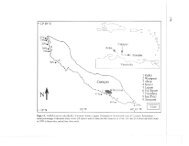
The Sula Group<br />
[p. 113] Three more large islands and several small ones belong to the Sultanate of<br />
<strong>Ternate</strong>. [p. 114] Situated approximately between 124°10’ and 126°30’ east longitude and<br />
1°40’ and 2°20’ south latitude, these islands are known as the Sula Group, after the island<br />
where the oldest <strong>Ternate</strong>se settlement is found. The following details have been collected<br />
on a few trips, which, because of their short duration, did not allow me the opportunity to<br />
obtain more information. Still, together with the little that has been reported by other<br />
writers this material may be of some value.<br />
The three big islands are called Taliabu, Mangole, and Sulabesi. They are divided<br />
into several districts, to which the smaller islands which lie nearby are believed to belong.<br />
This can be seen below:<br />
Taliabu has six districts:<br />
1. Tonghaya, on the northeast coast, has no permanent kampongs since the Alfurus<br />
stay in the interior. The islands of Ohu and Kaligaan belong to Tonghaya.<br />
2. Likitobi, on the south coast, is the main kampong. It is also the place where all<br />
the chiefs of the districts of the island live. The islands Kano, Seho, and Karama<br />
belong to Likitobi.<br />
3. Woyo is on the south coast, to the east of the previous district. It has an island of<br />
the same name.<br />
4. Samada is on the north coast, almost in the center. As on Tonghaya, no<br />
settlements are found near the beach here. The islands of Nanas and Nusa Kewa<br />
belong to Samada.<br />
5. Kabihu is on the southwest coast, and includes the islands of Papua, Pasikaya,<br />
Ala, and Nusa Tangan. It has no beach villages.<br />
6. Lede is on the northwest coast. As on the other islands, there are Alfurus in the<br />
interior. The islands of Masoni, Limbo, Posu, Magoa, Tonasi, Mangkaloli, Ulang,<br />
Katopu, Botolino, Panghaya, Tabalang, and Galuma belong to Lede. [p. 115]<br />
Mangole is divided into four districts:<br />
1. Waetina, on the east coast, includes the islands of Lifumatola and Pagama;<br />
2. Mangole, on the south coast, includes the islands of Tobokole, Kimakole, Mancari,<br />
Pasikore, Pulu Sambiki, Kedafota, and Lofanini;<br />
3. Alfola, which is also on the south coast; and<br />
SMITHSONIAN INSTITUTION LIBRARIES DIGITAL EDITION


