

Namibia PDNA 2009 - GFDRR
Namibia PDNA 2009 - GFDRR
Namibia PDNA 2009 - GFDRR

Create successful ePaper yourself
Turn your PDF publications into a flip-book with our unique Google optimized e-Paper software.
Executive Summary<br />
In March <strong>2009</strong>, flooding, caused by heavy rainfalls in the region, affected six Regions in northern <strong>Namibia</strong> (Caprivi, Kavango, Oshana,<br />
Oshikoto, Ohangwena, and Omusati) 1 . The <strong>2009</strong> flood is the second such event in two years, following three years of successive low<br />
rainfall events. Flood waters surged to near record, overtopping roads and washing out local routes. As a consequence, commercial<br />
and industrial activities were disrupted. Local access to health facilities and schools was cut off, urban sewage systems overflowed with<br />
the inundation of water supply and sewage stations, and electricity provision was compromised. Overall, the entire economy in the<br />
area was disrupted for almost three months and trade routes were severely interrupted.<br />
The floods affected a particularly<br />
vulnerable portion of the population; onethird<br />
of the country’s poor live in the six<br />
affected Regions. Most live in rural areas,<br />
and their income is highly dependent on<br />
subsistence farming. Many farmers lost<br />
the majority of their annual harvest as<br />
well as their livestock, jeopardizing their<br />
income and food sources. Many rural<br />
residents, as well as urban dwellers, lost<br />
their homes to the floods; in some cases<br />
houses made of mud simply washed<br />
away with the floods.<br />
The <strong>2009</strong> floods were the second<br />
natural disaster to occur in as many<br />
years. Following relatively frequent<br />
flooding in the 1960s and 1970s,<br />
<strong>Namibia</strong> had enjoyed several years with<br />
relatively little flooding. The past \years<br />
has seen a reversal in that trend, with<br />
flooding occurring in 2004 and 2008,<br />
and culminating with near record water<br />
levels in the <strong>2009</strong> floods.<br />
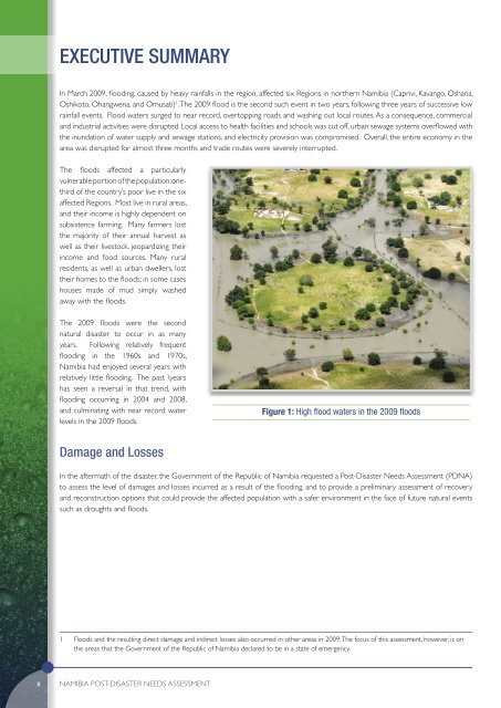
Figure 1: High flood waters in the <strong>2009</strong> floods<br />
Damage and Losses<br />
In the aftermath of the disaster, the Government of the Republic of <strong>Namibia</strong> requested a Post-Disaster Needs Assessment (<strong>PDNA</strong>)<br />
to assess the level of damages and losses incurred as a result of the flooding, and to provide a preliminary assessment of recovery<br />
and reconstruction options that could provide the affected population with a safer environment in the face of future natural events<br />
such as droughts and floods.<br />
1 Floods and the resulting direct damage and indirect losses also occurred in other areas in <strong>2009</strong>. The focus of this assessment, however, is on<br />
the areas that the Government of the Republic of <strong>Namibia</strong> declared to be in a state of emergency.<br />
x<br />
<strong>Namibia</strong> POST-DISASTER NEEDS ASSESSMENT


