Book 1 - City of St. Petersburg
Book 1 - City of St. Petersburg
Book 1 - City of St. Petersburg

Create successful ePaper yourself
Turn your PDF publications into a flip-book with our unique Google optimized e-Paper software.
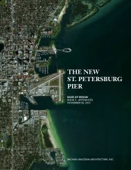
BASIS OF DESIGN BOOK 1<br />
3 GENERAL PLANNING CRITERIA<br />
ENGINEERING CRITERIA<br />
(continued)<br />
Wind and Wave Load Criteria<br />
Wind loads for the new Pier shall be calculated based on ASCE<br />
7-10 standard utilizing Risk Category II and Exposure D. This<br />
results in a maximum wind load <strong>of</strong> 141 psf at the top <strong>of</strong> the<br />
Canopy and 127 psf at the lower, more horizontal sections.<br />
Due to the unique shape and response characteristics <strong>of</strong> the<br />
structure, wind tunnel analysis will be required to determine the<br />
wind pressure more accurately. Analysis <strong>of</strong> wind direction and<br />
speed is necessary to determine dominant wind-generated wave<br />
heights and direction. M<strong>of</strong>fatt & Nichol provided an Extreme<br />
Value Analysis <strong>of</strong> historical wind speeds at MacDill Air Force Base<br />
from 1941 through 2011 in their report entitled ‘<strong>St</strong>. <strong>Petersburg</strong><br />
Pier Design Competition Metocean and <strong>St</strong>ructural Concept<br />
Level Design Basis’. It was reported that the majority <strong>of</strong> wind<br />
comes from the east-north east with winds in excess <strong>of</strong> 30 mph<br />
occurring in some instance in all directions. This is attributable to<br />
the passing <strong>of</strong> hurricane or tropical storm events. Return periods<br />
for the 25, 50 and 100-year events found 10 minute wind speeds<br />
<strong>of</strong> 74, 83 and 92 mph, respectively. However, these values did not<br />
take into account wind direction and therefore the recurrence <strong>of</strong><br />
directional extreme winds should be analyzed for final design.<br />
Waves found in Tampa Bay are either locally generated wind<br />
waves or <strong>of</strong>fshore swells that enter the Bay from the inlets<br />
between Mullet, Egmont, Passage, and School Keys. Locally<br />
generated wind waves are the dominant waves that are expected<br />
to be found at the proposed Pier location. Design wave heights<br />
shall be calculated to include storm surge as this will occur<br />
during significant storm events.<br />
<strong>St</strong>orm Load Criteria<br />
The Pier approach and Pier head are located in a Coastal High<br />
Hazard Area and designated a Velocity Zone (VE). The BFE is at 8<br />
ft. The Pier is located in a VE-8 flood zone.<br />
June through November is hurricane season in the Atlantic<br />
Ocean and Caribbean Sea with the majority <strong>of</strong> hurricane activity<br />
occurring between August and October. Tampa Bay experiences<br />
effects <strong>of</strong> passing storms, although it is uncommon for the area<br />
to receive a direct hit. The effect <strong>of</strong> these passing storms typically<br />
result with high winds, increased wave heights, flooding due to<br />
storm surge and increased cross-shore sediment transportation<br />
rates. The 25 October 1921 “Tarpon Springs” storm was the last<br />
major hurricane to directly hit the <strong>St</strong>. <strong>Petersburg</strong> area with wind<br />
speeds <strong>of</strong> approximately 115 mph at landfall.<br />
Hurricanes and tropical storms consist <strong>of</strong> large wind fields<br />
driven by pressure gradients from a central low pressure and<br />
temperature gradients in the atmosphere. The winds from these<br />
events create storm surges by blowing the ocean water up<br />
against the coastline. Flooding results from a combination <strong>of</strong> a<br />
storm or tidal surge and high river stages from heavy rain. The<br />
severity <strong>of</strong> flooding is dependent upon the intensity <strong>of</strong> the storm<br />
event and its duration.<br />
3 - 88<br />
THE NEW ST. PETERSBURG PIER