PNNL-13501 - Pacific Northwest National Laboratory
PNNL-13501 - Pacific Northwest National Laboratory
PNNL-13501 - Pacific Northwest National Laboratory

You also want an ePaper? Increase the reach of your titles
YUMPU automatically turns print PDFs into web optimized ePapers that Google loves.
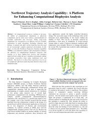
Application of a Crop Model<br />
The resolution of global climate models is far too coarse<br />
to drive crop models, particularly in regions with<br />
topography as complex as in the <strong>Pacific</strong> <strong>Northwest</strong>. The<br />
high spatial resolution meteorology simulated by the<br />
<strong>PNNL</strong> RCM provides the opportunity to drive crop<br />
models directly at the farm levels. The Erosion<br />
Productivity Impact Calculator was driven by<br />
meteorology simulated by the regional climate model to<br />
assess the impact of a 2xCO2 “greenhouse” scenario of<br />
climate change on winter wheat production in the Palouse<br />
region in eastern Washington and portions of Oregon and<br />
Idaho. The climate scenarios were extracted from the<br />
regional climate model baseline and 2xCO2 simulations<br />
for each 90 km grid cell of the regional climate model,<br />
with differentiation by elevation. Winter wheat crop<br />
yields for the baseline climate averaged 4.52 Mg ha -1<br />
across the study region. The lowest yields (0 Mg ha -1 )<br />
occurred at the higher elevations where temperatures were<br />
not sufficient to allow for crop maturity. The highest<br />
yields (7.32 Mg ha -1 ) occurred at intermediate elevations<br />
with sufficient precipitation and mild temperatures.<br />
Winter wheat mean yield increased to 5.45 Mg ha -1 for the<br />
2xCO2 climate, which was markedly warmer and wetter<br />
than baseline. Yield increases were principally explained<br />
by decreases in both cold temperature and water stress.<br />
Development of a Problem-Solving Environment<br />
The collaboration center modeling system must be<br />
intuitive and convenient if it is to be useful to the climate<br />
impact assessment community. This will require<br />
integration and coordination of each of the steps involved<br />
in using the modeling system. A user interface for the<br />
modeling system has been designed to guide the user<br />
through the process of defining the regional domain and<br />
resolution, selecting and interpolating the boundary<br />
conditions, compiling and running the regional climate<br />
model, mapping the regional climate simulation to the<br />
selected resolution, and displaying the data. As a proof of<br />
concept, a graphical user interface is being developed to<br />
facilitate the preprocessing of information that provides<br />
all data necessary for performing regional climate<br />
simulations. The model preprocessing is a very<br />
straightforward procedure masked by repetitive steps of<br />
script editing, source code editing, and data file renaming.<br />
By wrapping this process with Java codes to do the<br />
nonintuitive and repetitive parts, the user will be given a<br />
friendly, simple interface to the model.<br />
240 FY 2000 <strong>Laboratory</strong> Directed Research and Development Annual Report<br />
Summary and Conclusions<br />
Major accomplishments have been achieved toward the<br />
development of a prototype Collaboration Center. A twodimensional<br />
decomposition parallel version of the<br />
<strong>Laboratory</strong>’s regional climate model has been developed<br />
and tested on various supercomputing platforms. The<br />
hydrologic model has been enhanced to represent river<br />
basins of different spatial scales. A reservoir model and<br />
an optimization routine can be used to evaluate the<br />
impacts of climate change using realistic water<br />
management strategies for the altered climate conditions.<br />
The procedures of using regional climate model outputs to<br />
assess climate change impacts on crop yields have been<br />
demonstrated using regional climate model simulations of<br />
the control and 2xCO2 conditions to drive a crop model<br />
over the <strong>Pacific</strong> <strong>Northwest</strong> Palouse region. A prototype<br />
graphical user interface is being developed to facilitate the<br />
preprocessing of information for performing regional<br />
climate simulations. With the completion of these tasks,<br />
we will be ready to operate an Collaboration Center to<br />
deliver information of relevance to the climate change<br />
impact assessment community.<br />
References<br />
Leung LR and SJ Ghan. 1995. “A subgrid<br />
parameterization of orographic precipitation.” Theoretical<br />
and Applied Climatology 52:95-118.<br />
Leung LR and SJ Ghan. 1998. “Parameterizing subgrid<br />
orographic precipitation and surface cover in climate<br />
models.” Mon Wea Rev. 3271-3291.<br />
Leung LR, MS Wigmosta, SJ Ghan, DJ Epstein, and LW<br />
Vail. 1996. “Application of a subgrid orographic<br />
precipitation/surface hydrology scheme to a mountain<br />
watershed.” J. Geophys. Res. 101:12,803-12,817.<br />
Wigmosta MS, LW Vail, and DP Lettenmaier. 1994. “A<br />
distributed hydrology-vegetation model for complex<br />
terrain.” Water Resour. Res. 30:1665-1679.<br />
Publications<br />
Contributor 1999. “Impacts of climate variability and<br />
change in the <strong>Pacific</strong> <strong>Northwest</strong>.” A Regional Report for<br />
the USGCRP <strong>National</strong> Assessment. <strong>Pacific</strong> <strong>Northwest</strong><br />
Regional Assessment Group, pp 109.