

Low (web) Quality - BALTEX
Low (web) Quality - BALTEX
Low (web) Quality - BALTEX

You also want an ePaper? Increase the reach of your titles
YUMPU automatically turns print PDFs into web optimized ePapers that Google loves.
191<br />
Inter-comparison of Asian monsoon simulated by RCMs in Phase II of<br />
RMIP for Asia<br />
Jinming Feng, Congbin Fu, Shuyu Wang, Jianping Tang, D. Lee, Y. Sato, H. Kato, J. Mcgregor et al.<br />
Institute of Atmospheric Physics, Chinese Academy of Sciences, Beijing, China. fengjm@tea.ac.cn<br />
1. Abstract<br />
In phase II of the Regional Climate Model Inter-comparison<br />
Project (RMIP) for Asia, the regional climate has been<br />
simulated for July 1988 through December 1998 by five<br />
regional climate models and one global variable resolution<br />
model. Comparison of the 10-year simulated precipitation<br />
with the observations was carried out. The results show that<br />
most models have the capacity to reproduce the basic spatial<br />
pattern of precipitation for Asia, and the main rainbelt can<br />
be reproduced by most models, but there are distinctions in<br />
the location and the intensity. Most models overestimate the<br />
precipitation over most continental regions. Interannual<br />
variability of the precipitation can also be basically<br />
simulated, while differences exist between various models<br />
and the observations. The biases in the stream field are<br />
important reasons behind the simulation errors of the<br />
Regional Climate Models (RCMs). The cumulus scheme<br />
and land surface process have large influences on the<br />
precipitation simulation. Generally, the Grell cumulus<br />
scheme produces more precipitation than the Kuo-Anthes<br />
scheme.<br />
2. Design of experiments<br />
In order to understand the performance of RCMs on<br />
simulating Asian, especially East Asian climate, the<br />
Regional Climate Model Inter-comparison Project (RMIP)<br />
for Asia was launched by START Regional Center for<br />
Temperate East Asia in 2000 (Fu et al., 2005). There are six<br />
participant models in phase II of RMIP, of which five are<br />
RCMs and one is a global variable-resolution model. They<br />
include: RIEMS (Fu et al., 2000), NJU MM5, MRI<br />
JSM_BAIM, RegCM2b, SNU RCM, CSIRO CCAM. The<br />
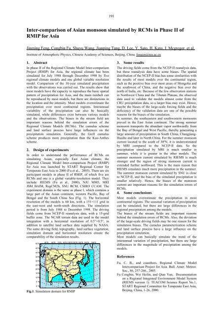
experiment domain is the same as phase I, which contains a<br />
large part of the Asian continent, western Pacific, Bay of<br />
Bengal and the South China Sea (Fig. 1). The horizontal<br />
resolution of the models is 60 km, with a 151×111 grid in<br />
the east-west and north-south directions. The simulation<br />
period is from July 1988 to December 1998. The driving<br />
fields come from NCEP-II reanalysis data, with a 15-grid<br />
buffer zone. The NCAR terrain data are used in the model<br />
integration with a horizontal resolution of 0.5°×0.5°, in<br />
addition to satellite land surface data supplied by NASA.<br />
The same driving field, topography, land surface vegetation,<br />
simulation domain and horizontal resolution ensure the<br />
comparability of the simulation results.<br />
50°N<br />
45°N<br />
40°N<br />
35°N<br />
30°N<br />
25°N<br />
20°N<br />
15°N<br />
10°N<br />
5 °N<br />
0 °N<br />
45°E 60°E 75°E 90°E 105°E120°E 135°E 150°E 165°E<br />
Fig.1. Simulation domain for RMIP<br />
3. Some results<br />
The driving fields come from the NCEP-II reanalysis data,<br />
but these reanalysis data have some biases. The spatial<br />
distribution of the NCEP-II bias has some similarities with<br />
the results of most models over the continental region,<br />
such as the positive bias over most areas of Mongolia and<br />
the southwest of China, and the negative bias over the<br />
north of India, etc. Because of the few observation stations<br />
in Northwest China and the Tibetan Plateau, the observed<br />
data used to validate the models almost come from the<br />
CRU precipitation data, so a larger bias may exist. Hence,<br />
maybe the biases of the large-scale forcing fields and the<br />
deficiency of the validation data are one of the possible<br />
reasons for the biases of the simulation.<br />
In summer, the southeastern and southwestern monsoons<br />
prevail in the East Asian continent. The strong summer<br />
monsoon transports the abundant vapor northwardly from<br />
the Bay of Bengal and West Pacific, thereby generating a<br />
large amount of precipitation in South China, Changjiang-<br />
Huaihe and later in North China. For the summer monsoon<br />
current located to the south of 30ºN, it is underestimated<br />
by MRI compared to the NCEP-II data. So the<br />
precipitation simulated by MRI is much smaller in<br />
summer, while it is greater in the other models. The<br />
summer monsoon current simulated by RIEMS is much<br />
stronger and the region of strong monsoon current is<br />
extended further northward. This is the main reason that<br />
RIEMS simulates much more precipitation in the summer.<br />
The summer monsoon current simulated by SNU is close<br />
to NCEP-II, and the bias of the simulated precipitation is<br />
smaller relatively. Hence, the biases of the monsoon<br />
current are important reasons for the simulation errors of<br />
RCMs.<br />
4. Some conclusions<br />
Most models overestimate the precipitation in most<br />
continental regions. The seasonal variation of precipitation<br />
can be simulated, but there are large differences in the<br />
regional precipitation among the models.<br />
The biases of the stream fields are important reasons<br />
behind the simulation errors of RCMs. Also, the deviation<br />
of the large-scale driving fields may be one reason for the<br />
simulation biases. The cumulus parameterization scheme<br />
and land surface process have a large influence on the<br />
precipitation simulation.<br />
Most models can basically simulate the trend of the<br />
interannual variation of precipitation, but there are large<br />
differences in the magnitude of precipitation among the<br />
models.<br />
References<br />
Fu, C. B., and coauthors, Regional Climate Model<br />
Intercomparison Project for Asia. Bull. Amer. Meteor.<br />
Soc., 86, 257-266., 2005.<br />
Fu Congbin, Wei Heilin, and Qian Yun, Documentation<br />
on a Regional Integrated Environment Model System<br />
(RIEMS version 1). TEACOM Science Report No.1,<br />
START Regional Committee for Temperate East Asia,<br />
Beijing, China, 1-26, 2000.


