- Page 1:
New Ideas for Motorbikes made for a
- Page 4 and 5:
HEADQUARTERS: TOURATECH AG Auf dem
- Page 6 and 7:
Imprint 3 Headquarters & Distributo
- Page 8 and 9:
Pannier System Alu Zega BMW HP2 311
- Page 10 and 11:
GPS bracket adapter, Hand protector
- Page 12 and 13:
Kickstand switch cover, Gear lever,
- Page 14 and 15:
Helmets 934 Helmet accessories 937
- Page 16 and 17:
www.touratech-video.de
- Page 18 and 19:
Touratech Homepage www.touratech.co
- Page 21:
keep you in the know about Touratec
- Page 24 and 25:
ight around the corner. The coopera
- Page 26 and 27:
TRAVEL GLOBAL
- Page 28:
shows included Dirk Schäfer’s
- Page 31:
EVENT
- Page 34 and 35:
034 Overview
- Page 36 and 37:
036 Overview
- Page 38 and 39:
038 Overview
- Page 40 and 41:
040 Overview
- Page 42 and 43:
042 Overview
- Page 44 and 45:
044 Overview
- Page 46 and 47:
046 Overview
- Page 48 and 49:
048 Overview
- Page 50 and 51:
050 Overview
- Page 52 and 53:
052 Overview
- Page 54 and 55:
054 Overview
- Page 56 and 57:
056 Overview
- Page 58 and 59:
058 Overview
- Page 60 and 61:
060 Overview
- Page 62 and 63:
062 Overview
- Page 64 and 65:
064 Overview
- Page 66 and 67:
066 Overview
- Page 68 and 69:
068 Overview
- Page 70 and 71:
070 Overview
- Page 72 and 73:
TIMELESS The Touratech special edit
- Page 74 and 75:
ockpit
- Page 76 and 77:
Roadbook RB-TT *MvG* For the first
- Page 78 and 79:
RB-TT 078 Cockpit We used our many
- Page 80 and 81:
RB-compact The Roadbook Holder for
- Page 82 and 83:
We offer a wide range of accessorie
- Page 84 and 85:
TT-USA / Jonah Street Cockpit BMW F
- Page 86 and 87:
IMO-100R50 Rallye The new rallye co
- Page 88 and 89: IMO-100R Rallye computer & Replacem
- Page 90 and 91: 090 Cockpit FB-PRO handlebar contro
- Page 92 and 93: TT-UK / Nick Plumb / Dakar Power co
- Page 94 and 95: Adapter plate L-I-K For mounting an
- Page 96 and 97: enduroXcup Künzelsau/ Ian Rowley /
- Page 98 and 99: TT-UK / Nick Plumb / Dakar The Rall
- Page 100 and 101: avigatio
- Page 102 and 103: Introduction to the subject There h
- Page 104 and 105: Herbert Schwarz/Bolivien Our sets:
- Page 106 and 107: POI * MEV * IPX7 * Adress Manual 10
- Page 108 and 109: Garmin Zumo 220 The new zumo 220 im
- Page 110 and 111: 110 Navigation Jo Deleker / Iberica
- Page 112 and 113: 112 Navigation Herbert Schwarz/TT-C
- Page 114 and 115: 114 The Headset for Bikers! This Bl
- Page 116 and 117: 116 Tripy II POI * ODB * The Tripy
- Page 118 and 119: 118 TwoNav-Aventura The next genera
- Page 120 and 121: Sportiva TwoNav GPS including Topo
- Page 122 and 123: GPS Map 78 / GPS Map 78s The GPS Ma
- Page 124 and 125: 124 IPX7 * ODB * POI * Oregon 550/5
- Page 126 and 127: 126 IPX7 * ODB * POI * Garmin Dakot
- Page 128 and 129: 128 POI * ODB * IPX7 * eTrex Ventur
- Page 130 and 131: 130 MEV * IPX7 * Garmin Edge 605 Th
- Page 132 and 133: Garmin Edge 800 *Bikecomputer* Bund
- Page 134 and 135: 134 Garmin Forerunner 31 OXT The al
- Page 136 and 137: Suunto watches Especially on long t
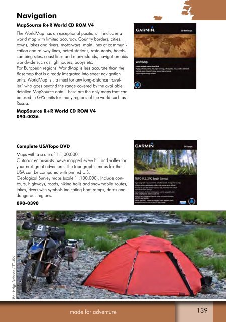
- Page 140 and 141: CD - TOPO Tunisia - Maps at a scale
- Page 142 and 143: 142 Garmin TransAlpine *Alpine regi
- Page 144 and 145: 144 Navigation Dirk Schäfer/Italy
- Page 146 and 147: 146 Data cards / memory modules The
- Page 148 and 149: 148 Handlebar mounting ZUMO 660 loc
- Page 150 and 151: Handlebar mounting BMW Navigator IV
- Page 152 and 153: 152 Navigation Alexander Schönborn
- Page 154 and 155: 065-0359 TwoNav Aventura not suppli
- Page 156 and 157: 156 Garmin GPSMAP 62 handlebar moun
- Page 158 and 159: 158 Navigation Pic.: Herbert Schwar
- Page 160 and 161: 160 Handlebar bracket GPS 60 The Hi
- Page 162 and 163: 162 GPSMap 620 nicht im Lieferumfan
- Page 164 and 165: 164 Handlebar bracket PDA Large 065
- Page 166 and 167: 166 Navigation
- Page 168 and 169: Handlebar mounting for Nokia 6110 N
- Page 170 and 171: We produce in house Touratech is st
- Page 172 and 173: 065-0550 065-0552 172 Lowrance Endu
- Page 174 and 175: 174 065-0009 065-0014 Handlebar mou
- Page 176 and 177: 176 Navigation
- Page 178 and 179: 178 Handlebar bracket GPS Forerunne
- Page 180 and 181: 180 Navigation Oliver Hahn/Ukraine
- Page 182 and 183: 182 RAM round plate adhesive disk T
- Page 184 and 185: 184 RAM hex ball for M8 screws You
- Page 186 and 187: 186 Navigation Ramona Schwarz/Asia
- Page 188 and 189:
188 Set of 20 soft ties in lengths
- Page 190 and 191:
190 GPS bracket adapter R 1200 GS/A
- Page 192 and 193:
192 R 1200 RT bracket adapter (For
- Page 194 and 195:
194 BMW K 1200 GT bracket adapter (
- Page 196 and 197:
196 GPS handlebar bracket adapter H
- Page 198 and 199:
1 2 3 4 5 6 7 8 198 Pic.: Torsten K
- Page 200 and 201:
065-0220 065-0284 065-0279 200 Powe
- Page 202 and 203:
Power connections for your GARMIN G
- Page 204 and 205:
GARMIN GTM 12 TMC-integrated aerial
- Page 206 and 207:
206 KS accessory pouch Navigation H
- Page 208 and 209:
Powerline 4 ZeroWatt for AAA (micro
- Page 210 and 211:
210 Navigation Matthias Hirt 2010
- Page 212 and 213:
Completely NEW! Not a cosmetic make
- Page 214 and 215:
214 Navigation
- Page 216 and 217:
Touratech QV 5 Basic Package with d
- Page 218 and 219:
The best navigation software is onl
- Page 220 and 221:
Elevation data: In general, digital
- Page 222 and 223:
- Define the route that you want to
- Page 224 and 225:
224 France High quality road map at
- Page 226 and 227:
226 Top 100 Top 25 Top 25 The Nethe
- Page 228 and 229:
228 Touratech QV-Map Top 25 Spain A
- Page 230 and 231:
World mapping project digital More
- Page 232 and 233:
Algeria CD, IGN map, 1:500,000 090-
- Page 234 and 235:
Russian army maps South America - s
- Page 236 and 237:
Russian Army map Eurasia - seamless
- Page 238 and 239:
Trackpicker BT-Q 1000XT This is the
- Page 240 and 241:
Microtracker GC-101F Out there off-
- Page 242 and 243:
SPOT HUG Spot HUG is the latest add
- Page 244 and 245:
The other Face of Europe Text and p
- Page 247 and 248:
The quickest way from Germany to Al
- Page 249 and 250:
out the road, leaving channels stre
- Page 251 and 252:
Spurred on by our success yesterday
- Page 253 and 254:
eminded of Karl May’s „Durch da
- Page 255 and 256:
e Dirk Schäfer / Albania
- Page 257 and 258:
Luggage In a modern design and stat
- Page 259 and 260:
Some of the other benefits of the Z
- Page 261 and 262:
Luggage ZEGA Pro Alucase 31 litres
- Page 263 and 264:
Luggage ZEGA Pro Topcase ZEGA Pro T
- Page 265 and 266:
Luggage Rapid Trap For all ZEGA Pro
- Page 267 and 268:
Luggage ZEGA Pro Carrying Handle an
- Page 269 and 270:
Luggage ZEGA Pro World Map Pannier
- Page 271 and 272:
Luggage Luggage space expansion ZEG
- Page 273 and 274:
Luggage ZEGA Pro Bag Keep everythin
- Page 275 and 276:
Luggage ZEGA-case Touring Pannier V
- Page 277 and 278:
Luggage ZEGA-top L/XL The ZEGA-top
- Page 279 and 280:
Luggage ZEGA Lid Expander-Set Cargo
- Page 281 and 282:
Luggage ZEGA-Table A brilliant addi
- Page 283 and 284:
Luggage 3-Litres Jerrycan This 3-li
- Page 285 and 286:
Luggage Strap with ratchet (1 piece
- Page 287 and 288:
Luggage With the Cube Pack-It Shoe
- Page 289 and 290:
Luggage Roll Closing Q Packsack The
- Page 291 and 292:
Luggage With the brand new ZEGA FLE
- Page 293 and 294:
Luggage ZEGA FLEX Bag Set Consists
- Page 295 and 296:
Luggage Pannier Frames BMW F 800/65
- Page 297 and 298:
Luggage Pannier Frames Reliable - R
- Page 299 and 300:
Luggage Pannier Frames Yamaha XTZ 1
- Page 301 and 302:
Luggage Pannier frame hoops So far
- Page 303 and 304:
Systems Markus Kirchgeßner/ Uganda
- Page 305 and 306:
Luggage 102 cm ZEGA Pro Aluminium P
- Page 307 and 308:
Luggage 96,0 cm Aluminium Pannier S
- Page 309 and 310:
Luggage 105,6 cm *ZEGA Pro* Alumini
- Page 311 and 312:
Luggage Travelling comfortably to o
- Page 313 and 314:
Luggage 052-3153 (BMW G650GS) ZEGA
- Page 315 and 316:
Luggage 31 38 92,6 cm 100,6 cm ZEGA
- Page 317 and 318:
Luggage 31 92,6 cm made for adventu
- Page 319 and 320:
Luggage Aluminium Pannier System Ya
- Page 321 and 322:
Luggage Aluminium Pannier System Ho
- Page 323 and 324:
Luggage Aluminium Pannier System Du
- Page 325 and 326:
Luggage made for adventure Herbert
- Page 327 and 328:
Luggage 95,0 cm 31 31 ZEGA Pro Alu-
- Page 329 and 330:
Seven road books with a total of 70
- Page 331 and 332:
Forest frisbee to balancing acts hi
- Page 333 and 334:
PARTS Herbert Schwarz / TT-CEO / So
- Page 335 and 336:
BMW R1200GS made for adventure 335
- Page 337 and 338:
BMW R1200GS made for adventure 337
- Page 339 and 340:
BMW R1200GS Spoiler for windscreen
- Page 341 and 342:
BMW R1200GS made for adventure 044-
- Page 343 and 344:
BMW R1200GS Hard Part LA steering s
- Page 345 and 346:
BMW R1200GS Front brake fluid reser
- Page 347 and 348:
BMW R1200GS Touratech Hand Protecto
- Page 349 and 350:
BMW R1200GS GPS adapter BMW R1200GS
- Page 351 and 352:
BMW R1200GS Micro indicator kit BMW
- Page 353 and 354:
BMW R1200GS made for adventure FOG
- Page 355 and 356:
BMW R1200GS LEDayFlex daytime runni
- Page 357 and 358:
BMW R1200GS Comfort Seat „High En
- Page 359 and 360:
BMW R1200GS Sport seat R1200GS / Ad
- Page 361 and 362:
BMW R1200GS Hard-Part GS Fork prote
- Page 363 and 364:
BMW R1200GS Tube manifold cover (le
- Page 365 and 366:
BMW R1200GS REMUS. Hexacone.R1200GS
- Page 367 and 368:
BMW R1200GS made for adventure Pic.
- Page 369 and 370:
BMW R1200GS ESA sensor protection (
- Page 371 and 372:
BMW R1200GS Petrol Line Protection
- Page 373 and 374:
BMW R1200GS Brake fluid reservoir c
- Page 375 and 376:
BMW R1200GS Cylinder protection BMW
- Page 377 and 378:
BMW R1200GS Aluminium sump guard BM
- Page 379 and 380:
BMW R1200GS BMW R 1200 GS crash bar
- Page 381 and 382:
BMW R1200GS Locking oil filler cap
- Page 383 and 384:
BMW R1200GS 044-0650 made for adven
- Page 385 and 386:
BMW R1200GS Brake lever extension R
- Page 387 and 388:
BMW R1200GS Mudguard protection R 1
- Page 389 and 390:
BMW R1200GS Front Rallye mudguard B
- Page 391 and 392:
BMW R1200GS Adventure Luggage rack
- Page 393 and 394:
BMW R1200GS RoadTech B1- Tool kit f
- Page 395 and 396:
BMW R1200GS Accessory socket If you
- Page 397 and 398:
BMW R1200GS Tankbag BMW R 1200 GS T
- Page 399 and 400:
BMW R1200GS Tank bag *Day Trip* BMW
- Page 401 and 402:
BMW R1200GS R 1200 GS Adventure A b
- Page 403 and 404:
BMW R1200GS Auxiliary bag below the
- Page 405 and 406:
BMW R1200GS Universal toolcase /Zeg
- Page 407 and 408:
BMW R1200GS BMW R1200GS/Adventure S
- Page 409 and 410:
BMW R1200GS 102 cm Alu And-S And-Bl
- Page 411 and 412:
BMW R1200GS BMW R 1200 GS SPECIAL S
- Page 413 and 414:
BMW R1200GS Zega Pro Topcase rack T
- Page 415 and 416:
BMW HP2 PECIAL PARTS
- Page 417 and 418:
BMW HP2 HP2 Roadbookholder/front co
- Page 419 and 420:
BMW HP2 Touratech hand protectors G
- Page 421 and 422:
BMW HP2 Travelling comfortably to o
- Page 423 and 424:
BMW HP2 REMUS Revolution rear silen
- Page 425 and 426:
BMW HP2 Petrol Line Protection HP2
- Page 427 and 428:
BMW HP2 Aluminium sump guard BMW HP
- Page 429 and 430:
BMW HP2 Ceramic Clutch The ceramic
- Page 431 and 432:
BMW HP2 EXCEL wheels for the BMW HP
- Page 433 and 434:
BMW HP2 BMW HP2 Luggage Rack An ess
- Page 435 and 436:
BMW HP2 HP2 Tank Bag The sport tank
- Page 437 and 438:
BMW HP2 HP2 luggage system ZegaTex
- Page 439 and 440:
BMW HP2 Travelling comfortably to o
- Page 441 and 442:
GS 13.11.2010 TROPHY WELCOME to TOU
- Page 443 and 444:
GS Trophy 2010 Day 1 of the race th
- Page 445 and 446:
the front wheel lifted onto the adj
- Page 447 and 448:
out your competitors from yesterday
- Page 449 and 450:
GS Trophy 2010 Day 4 of the race th
- Page 451 and 452:
laughter. The clock is ticking as t
- Page 453 and 454:
South Africa, which share second pl
- Page 455 and 456:
GS Trophy 2010 Day 7 of the race th
- Page 457 and 458:
PARTS Ramona Schwarz / TT-Marketing
- Page 459 and 460:
BMW F800GS Desierto F Fairing for B
- Page 461 and 462:
BMW F800GS Spoiler for Windscreen T
- Page 463 and 464:
BMW F800GS Handlebar Height Increas
- Page 465 and 466:
BMW F800GS Guard for Brake Fluid Co
- Page 467 and 468:
BMW F800GS Touratech Hand Protector
- Page 469 and 470:
BMW F800GS Steel Headlight Protecto
- Page 471 and 472:
BMW F800GS Tank Conversion Kit BMW
- Page 473 and 474:
BMW F800GS Seat “Touring” This
- Page 475 and 476:
BMW F800GS AC Schnitzer Stealth Rea
- Page 477 and 478:
BMW F800GS Shield Rear Silencer As
- Page 479 and 480:
BMW F800GS Frame Guard Alu Left BMW
- Page 481 and 482:
BMW F800GS Oil Filter Guard BMW F80
- Page 483 and 484:
BMW F800GS Crash Bar for BMW F800GS
- Page 485 and 486:
BMW F800GS Hard Part Radiator, BMW
- Page 487 and 488:
BMW F800GS Adjustable Gear Lever BM
- Page 489 and 490:
BMW F800GS Kick Stand Support Exten
- Page 491 and 492:
BMW F800GS Mudguard Extension Front
- Page 493 and 494:
BMW F800GS Luggage Rack Aluminium B
- Page 495 and 496:
BMW F800GS Water protected Tank Bag
- Page 497 and 498:
BMW F800GS Tail Rack Bag BMW F800GS
- Page 499 and 500:
BMW F800GS 105,6 cm *ZEGA Pro* Alum
- Page 501 and 502:
BMW G650GS BMW F650GS PECIAL PARTS
- Page 503 and 504:
BMW F650GS / G650GS Headlight Prote
- Page 505 and 506:
BMW F650GS / G650GS Rear Break Flui
- Page 507 and 508:
BMW F650GS / G650GS Cockpit Convers
- Page 509 and 510:
BMW F650GS / G650GS Steel Headlight
- Page 511 and 512:
BMW F650GS / G650GS Tank Conversion
- Page 513 and 514:
BMW F650GS / G650GS Fork Springs fr
- Page 515 and 516:
BMW F650GS / G650GS Locking Oil Fil
- Page 517 and 518:
BMW F650GS / G650GS Engine Guard BM
- Page 519 and 520:
BMW F650GS / G650GS Gear Lever BMW
- Page 521 and 522:
BMW F650GS / G650GS Chain Wheel wit
- Page 523 and 524:
BMW F650GS / G650GS Steel Braided B
- Page 525 and 526:
BMW F650GS / G650GS ZEGA Pannier Sy
- Page 527 and 528:
BMW F650GS / G650GS ZEGA Pro Pannie
- Page 529 and 530:
Photo: Joanna Patterson
- Page 531 and 532:
munity. The film takes you on a mot
- Page 533 and 534:
Photos: Robyn Appleton, Javier Vall
- Page 535 and 536:
BWM G650X PECIAL PARTS Ramona Schwa
- Page 537 and 538:
BMW G650X Rally fairing with alumin
- Page 539 and 540:
BMW G650X Fog headlight BMW G 650 X
- Page 541 and 542:
BMW G650X Öhlins‘ shock absorber
- Page 543 and 544:
BMW G650X REMUS rear silencer, Revo
- Page 545 and 546:
BMW G650X Frame guard kit BMW G650
- Page 547 and 548:
BMW G650X made for adventure 547
- Page 549 and 550:
BMW G650X Sport, rally and long-dis
- Page 551 and 552:
BMW G650X Footpeg System BMW G 650
- Page 553 and 554:
BMW G650X Folding brake lever fixin
- Page 555 and 556:
BMW G650X Mud-guard extension BMW G
- Page 557 and 558:
BMW G650X Spray guard Sport G 650 X
- Page 559 and 560:
BMW G650X Tank bag G 650 X Challeng
- Page 561 and 562:
BMW G650X Aluminium pannier system
- Page 563 and 564:
PARTS Pic.: Margit Rowley / Enduran
- Page 565 and 566:
BMW G450X Touratech Hand protectors
- Page 567 and 568:
BMW G450X Brake lever Three-finger
- Page 569 and 570:
BMW G450X Handlebar crossbar BMW G
- Page 571 and 572:
BMW G450X Rally fairing with alumin
- Page 573 and 574:
BMW G450X Motocross conversion, BMW
- Page 575 and 576:
BMW G450X Tank cap opener BMW G 450
- Page 577 and 578:
BMW G450X Öhlins TTX shock absorbe
- Page 579 and 580:
BMW G450X 043-0068 043-0067 made fo
- Page 581 and 582:
BMW G450X Engine guard BMW G450X Th
- Page 583 and 584:
BMW G450X Oil filling screw, hex so
- Page 585 and 586:
BMW G450X Triangular stand BMW G 45
- Page 587 and 588:
BMW G450X RK chain, 520 SHO (120 li
- Page 589 and 590:
BMW G450X Supermoto mudguard G 450
- Page 591 and 592:
BMW G450X Matrix T- Zoom Our tried
- Page 593 and 594:
2010 Text: Andreas Reimar, Margit R
- Page 595 and 596:
Endurance Day 2010 Five years ago,
- Page 597 and 598:
German Cross Country Championship A
- Page 599 and 600:
Erzberg Rodeo They say it’s the h
- Page 601 and 602:
Red Bull Romaniacs Alongside its to
- Page 603 and 604:
“On the morning of the third off-
- Page 605 and 606:
Each lap is about 20 kilometres lon
- Page 607 and 608:
Roof of Africa Even on his first at
- Page 609 and 610:
Husqvarna TE 250-511 Handlebar Rise
- Page 611 and 612:
Husqvarna TE 250-511 Rally Stem Hus
- Page 613 and 614:
Husqvarna TE 250-511 Öhlins TTX Sh
- Page 615 and 616:
Husqvarna TE 250-511 Brake Line Cla
- Page 617 and 618:
Husqvarna TE 250-511 Radiator Hard
- Page 619 and 620:
Husqvarna TE 250-511 Brake Lever Pr
- Page 621 and 622:
Husqvarna TE 250-511 Esjot alumn- r
- Page 623 and 624:
Husqvarna TE 250-511 Small Luggage
- Page 625 and 626:
Husqvarna TE 250-511 Rally stem Hus
- Page 627 and 628:
Husqvarna TE 250-511 Engine Guard,
- Page 629 and 630:
Husqvarna TE 250-511 Aluminium Chai
- Page 631 and 632:
Husqvarna TE 250-511 Luggage Rack H
- Page 633 and 634:
Husqvarna TE 630 Crossbar 275 mm fo
- Page 635 and 636:
Husqvarna TE 630 Manifold Guard Hus
- Page 637 and 638:
Husqvarna TE 630 Engine Guard, Husq
- Page 639 and 640:
Husqvarna TE 630 95,0 cm 31 31 ZEGA
- Page 641 and 642:
PARTS www.time-2-travel.de / Turkey
- Page 643 and 644:
www.time-2-travel.de / Ethiopia KTM
- Page 645 and 646:
KTM KTM 950/990 Adventure light cov
- Page 647 and 648:
KTM Adventure 950/990 LC8 tank In o
- Page 649 and 650:
KTM Crashbars KTM LC8 990 Even fall
- Page 651 and 652:
KTM Engine guard KTM LC8 Adventure
- Page 653 and 654:
KTM Luggage rack extension KTM LC 8
- Page 655 and 656:
KTM 31 92,6 cm made for adventure 3
- Page 659 and 660:
have three weeks and an extended lo
- Page 662 and 663:
662 Handlebar crossbar KTM Super En
- Page 664 and 665:
664 KTM Pic.: Herbert Schwarz / TT-
- Page 666 and 667:
666 Water protected Multi-functiona
- Page 668 and 669:
Aluminium pannier system with steel
- Page 670 and 671:
670 Hard Part, Ignition lock KTM 69
- Page 672 and 673:
672 370-1530 370-1514 Horn repositi
- Page 674 and 675:
Markus Golletz / Italy 674 KTM LC 8
- Page 676 and 677:
Markus Golletz / Italy 676 Tank bag
- Page 678 and 679:
Aluminium pannier system with stain
- Page 680 and 681:
680 Fog lamp KTM LC 4 Adventure The
- Page 682 and 683:
Touratech CZ / Mongolia 682 Tank ba
- Page 684 and 685:
684 Spoiler for Windscreen This spe
- Page 686 and 687:
686 Touratech Handprotectors GD, Ya
- Page 688 and 689:
688 Auxiliary Lights Our auxiliary
- Page 690 and 691:
690 Lambda Sensor Cover Where as da
- Page 692 and 693:
692 Crash Bars *Stainless Steel* Ev
- Page 694 and 695:
694 Side Stand Base Extension In th
- Page 696 and 697:
696 Yamaha XT1200Z Herbert Schwarz
- Page 698 and 699:
698 Luggage Rack Our luggage rack i
- Page 700 and 701:
700 ZEGA Pro Topcase Rack Yamaha XT
- Page 702 and 703:
702 Handlebar conversion The standa
- Page 704 and 705:
704 Xenon headlight State-of-the-ar
- Page 706 and 707:
706 Horn repositioner, Yamaha XT660
- Page 708 and 709:
708 Engine guard, large Yamaha XT66
- Page 710 and 711:
710 Splash guard Yamaha XT660 Tén
- Page 712 and 713:
712 Luggage rack, small, XT660 Tén
- Page 714 and 715:
714 Aluminium pannier system Yamaha
- Page 716 and 717:
716 Handlebar conversion The standa
- Page 718 and 719:
718 Rear XT 660 R brake fluid reser
- Page 720 and 721:
720 Kickstand switch cover Useful,
- Page 722 and 723:
722 Mudguard flap - Efficient mudgu
- Page 724 and 725:
724 Tail bag for the rear seat This
- Page 726 and 727:
726 Spoiler for Windscreen This spo
- Page 728 and 729:
728 Suzuki V-Strom Dennis Ciminski-
- Page 730 and 731:
730 Engine Guard DL 650 incl. Oil C
- Page 732 and 733:
732 Suzuki V-Strom Dennis Ciminski-
- Page 734 and 735:
734 Mudguard (Sport) Suzuki DL 650
- Page 736 and 737:
102 cm 31 38 ZEGA Pro Aluminium Pan
- Page 738 and 739:
738 Pannier Racks Suzuki DL 650 V-S
- Page 740 and 741:
740 Tank Crashbar Suzuki DL 1000 V-
- Page 742 and 743:
742 Suzuki V-Strom
- Page 744 and 745:
Oil Filler Plug Suzuki DL 650/1000
- Page 746 and 747:
746 Tail Rack Bag for DL 650/1000 T
- Page 748 and 749:
GPS Mounting Adapter for Handlebar
- Page 750 and 751:
Small/Large Frame Plugs (Pair) for
- Page 752 and 753:
Oil Cooler Guard, Anodised Black Du
- Page 754 and 755:
Stickerset Touratech Silver Ducati
- Page 756 and 757:
optional Rack / Luggage Rack Ducati
- Page 758 and 759:
758 Repositioning Adapter for the O
- Page 760 and 761:
760 Headlight Protector Steel Honda
- Page 762 and 763:
ABS Sensor Protection, Front Honda
- Page 764 and 765:
764 Mudguard Sport Honda Transalp X
- Page 766 and 767:
766 Pannier Frames Honda Transalp X
- Page 768 and 769:
ZEGA Pro Aluminium Pannier System H
- Page 770 and 771:
Gear lever Aprilia Caponord Lightwe
- Page 772 and 773:
772 Xenon headlight Headlight prote
- Page 774 and 775:
774 Long-distance footpegs, Triumph
- Page 776 and 777:
Triumph Tiger 800 PECIAL PARTS
- Page 778 and 779:
778 Windscreen Adjuster with GPS Mo
- Page 780 and 781:
780 Makrolon Headlight Protector, w
- Page 782 and 783:
782 Swingarm Bearing Cover (Set), T
- Page 784 and 785:
784 Side Stand Switch Protector, Ti
- Page 786 and 787:
786 Mudguard Riser, Triumph Tiger 8
- Page 788 and 789:
788 Tank Bag Triumph Tiger 800 The
- Page 790 and 791:
ZEGA Pro Special System, Frame Stai
- Page 792 and 793:
Spare lever 792 Special parts Ultra
- Page 794 and 795:
WRP Pro Bar handlebars Many rallyis
- Page 796 and 797:
Crossbar For some time now, many en
- Page 798 and 799:
Rallye bracket The bracket makes yo
- Page 800 and 801:
800 Special parts LED for BMW R850G
- Page 802 and 803:
Motorcycle planner Additional rear
- Page 804 and 805:
Honda XR 650 R KTM EXC Universal 6
- Page 806 and 807:
Fork springs per Set Aprilla CapoNo
- Page 808 and 809:
Type 36DR/L: The gas reservoir is i
- Page 810 and 811:
Lother Teufer/TT-Key account/Croati
- Page 812 and 813:
Helmet cameras Motorcycling is a lo
- Page 814 and 815:
Screw-in spikes 1800, pack of 100 8
- Page 816 and 817:
410-5646 410-5648 Plastic “enduro
- Page 818 and 819:
Unifilter - High performance for cl
- Page 820 and 821:
Endurance Day 2010 Kent SF100 A wat
- Page 822 and 823:
BOXER OIL 4T 15W/50 - Specially des
- Page 824 and 825:
MOTOREX Airfilter Cleaning Kit Cont
- Page 826 and 827:
MOTOREX CHAINLUBE 622 STRONG - Spec
- Page 828 and 829:
Made for touring! Touratech Streetl
- Page 830 and 831:
830 Water protected Tankbag BMW R 1
- Page 832 and 833:
832 R 1200 GS „Day trip“ tank b
- Page 834 and 835:
834 Tank bag F 650 GS (Twin)/ F 800
- Page 836 and 837:
836 Tank bags 055-1060 055-1061 Bas
- Page 838 and 839:
838 Multi-functional tank bag for K
- Page 840 and 841:
840 Tank bag Honda Transalp 2008 Th
- Page 842 and 843:
842 Tank bag Yamaha XT 660 Ténér
- Page 844 and 845:
844 Tank bag, water protected Ducat
- Page 846 and 847:
Colours: black Dimensions (Lx Wx H)
- Page 848 and 849:
848 Water protected Water-protected
- Page 850 and 851:
055-1072 850 Abbildung ähnlich 055
- Page 852 and 853:
1 852 CM1 CM2 3 2 4 The CM 1 is big
- Page 854 and 855:
854 Zega Tex R 1200 GS / Adventure
- Page 856 and 857:
856 044-5814 044-5818 Extra bag und
- Page 858 and 859:
858 Sadlebag set A4 Traditional sad
- Page 860 and 861:
HP2 luggage system Zegatex A light,
- Page 862 and 863:
862 Tail bag „Seat“ This versat
- Page 864 and 865:
864 Tail rack bag for pillion BMW F
- Page 866 and 867:
866 Tail bag for the KTM 690 Enduro
- Page 868 and 869:
868 Water protected Tail bag for th
- Page 870 and 871:
870 Tail bag for the pillion seat f
- Page 872 and 873:
FB 1 872 FB 2 Tail bag Enduro 1 & 2
- Page 874 and 875:
Universal toolcase /Zega Case BMW R
- Page 876 and 877:
It all started when our Touratech s
- Page 878 and 879:
The joys of sidecar riding As luck
- Page 880 and 881:
Cari Saluti di Bella Italia
- Page 883 and 884:
Mount Etna Standing 3,323 metres hi
- Page 885 and 886:
agged clothes. But I‘m already fa
- Page 887 and 888:
ducted today.“ Apropos conducting
- Page 890 and 891:
The Journey Back From the east coas
- Page 892 and 893:
Touratech Compañero “all in one
- Page 894 and 895:
COMPAÑERO Summer Material: Cordura
- Page 896 and 897:
See-through pocket on the arm Sungl
- Page 898 and 899:
Inside and over the boot 898 Equipm
- Page 900 and 901:
Rukka Armas Rukka Armiina Rukka Air
- Page 902 and 903:
RUKKA ARGONAUT trousers The Argonau
- Page 904 and 905:
RUKKA KALAHARI trousers The touring
- Page 906 and 907:
RUKKA ROMEO trousers The touring tr
- Page 908 and 909:
908 Equipment RUKKA HERO summer glo
- Page 910 and 911:
N2S shirt / pants 910 Equipment Ruk
- Page 912 and 913:
WOOLPOWER Ullfrotté Original Woolp
- Page 914 and 915:
Airbag for bikers The MOTOAIRBAG®
- Page 916 and 917:
Outlast kidney belt 916 Equipment R
- Page 918 and 919:
Ortema X-Pants LP (LONG PROTECTION)
- Page 920 and 921:
LEISTUNGSDIAGNOSTIK - & TRAININGSZE
- Page 922 and 923:
922 Equipment Ian Rowley/Dawn to Du
- Page 924 and 925:
924 Equipment Xciting articulated k
- Page 926 and 927:
926 Equipment XC-TING All Terrain R
- Page 928 and 929:
928 Equipment Rain jacket black/yel
- Page 930 and 931:
Q: What testing have you conducted?
- Page 932 and 933:
Q: What about the other neck device
- Page 934 and 935:
934 Equipment Marushin RS-MX 850g C
- Page 936 and 937:
The X-551 feels at home on all type
- Page 938 and 939:
938 Equipment Quick Straps Highly p
- Page 940 and 941:
940 Equipment Alpinestar Tech 7 The
- Page 942 and 943:
942 Equipment Alpinestar Tech 10 Hi
- Page 944 and 945:
944 Equipment Skip hat This handy l
- Page 946 and 947:
Gore Bike Wear - Countdown jacket T
- Page 948 and 949:
948 Equipment Touratech Iso-Layer G
- Page 950 and 951:
950 Longsleeve „Postcard“ Adven
- Page 952 and 953:
Brand new: Touratech Adventure-T-Sh
- Page 954 and 955:
954 T-Shirt “Race-Line” - Unise
- Page 956 and 957:
Touratech Racing / Endurance Day 95
- Page 958 and 959:
Fleece Jacket “Basic Line” High
- Page 960 and 961:
960 T-Shirt TT-QV „The End of the
- Page 962 and 963:
962 Cap “New Ideas” Fashionable
- Page 964 and 965:
Cup „Everything You Need for Your
- Page 966 and 967:
Polyglass 3D Sticker “Touratech
- Page 968 and 969:
utdoo
- Page 970 and 971:
Strap It Motorbike Adjustable “Pe
- Page 972 and 973:
Roll closing Q packsack The absolut
- Page 974 and 975:
974 Outdoor Ortlieb Daypack COR 13
- Page 976 and 977:
976 Outdoor The classic: Haglöfs T
- Page 978 and 979:
Haglöfs ACE Sport-Set With the Sou
- Page 980 and 981:
Cube HALF CUBE CUBE QUARTER CUBE To
- Page 982 and 983:
Pack-It MOBILE LOCKER Pack-It EXPAN
- Page 984 and 985:
Pacsafe security bum bag, StashSafe
- Page 986 and 987:
Pack-It Wallaby 986 Outdoor The Pac
- Page 988 and 989:
988 Outdoor Cascade pack shower A c
- Page 990 and 991:
990 Outdoor Care Plus Bio Soap A no
- Page 992 and 993:
Spoilt for choice which tent is the
- Page 994 and 995:
070-1675 994 Outdoor MSR HUBBA Our
- Page 996 and 997:
Entrances: 2 Dimensions: 210 x 170
- Page 998 and 999:
Hilleberg STAIKA The STAIKA is unqu
- Page 1000 and 1001:
Tent Hilleberg NAMMATJ 2/ NAMMATJ 3
- Page 1002 and 1003:
Hilleberg NALLO This is the ultimat
- Page 1004 and 1005:
Outer tent: RipStop nylon (Kerlon 1
- Page 1006 and 1007:
VauDe HOGAN The Hogan is ideal if y
- Page 1008 and 1009:
VauDe MARK II LIGHT With the MARK I
- Page 1010 and 1011:
1010 Outdoor Magnesium tent peg The
- Page 1012 and 1013:
SLEEPING BAG Anyone who spends time
- Page 1014 and 1015:
TOURATECH TROPHY sleeping bag Sleep
- Page 1016 and 1017:
Carinthia EXPLORER TOP MF Pimp my s
- Page 1018 and 1019:
SAWTOOTH ANGEL FIRE Marmot Arroyo 1
- Page 1020 and 1021:
Yeti FUSION 750 Yeti FUSION 900 102
- Page 1022 and 1023:
Haglöfs LIM 50 Haglöfs SLUMBER 10
- Page 1024 and 1025:
Mountain Equipment STARLIGHT Micro
- Page 1026 and 1027:
Size Volume Dimensions Weight Art.N
- Page 1028 and 1029:
Isomats Therm-a-Rest The original I
- Page 1030 and 1031:
1030 Outdoor Therm-a-Rest Couple Ki
- Page 1032 and 1033:
Exped SDYNMAT UL 7 Unrivalled comfo
- Page 1034 and 1035:
1034 Outdoor Outdoor-Stühle und Fa
- Page 1036 and 1037:
1036 Outdoor Feldten Down soap Phos
- Page 1038 and 1039:
Mosquito Headnet 1038 Outdoor Effec
- Page 1040 and 1041:
1040 Outdoor Touratech CZ/Mongolei
- Page 1042 and 1043:
1042 Outdoor Tropi Care Rehydration
- Page 1044 and 1045:
Whisperlite Dragonfly MSR DragonFly
- Page 1046 and 1047:
Primus Stove OmniFuel One of the mo
- Page 1048 and 1049:
Trangia spirit stove A lightweight,
- Page 1050 and 1051:
1050 Outdoor MSR Pocket Rocket gas
- Page 1052 and 1053:
MSR BASE SET Non-stick cooking set
- Page 1054 and 1055:
MSR Quick 2 System cooking set The
- Page 1056 and 1057:
Snow Peak titanium cup After many r
- Page 1058 and 1059:
Titanium Cutlery 1058 Outdoor Light
- Page 1060 and 1061:
Travel Lunch: For Expeditions, Outd
- Page 1062 and 1063:
1062 Outdoor Tomáš Kocanda/ TT-CZ
- Page 1064 and 1065:
1064 Outdoor Victorinox SPIRIT Swis
- Page 1066 and 1067:
1066 Outdoor Markus Kirchgeßner +
- Page 1068 and 1069:
POCKET 1068 Outdoor Katadyn POCKET
- Page 1070 and 1071:
1070 Outdoor SteriPen Adventurer OP
- Page 1072 and 1073:
1072 Outdoor Thermo-flask stainless
- Page 1074 and 1075:
Whistler SPINNER PRO 1074 Outdoor C
- Page 1076 and 1077:
Source drinking tube Tube length: a
- Page 1078 and 1079:
1078 Outdoor Andreas & Claudia Hül
- Page 1080 and 1081:
Forehead light APEX Princeton Tec w
- Page 1082 and 1083:
Charge Lamp CHALA 12-HD - Bright ca
- Page 1084 and 1085:
Extra rugged, high-quality Cordura
- Page 1086 and 1087:
1086 Outdoor Pic.: Jörg Becker/USA
- Page 1088 and 1089:
1088 Outdoor Airchamp CO² cartrige
- Page 1090 and 1091:
1090 Outdoor Tyre puncture repair k
- Page 1092 and 1093:
1092 NO PLAN IS A GOOD PLAN A voyag
- Page 1094 and 1095:
1094 DVD Back to SCOTLAND Retracing
- Page 1096 and 1097:
Andreas Reimar / Bolivia 1096 DVD B
- Page 1098 and 1099:
1098 DVD - ENDURANCE DAY 2005 / 24
- Page 1100 and 1101:
DVD The Achievable Dream - The Moto
- Page 1102 and 1103:
LONG WAY DOWN Ewan McGregor and Cha
- Page 1104 and 1105:
1104 Globeriders BMW R 1200/1100/11
- Page 1106 and 1107:
1106 Tour Nordlicht This film is on
- Page 1108 and 1109:
1108 DVD „BMW GS Off-Road Riding
- Page 1110 and 1111:
1110 GPS für Motorradfahrer Only a
- Page 1112 and 1113:
1112 Amazon Through the Green Hell
- Page 1114 and 1115:
1114 30 Jahre Abenteuer (Michael Ma
- Page 1116 and 1117:
1116 Book „10 Years on 2 Wheels
- Page 1118 and 1119:
1118 Zauber des Orients This book i
- Page 1120 and 1121:
1120 new new Book „Building the U
- Page 1122 and 1123:
1122 Die weiße Katha Der weite Weg
- Page 1124 and 1125:
1124 ON THE BOIL - The creative tra
- Page 1126 and 1127:
1126 Internet für die Reise This b
- Page 1128 and 1129:
1128 Suerte - 8 Monate auf Motorrä
- Page 1130 and 1131:
1130 Lettland 090-2030 These books
- Page 1132 and 1133:
1132 Sardinien 090-2035 These books
- Page 1134 and 1135:
1134 Book „BMW GS- Die Geschichte
- Page 1136 and 1137:
1136 Maps from the Reise-Know-How p
- Page 1138 and 1139:
Art.-Nr. Map Scale 090-3167 Sudan 1
- Page 1140 and 1141:
20 years of wanderlust The name Tou
- Page 1142 and 1143:
990 1992 1993 1991 a secure job to
- Page 1144 and 1145:
000 2002 2004 2001 bikes, travel an
- Page 1146 and 1147:
touratech place 29. Touratech may n
- Page 1148 and 1149:
At our selected Touratech test cent
- Page 1150 and 1151:
1150 AUSTRIA - Landeck The ideal st
- Page 1152 and 1153:
1152 SPAIN Exclusive motorcycle tou
- Page 1154 and 1155:
1154 24 hectares with spectacular w
- Page 1156 and 1157:
F iPad_TT-Katalog_Nov10_dt_eng 09.1
- Page 1158 and 1159:
Faszination Faszination ENDURO ENDU
- Page 1160 and 1161:
1160 Partner
- Page 1162 and 1163:
1162 Partner
- Page 1164 and 1165:
1164 Partner
- Page 1166 and 1167:
1166 Partner
- Page 1168 and 1169:
Ad_Villa_TT_Hauptkatalog_2011_135x1
- Page 1170 and 1171:
Domaine de Fombeton The ultimate ac
- Page 1172 and 1173:
1172 Partner
- Page 1174 and 1175:
From idea... development modelling
- Page 1176 and 1177:
Mongolia from the seat of a motorcy
- Page 1178 and 1179:
Uli Jacken Siedlungsstraße 4 76863
- Page 1180 and 1181:
INSPIRATIONEN 98 seiten GRATIS TRAV
- Page 1182 and 1183:
eMail: sales@touratech-usa.com Webs
- Page 1184 and 1185:
TOURATECH CZ Touratech-CZ opened a
- Page 1186 and 1187:
distributors Meeting Text: Margit R
- Page 1188 and 1189:
TIMELESS The Touratech special edit
- Page 1190 and 1191:
1190 REGISTER A-Z Aprilia Caponord
- Page 1192 and 1193:
Frame Guard Alu Left 479 Frame Guar
- Page 1194 and 1195:
EXCEL wheels 555 Fog headlight 539
- Page 1196 and 1197:
Handlebar bag 403 Handlebar crossba
- Page 1198 and 1199:
Radiator shield, stainless steel 75
- Page 1200 and 1201:
Protective Plate for Oil Inspection
- Page 1202 and 1203:
Lifestyle Fashion Basic Line Polo S
- Page 1204 and 1205:
DVD Desert Riders 1109 DVD Dolomite
- Page 1206 and 1207:
Handlebar bracket Lowrance Endura 1
- Page 1208 and 1209:
Pannier Systems Pannier Special Sys
- Page 1210 and 1211:
Tank cap 805 Threadlocker 5 ml - Lo
- Page 1212 and 1213:
Tank bag BMW F 650 GS (Twin)/ F 800
- Page 1214 and 1215:
ABS Sensor Protection (Set) 695 Alu
- Page 1216 and 1217:
Rebuilds and TÜV (German Technical