searchable PDF - Association for Mexican Cave Studies
searchable PDF - Association for Mexican Cave Studies
searchable PDF - Association for Mexican Cave Studies
Create successful ePaper yourself
Turn your PDF publications into a flip-book with our unique Google optimized e-Paper software.
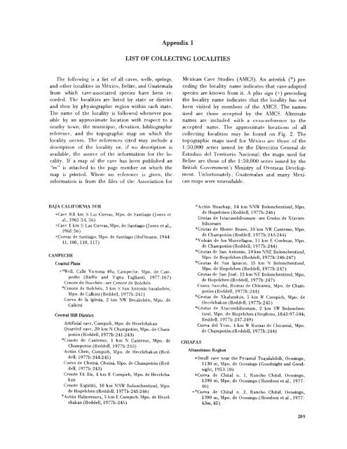
Appendix 1LIST OF COLLECTING LOCALITIESThe following is a list of all caves, wells, springs,and other localities in Mexico, Belize, and Guatemalafrom which cave-associated species have been recorded.The localities are listed by state or districtand then by physiographic region within each state.The name of the locality is followed whenever possibleby an approximate location with respect to anearby town, the municipio, elevation, bibliographicreference, and the topographic map on which thelocality occurs. The references cited may include adescription of the locality or, if no description isavailable, the source of the in<strong>for</strong>mation <strong>for</strong> the locality.If a map of the cave has been published an"m" is attached to the page number on which themap is printed. Where no reference is given, thein<strong>for</strong>mation is from the files of the <strong>Association</strong> <strong>for</strong><strong>Mexican</strong> <strong>Cave</strong> <strong>Studies</strong> (AMCS). An asterisk (*) precedingthe locality name indicates that cave-adaptedspecies are known from it. A plus sign (+) precedingthe locality name indicates that the locality has notbeen visited by members of the AMCS. The namesused are those accepted by the AMCS. Alternatenames are included with a cross-reference to theaccepted name. The approximate locations of allcollecting localities may he found on Fig. 2. Thetopographic maps used <strong>for</strong> Mexico are those of the1:50,000 series issued by the Direcci6n General deEstudios del Territorio Nacional; the maps used <strong>for</strong>Belize are those of the 1:50,000 series issued by theBritish Government's Ministry of Overseas Development.Un<strong>for</strong>tunately, Guatemalan and many <strong>Mexican</strong>maps were unavailable.BAJA CALIFORNIA SUR+<strong>Cave</strong> 0.8 km S Las Cuevas, Mpo. de Santiago (Jones etal., 1965:54, 56)+<strong>Cave</strong> 1 km S Las Cuevas, Mpo. de Santiago (Jones et al.,1965:56)+Cuevas de Santiago, Mpo. de Santiago (Hoffmann, 1944:41,108, 1l0, 117)CAMPECHECoastal Plain+*Well, Calle Victoria 49a, Campeche, Mpo. de Campeche(Ruffo and Vigna Taglianti, 1977:167)Cenote de Bocchen-see Cenote de Bolchen*Cenote de Bolchen, 3 km S San Antonio Sacabchen,Mpo. de Calkini (Reddell, 1977b:241)Cueva de la Iglesia, 2 km NW Becabchen, Mpo. deCalkiniCentral Hill DistrictArtificial cave, Cumpich, Mpo. de HecelchakanQuarried cave, 20 km N Champoton, Mpo. de Champoton(Reddell, 1977b:241-243)*Cenote de Cantemo, 1 km N Cantemo, Mpo. deChampoton (Reddell, 1977b:243)Actun Chen, Cumpich, Mpo. de Hecelchakan (Reddell,1977b:244-245)Cueva de Chuina, Chuina, Mpo. de Champoton (Reddell,1977b:243)Cenote Ek Bis, 4 km E Cumpich, Mpo. de HecelchakanCenote Espiritu, 10 km NNW Bolonchenticul, Mpo.de Hopelchen (Reddell, 1977b:245-246)*Aetun Halmensura, 5 km E Cumpich, Mpo. de Hecel·chakan (Reddell, 1977b:245)CHIAPAS*Actun Huachap, 14 km NNW Bolonchenticul, Mpo.de Hopelchen (Reddell, 1977b:246)Grutas de Ixtacumbilxunam-see Grutas de Xtacumbilxunam*Grutas de Monte Bravo, 10 km NW Cantemo, Mpo.de Champoton (Reddell, 1977b:243-244)*Volcan de los Murcielagos, 11 km E Conhuas, Mpo.de Champoton (Reddell, 1977b:244)*Grutas de San Antonio, 10 km NNE Bolonchenticul,Mpo. de Hopelchen (Reddell, 1977b:246-247)*Grutas de San Ignacio, 15 km N Bolonchenticul,Mpo. de Hopelchen (Reddell, 1977b:247)Grutas de San Jose, 15 km NE Bolonchenticul, Mpo.de Hopelchen (Reddell, 1977b:247)Cueva Sascab:i, Ruinas de Chicanna, Mpo. de Champoton(Reddell, 1977b:244)*Grutas de Xkalumkin, 5 km W Cumpich, Mpo. deHecelchakan (Reddell, 1977b:245)*Grutas de Xtacumbilxunam, 2 km SW Bolonchenticul,Mpo. de Hopelchcn (Stephens, 1843:97-104;Reddell, 1977b:247.249)Cueva del Yeso, 4 km W Ruinas de Chicanna, Mpo.de Champoton (Reddell, 1977b:244)Altamirano Region+Small cave near the Pyramid Tzajalalchih, Ocosingo,1130 m, Mpo. de Ocosingo (Goodnight and Goodnight,1953:10)+Cueva de Chital n. J, Rancho Chital, Ocosingo,1390 m, Mpo. de Ocosingo (Sbordoni et al., 1977:46)+*Cueva de Chilal n. 2, Rancho Chital, Ocosingo,1390 m, Mpo. de Ocosingo (Sbordoni et aI., 1977:43m,45)289


