*Cenote Xtacabiha, 9 km NNE Tikuch, Mpo. deValladolid (Reddell, 1977b: 293)+Cenote X-Tojil, Libre Union, Mpo. de Yaxcaba (lullini,1977:76)Cenote Xtolok, Chichen Itza, Mpo. de Tinum (Hall,1936:9m;Reddell,1977b:287)*Cueva del Cenote Xtolok, Chichen Itza, Mpo. deTinum (Reddell, 1977b:287-288)+*Cenote Yunchen, Libre Union, Mpo. de Yaxcaba(Reddell,1977b:293)Cueva Yunchen-see Cenote Yunchen+Cenote Yuncu, Yuncu, Mpo. de ?Abala (Reddell,1977b:256)+*Cenote laci, 36 km ENE Tizimin, Mpo. de Tizimin(Holthuis, 1977:175)Cueva de lopilote Negro, Ruinas de Ake, Mpo. deTixkokob (Reddell, 1977b:288)Sierra de Tieul<strong>Cave</strong> on the Hacienda San Bernardo-see Actun Xpukil+<strong>Cave</strong>, Ticul, Mpo. de Tieul (Reddell, 1977b: 284)+<strong>Cave</strong>, Yocat, Mpo. de Ticul (Reddell, 1977b:284)Cueva de Aguacate, 2 km S Maxcanu, Mpo. de Maxcanu(Reddell, 1977b:262-263)Actun Ankah-see Actun ChacaljasGrutas de Calcehtok-see Actun Xpukil*Actun Chac, 15 km ESE Santa Elena, Mpo. deSanta Elena (Mercer, 1896:91-93, 92m; Reddell,1977b:277)Actun Chacaljas, 3 km S Calcehtok, Mpo. de Opichen(Reddell,1977b:269)+Cueva Chakxix, near Tekax, Mpo. de Tekax (Reddell,1977b:282)Actun Chen, 3 km W Kiuick, Mpo. de Oxkutzcab(Reddell,1977b:273)Actun Chom, 1 km S Calcehtok, Mpo. de Opichen(Reddell,1977b:269)*Actun Chukum, 2 km S Maxcanu, Mpo. de Maxcanu(Reddell,1977b:263-264)Actun Chunup, 2 km SW Maxeanu, Mpo. de Maxcanu(Reddell, 1977b:264)Cueva del Cinco de Mayas-see Cueva del Cinco deMayo+Cueva del Cinco de Mayo, 1 km SW Tekax, Mpo. deTekax (Finch, 1965:132m, 133; Reddell, 1977b:281-282)Actun Coch Leb, 3 km S Calcehtok, Mpo. de Opichen(Reddell, 1977b:269-270)+Actun Coyok, 6.5 km SW Oxkutzcab, Mpo. de Oxkutzcab(Hatt, 1953:15m; Reddell, 1977b:273)+Actun Ebizt, near Oxkutzcab, Mpo. de Oxkutzcab(Pearse, 1938a:l0, 11m; Reddell, 1977b:273)+*Actun Gongora, 1.5 km S or 3 km E Oxkutzcab,Mpo. de Oxkutzcab (Pearse, 1938a:10, 11m;Reddell,1977b:273-274)Actun Gongurrah-see Actun GongoraCueva de Gorgosa-see Actun Gongora+Actun Has, 6.5 km S Yocat, Mpo. de Ticul (Reddell,1977b:284)Actun Hi-see Actun J ihActun Ix-kix-see Aemn XkycActun Jih, 3 km W Tieul, Mpo. de Ticul (Reddell,1977b:284)Actun Kiuick, Ruinas de Kiuick, Mpo. de Oxkutz·cab (Reddell, 1977b:274)+Aetun Lara, between Yocat and Ticul, Mpo. de Ticul(Mercer, 1896:83m, 84; Hatt, 1953:17-18, 17m;Reddell,1977b:284)*Actun Loltun, 7 km SSW Oxkutzcab, Mpo. de Oxkutzcab(Mercer, 1896:98-125, 99m; Thompson,1897:6-22, 8.10m; Finch, 1965:140-147, 141m,143m; Reddell, 1977b:274-275)+Manhole <strong>Cave</strong>, 3.2 km S Yocat, Mpo. de Ticul (Reddell,1977b:284)Actun Nohcacab, Santa Elena, Mpo. de Santa Elena(Reddell,1977b:277-278)*Actun Okobichen, 8 km SW Santa Elena, Mpo. deSanta Elena (Reddell, 1977b:278)+Actun On, 4 km SW Oxkutzcab, Mpo. de Oxkutzcab(Finch, 1965:136-140, 137m)+Actun Oxkintok, 2 km SW Calcehtok, Mpo. de Opichen(Mercer, 1896:44m, 45-46; Hatt, 1953:18-20,19m; Reddell, 1977b:270)Cueva de Oxkintok-see also Actun Xpukil+Gruta de Pichjabin, near Muna, Mpo. de ?Muna(Gonzalez·Ochoa, 1963b:84)<strong>Cave</strong>rna P'us-see Actun Puz+* Actun Puz, near Oxkutzcab, Mpo. de Oxkutzcab(Pearse, 1938a:l0, 11m; Reddell, 1977b:275-276)*Actun Sabaca, 6 km SW Tekax, Mpo. de Tekax(Mercer, 1896:146-149, 147m; Reddell, 1977b:282)Actun Sabacha-sec Actun SabacaActun Sabaka-see Actun SabacaCueva Sabre~see Actun SabacaCueva de San Roque-see Cueva Primera del Caminoa San RoqueSan Roque Road <strong>Cave</strong>-sec Cueva Primera del Caminoa San Roque+Cueva Primera del Camino a San Roque, on roadfrom Oxkutzcab to San Roque, Mpo. de Oxkutzcab(Reddell, 1977b:276)+Cueva Segunda del Camino a San Roque, on roadfrom Oxkutzcab to San Roque, Mpo. de Oxkutzcab(Pearse, 1938a:l0, 11m; Reddell, 1977b:276)<strong>Cave</strong>rna Sasich-see Actun Sazich+Actun Sazich, near Calcehtok, Mpo. de Opichen(Reddell,1977b:270)Cueva de Sebaca-see Actun SahacaAcmn Silil, 3 km S Calcehtok, Mpo. de Opichen(Reddell,1977b:270)Actun Sitz-see Actun lizActun Spukil~see Actun Xpukil*Actun Tucil, 2 km S Muna, Mpo. de Muna (Reddell,1977b:268-269)Actun Tusil-see Actun TucilActun Xcoch-see Actun Xkoch<strong>Cave</strong>rna Xkic-see Actun XkyeActun Xkoch, north of Santa Elena, Mpo. de SantaElena (Reddell, 1977b:278)Actun X-Koyoc-see Actun Coyok*Actun Xkyc, 2 km S Calcehtok, Mpo. de Opichen(Reddell,1977b:270-271)+Actun Xmahit, near Tekax, Mpo. de Tekax (Reddell,1977b:282)Actun Xpek, 1 km S Muna, Mpo. de Muna (Reddell,1977b:269)<strong>Cave</strong>rna Xpueil-see Actun Xpukil316
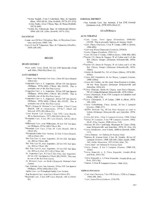
*Actun Xpukil, 3 km S Calcehtok, Mpo. de Opichen(Hatt, 1953:20.24, 22m; Reddell, 1977b:271-273)Acron Ziizha, 2 km S Muna, Mpo. de Muna (Reddell,1977b:269)*Actun Ziz, Oxkutzcab, Mpo. de Oxkutzcab (Mercer,1896:128·129, 129m; Reddell, 1977b:276)ZACATECAS+Large cave 8.8 km S Moyahua, Mpo. de Moyahua (Geno·ways and Jones, 1968:744)+<strong>Cave</strong> 21 km W Valparaiso, Mpo. de Valparaiso (Handley,1959:149-150)BELIZE DISTRICTBELIZE+<strong>Cave</strong> under Gracy Rock, 8.5 km SSW Hattieville (Neilland Allen, 1962:84)(Sheet 21)CAYO DISTRICTFissure near Mountain Cow <strong>Cave</strong>, 2 km SE <strong>Cave</strong>s Branch(Sheet 25)+Augustine <strong>Cave</strong> n. 1, Augustine, 22 km SSE San Ignacio(Williams, 1976c:602) ('!Sheet 28) (NOTE: This isprobably one of the Rio Frio <strong>Cave</strong>s)+Augustine <strong>Cave</strong> n. 2, Augustine, 22 km SSE San Ignacio(Williams, 1976c:602) (?Sheet 28) (NOTE: This isprobably one of the Rio Frio <strong>Cave</strong>s)+Augustine <strong>Cave</strong> n. 3, Augustine, 22 km SSE San Ignacio(Williams, 1976c:602) (?Sheet 28) (NOTE: This isprobably one of the Rio Frio <strong>Cave</strong>s)*Buck's Bypass-St. Herman's <strong>Cave</strong> System, 2 km E <strong>Cave</strong>sBranch, 120 m (Anonymous, 1974a:7; Albert andMcLeod, 1971:29)(Sheet 25)<strong>Cave</strong>s Branch <strong>Cave</strong> System, 5 km NNE <strong>Cave</strong>s Branch,40 m (Bartholomew, 1973:260-261) (Sheet 25)*Footprint <strong>Cave</strong>, 4 km SW <strong>Cave</strong>s Branch, 120 m (Sheet25)+Millionario <strong>Cave</strong>, near Millionario, 45 km SSE San Ignacio(Williams, 1976c:602 (?Sheet 28)*Mountain Cow <strong>Cave</strong>, 2 km SE <strong>Cave</strong>s Branch, 160 m(Sheet 25)Petroglyph-Satibe <strong>Cave</strong> System, 2.5 km S <strong>Cave</strong>s Branch,160 m (Sheet 25)Rio Frio <strong>Cave</strong> A, near Augustine, 22 km SSE San Ignacio,450 m (?Sheet 28)Rio Frio <strong>Cave</strong> B, near Augustine, 22 km SSE San Ignacio,450 m (?Sheet 28)+Rio Frio <strong>Cave</strong> D, near Augustine, 22 km SSE San Ignacio,450 m (LaVal, 1973:25)(?Sheet 28)St. Augustine <strong>Cave</strong>, 0.5 km E Rio Frio, near Augustine,22 km SSE San Ignacio (?Sheet 28)(NOTE: This maybe one of the Rio Frio <strong>Cave</strong>s)St. Herman's <strong>Cave</strong>-see Buck's Bypass-St. Herman's <strong>Cave</strong>System+San Antonio <strong>Cave</strong>, San Antonio, 10 km SSE San Ignacio(Williams, 1976c:602) (Sheet 23)Satibe <strong>Cave</strong>-see Petroglyph-Satibe <strong>Cave</strong> SystemTop Breakout <strong>Cave</strong>, near <strong>Cave</strong>s Branch (Sheet 25)*Waterfall <strong>Cave</strong>, 5 km SSW Cavcs Branch, 160 m (Sheet25)COROZAL DISTRICT+San Antonio <strong>Cave</strong>, San Antonio, 2 km ENE Corozal(Quinones et aI., 1978:559) (Sheet 2)ALTA VERAPAZGUATEMALA+<strong>Cave</strong>, Cacao, Trece Aguas (Froeschner, 1960:661(NOTE: This is probably Sistema de Seamay-Sejul)+<strong>Cave</strong>, Finca Chicoyou, 1 km W Coban, 1300 m (Jones,1966:456)+<strong>Cave</strong> near Finca Chimoxan (Goodwin, 1934:8)+<strong>Cave</strong>s, Chipoc (Goodwin, 1934:11)+<strong>Cave</strong> 14.5 km S Coban, 1360 m (Jones, 1966:464, 465)+*Grotte C3, Sierra de Pampur, W of Coban and S of theRio Chixoy Onegro (Delamare Deboutteville, 1976:127m)+*Grotte G3, Sierra de Pampur, W of Coban and S of theRio Chixoy Onegro (Delamare Deboutteville, 1976:126m)+Grotte de Bombil Pee, NE of Chisec (Dreux, 1974:205,210m)+Cueva del Cementerio de los Mayas, Lanquin (Gurnee,1968:150m)+Cueva del Cerrito, on the route from Raxjura to Coban,10 km from Raxjura (Delamare Deboutteville andJ uberthie, 1976:23)+*Cueva Chiacam, Sierra de Chama, near Finca Chiacam,NE of Coban(Delamare Deboutteville, 1976:128m)+Cueva Chiantejau, 8 km ENE Lanquin on Cahab6n road(Mohr, 1968:172)+*Cueva Chirrepeck, S of Coban, 1400 m (Beier, 1974:101,102)+Cueva Golondrinas, Finca Arenal, 10 km S Lanquin(Gurnee, 1968:157)+J ul'Pec Beneack Yaj, 10 km from Raxjura on road toCoban (Delamare Deboutteville and Juberthie, 1976:23)+Cueva .lui Seluc, 2 km S Lanquin (Gurnee, 1968:154m)*Grutas de Lanquin, 1 km NW Lanquin (Gurnee, 1962:26-27, 27m; Gurnee, 1968:151m, 152)+Sistema del Rio Candelaria, Municipio de Chisec (DelamareDeboutteville and Juberthie, 1976:19, 21m, 23)+Cueva Sakalkunte, near Senahu, 1800 m (Bartsch, 1906:117)Cueva Seamay-see Sistema de Seamay-Sejul*Sistema de Seamay-Sejul, 2 km SE Senahu, 26 km SELanquin (Gurnee, 1968:158-160, 158m; Smith, 1968:162, 163m; Shawcross, 1971 :63-64, 69m, 71)Cueva Sejul-see Sistema de Seamay-Sejul+Cueva Seanay, 2 km S Lanquin (Gurnee, 1968:152,154m)*Cueva Sepacuite n. 2, Finca Sepacuite, Senahu (Peckand Peck, 1973:70)Cueva Sepacuite n. 3, Finca Sepacuite, Scnahu (Peck andPeck,1973:70)+Siguan, 1.5 km W Lanquin (Gurnee, 1968:152)CHIMALTENANGO+<strong>Cave</strong> near Chocoyos, 7 km NW Patzun, 1520 m (Usinger,1966:298,360)+<strong>Cave</strong>, Santa Elena (Sanborn, 1936:99)317
- Page 1:
A REVIEW OF THECAVERNICOLE FAUNA OF
- Page 8:
. 1-----,, ,", ,\'"I/I~" )/Fig. I.-
- Page 12 and 13:
collected a troglobitic cirolanid i
- Page 14 and 15:
C. Bolivar and J. Carranza investig
- Page 16 and 17:
springs in the vicinity of Cautro C
- Page 18 and 19:
Cueva del Diablo near Orizaba, Vera
- Page 20 and 21:
Those species of troglobite which h
- Page 22 and 23:
Table 2.-(continued)1970. Eodrilus
- Page 25 and 26:
CAVE REGIONSOnly the cave regions o
- Page 27 and 28:
Table 3.-(continued)TroglobitesTrog
- Page 29 and 30:
y the waters of the Amistad Reservo
- Page 31 and 32:
Although a few caves in the Norther
- Page 33 and 34:
an elevation of about 900 meters. T
- Page 35 and 36:
the gryllid cricket Paracophus suba
- Page 37 and 38:
has been Jiscussed by Segerstrom (1
- Page 39 and 40:
only apparent troglophile is the ps
- Page 41 and 42:
The cave fauna of this region is ri
- Page 43 and 44:
igneous rock immediately east of th
- Page 45 and 46:
Rio Soto la Marina and terminates a
- Page 47 and 48:
caves studied are many large stream
- Page 49 and 50:
unusual species is Neogovea mexasca
- Page 52 and 53:
pallidus Rowland, the nesticid spid
- Page 54 and 55:
troglobites: the trichoniscid isopo
- Page 56 and 57:
Cambridge, and Pholcophora bispinos
- Page 58 and 59:
of the genus Lutzomyia has not been
- Page 60 and 61:
The principal cavernous fonnation i
- Page 62 and 63:
ocks of Paleocene to Pliocene age.
- Page 64 and 65:
Beach and Supra-tidal Zone, the I\o
- Page 66 and 67:
The aquatic fauna of Mexico and Cen
- Page 68 and 69:
oaxacae Hobbs from the Valle Nacion
- Page 70 and 71:
described, the genus occurs in cave
- Page 72 and 73:
large genus with numerous epigean s
- Page 74 and 75:
milliped, laniatorid harvestmen, an
- Page 76 and 77:
Table 4.-Summary of cave inhabiting
- Page 78 and 79:
Discussion.-This large, troglobitic
- Page 80 and 81:
any way a part of the true cave fau
- Page 82 and 83:
they have been washed in with soil
- Page 84 and 85:
part of the aquatic fauna. A very l
- Page 86 and 87:
The genus Helicodiscus is a signifi
- Page 88 and 89:
associated with true cave waters. P
- Page 90 and 91:
Family DaphnidaeWilson (1936) repor
- Page 92 and 93:
tul), Cueva de San Isidro, Cueva de
- Page 94 and 95:
30 m below entrance of Cueva de la
- Page 96 and 97:
underflow of rivers, alluvial grave
- Page 98 and 99:
the similarities between the distri
- Page 100 and 101:
Yucatan but did not identify the sp
- Page 102 and 103:
Protrichoniscus: Reddell, 1967a:24.
- Page 104 and 105:
It indudes five spccies, of which t
- Page 106 and 107:
Type-locality.-Pozzo, Etla, Oaxaca,
- Page 108 and 109:
Records.-Campeche: Volc
- Page 110 and 111:
164; Pearse, 1945:167, 168, fig. 13
- Page 112 and 113:
Family AtyidaeThe family Atyidae is
- Page 115 and 116:
Creaseria morleyi (Creaser)Blind sh
- Page 117 and 118:
the pond which is fed by the cave s
- Page 119 and 120:
philes. Pseudothelphusa (Pseudothel
- Page 121 and 122:
Typhlochactas elliotti MitchellTyph
- Page 123 and 124:
Distribution.-Known only from the t
- Page 125 and 126:
(Dumitresco and Orghidan, 1977); th
- Page 127 and 128:
Leucohya magnifica MuchmoreUndescri
- Page 129 and 130:
Discussion.-This is the largest spe
- Page 131 and 132:
Type-Iocality.-S6tano de Huitzmolot
- Page 133 and 134:
Bartolo is a name applied to two ne
- Page 135 and 136:
Rowland, 1975b:19, 20; Dumitresco,
- Page 137 and 138:
Type-Iocality.-Actlin Kaua, Yucatan
- Page 139 and 140:
Distribution.-Known only from caves
- Page 141 and 142:
een collected. It is frequently fou
- Page 143 and 144:
Distribution.-Known from two caves
- Page 146 and 147:
actually a natural cave artificiall
- Page 148 and 149:
Discussion.-This large species has
- Page 150 and 151:
and T. patellaris Bryant from caves
- Page 152 and 153:
estricted to the Mexican Plateau (s
- Page 154 and 155:
maya Chamberlin and Ivie from Campe
- Page 156 and 157:
Metagonia chiquita GertschMetagonia
- Page 158 and 159:
Metagonia capilla: Mitchell and Kaw
- Page 160 and 161:
the cave and in general association
- Page 162 and 163:
DiscWlSion.-This is a delicate, eye
- Page 164 and 165:
Type-Iocality.-Cueva de Los Sabinos
- Page 166 and 167:
family. Clarence and Marie Goodnigh
- Page 168 and 169:
n. 2, San Luis Potosi; and K. rugos
- Page 170 and 171:
Type-locality.-Cueva de Apoala, San
- Page 172 and 173:
Records.-Chiapas: Sumidero de Canad
- Page 174 and 175:
Family HeterozerconidaeSpecimens of
- Page 176 and 177:
only one species. All known epigean
- Page 178 and 179:
nation must await study, but it is
- Page 180 and 181:
Mexico and Guatemala, and several u
- Page 182 and 183:
Type-locality.-Gruta de Atoyac, Ver
- Page 184 and 185:
Records.-San Luis PotOSI: Sotano de
- Page 186 and 187:
Records.-Veracruz: Grutas de Atoyac
- Page 188 and 189:
the genus Synoptura and removed the
- Page 190 and 191:
known from caves all contain troglo
- Page 192 and 193:
las Perlas, Cueva Chica de la Perra
- Page 194 and 195:
Discussion.-This species is distinc
- Page 196 and 197:
Speodesmus pecki ShearPolydesmidae,
- Page 198 and 199:
appears to be most closely related
- Page 200 and 201:
this is almost certainly M. russell
- Page 202 and 203:
Table 21.-Summary of cave inhabitin
- Page 204 and 205:
Type-Iocality.-Cueva Bonita del Pre
- Page 206 and 207:
Type-Iocality.-Cueva de El Jobo, El
- Page 208 and 209:
Order DipluraFamily CampodeidaeAlth
- Page 210 and 211:
of small soil inhabiting japygoids
- Page 212 and 213:
(Linnaeus) has been collected from
- Page 214 and 215:
Cave. Paracophus caecus appears to
- Page 216 and 217:
the most poorly known species in th
- Page 218 and 219:
Family EpipsocidaeThe family Epipso
- Page 220 and 221:
citata Van Tyne in Cenote de Piste,
- Page 222 and 223:
een found in caves and mines in Yuc
- Page 224 and 225:
ground dwelling habit, many beetles
- Page 226 and 227:
Type-Iocality.-Sotano de Tejamanil,
- Page 228 and 229:
Vigna Taglianti, 1972:118, 121-127,
- Page 230 and 231:
Veracruz) belongs in another subgen
- Page 232 and 233:
Troglobacanius sbordonii VomeroTrog
- Page 234 and 235:
Ptomaphagus (Adelops) is a group of
- Page 236 and 237:
(A.) speLaeus, from Grutas de Cacah
- Page 238 and 239:
epresented by many species. Tenebri
- Page 240 and 241:
Myodopsylla gentilis Jordan and Rot
- Page 242 and 243:
genus Pholeomyia have been collecte
- Page 244 and 245:
Wheeler (1938) has reported the pre
- Page 246 and 247:
263.264, 265, 267, 270, 273, fig. 5
- Page 248 and 249:
Anophthyctys jordani: Stefanelli, 1
- Page 250 and 251:
Prietella phreatophila Carranza, 19
- Page 252 and 253:
TyphlilJs: Pearse, 1938a:13, 15; Hu
- Page 254 and 255:
Family BufonidaeFour species of toa
- Page 256 and 257:
Oaxaca; and E. yucatanensis Lynch f
- Page 258 and 259:
sity of bats in the tropics. In add
- Page 260 and 261:
Three species of short-tailed bats
- Page 262 and 263:
abundant in the entrance area of Cu
- Page 264 and 265:
Andrews, E. W., IV. 1970. Balankanc
- Page 266 and 267:
Bolivar y Pieltain, C. 1940. Explor
- Page 268 and 269:
Brignoli, P. M. 1979a. The morpholo
- Page 270 and 271:
Conde, B. 1975. Description du prem
- Page 272 and 273: Ediger, G. 1970. The Birthday Passa
- Page 274 and 275: Gonzalez Ochoa, A. 1963b. Relacione
- Page 276 and 277: Hobbs, H. H.,Jr., and T. C. Barr, J
- Page 278 and 279: Jordan, c. B. 1937. Bringing in the
- Page 280 and 281: McKenzie, D. 1965a. Caves of the Si
- Page 282 and 283: Monod, T. 1975. Sur la distribution
- Page 284 and 285: Peck, S. B., and J. J. Lewis. 1977.
- Page 286 and 287: Reddell, J. R., and W. R. Elliott.
- Page 288 and 289: Sanborn, C. C. 1936. Records and me
- Page 290 and 291: Stone, B. 1979. The 1979 San Agusti
- Page 292 and 293: Villa R., B. 1956. Una extrana y se
- Page 294 and 295: Wimsatt, W. A. 1969. Transient beha
- Page 296 and 297: +*Cueva de los Chivos, 5 km E Altam
- Page 298 and 299: Sumidero Yochib, Yochib, 8 km NE Te
- Page 300 and 301: Serrania del Burro RegionCave, Haci
- Page 302 and 303: +Cueva de Tezoapa, 1.5 km E Acahuiz
- Page 304 and 305: *Gruta Sur de San Bartolo, 9 km S S
- Page 306 and 307: *Cueva del Puente de Fierro, 1.5 km
- Page 308: Cueva de los Riscos, 2 km S Rancho
- Page 311 and 312: Cueva de El Coy-see Cueva del Nacun
- Page 313 and 314: +*Cueva del Aire, 1.8 km at S85°W
- Page 315 and 316: *Sistema Purificacion, Conrado Cast
- Page 317 and 318: *Cueva del Nacimiento del Rio Frio,
- Page 319 and 320: Sotano de Humo, 5 km NW San Andres,
- Page 321: and Bohor, 1975:25-27, 26m; Reddell
- Page 325 and 326: Appendix 2LIST OF TROGLOBITES BY ST
- Page 327 and 328: Paravachonium superbum-I'seudoscorp
- Page 329 and 330: SUPPLEMENTWhile this manuscript was
- Page 331 and 332: Cambala speobia (Chamberlin) (p. 19
- Page 333: mida (Arachnida) in the New World.


