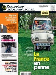
2 ОРГАНИЗАЦИЯ И МЕТОДИКА РАБОТ - Courrier international
2 ОРГАНИЗАЦИЯ И МЕТОДИКА РАБОТ - Courrier international
2 ОРГАНИЗАЦИЯ И МЕТОДИКА РАБОТ - Courrier international

You also want an ePaper? Increase the reach of your titles
YUMPU automatically turns print PDFs into web optimized ePapers that Google loves.
Figure 13.1. Schematic map of sampling points in the area of fuel and lubricant storage<br />
facility and near the Severnaya Bay<br />
Table 13.1 - Coordinates of points of new area boundaries<br />
Number<br />
N<br />
of Point<br />
E Notes<br />
056 80 46'28,8'' 47 40'53,0'' Sea coast, creek inflow<br />
057 80 46'31,3'' 47 40'39,8'' Creek bank<br />
058 80 46'32,9'' 47 40'33,3'' Lakeside, creek headwater<br />
059 80 46'32,1'' 47 40'18,4'' Lakeside<br />
060 80 46'30,2'' 47 39'48,3'' Slope near the lake (there are drums and logs)<br />
061 80 46'32,0'' 47 39'34,7'' Lakeside (cisterns)<br />
062 80 46'32,2'' 47 39'13,9'' Lakeside (upward turning point)<br />
063 80 46'28,8'' 47 39'08,5''<br />
Slope (Accumulation of drums with TS 200<br />
500 pcs<br />
064 80 46'26,0'' 47 38'56,6'' Watershed (plateau)<br />
065 80 46'23,9'' 47 38'53,7'' Upper clift near sea<br />
066 80 46'22,0'' 47 39'02,8'' Lower plateau near sea<br />
067 80 46'20,4'' 47 39'33,6'' Lower clift near sea<br />
068 80 46'20,7'' 47 39'50,0'' Sea coast<br />
069 80 46'24,0'' 47 40'17,2'' Sea coast (half-sunk tow is nearby)<br />
070 80 46'26,3'' 47 40'40,5'' Sea coast (small cape)<br />
FINAL REPORT for Contract No. CS-NPA-Arctic-13/2009 of December 01, 2009 within the framework of pilot project<br />
Development of Technology of clean up of the area of Decommissioned Sites of The Russian Federation Ministry of Defense in<br />
the Arctic by the Example of Alexanra Island of Franz Josef Land Archipelago from Hazardous Waste<br />
202