- Page 1 and 2:
11 Mosaic The training kit for Euro
- Page 3 and 4:
2 This document does not necessaril
- Page 6 and 7:
5 Contents List of figures and tabl
- Page 8 and 9:
7 List of figures and tables Figure
- Page 10 and 11:
9 List of abbreviations AHDR Arab H
- Page 12:
11 Acknowledgements The production
- Page 15 and 16:
14 work, a history textbook or a po
- Page 18 and 19:
1 17 T he Mediterranean is both hom
- Page 20 and 21:
1 19 and comments on the texts on l
- Page 22 and 23:
1 21 Environment The Mediterranean
- Page 24 and 25:
1 23 Table 0.1: What is in an activ
- Page 26 and 27:
1 25 D Intercultural learning Chapt
- Page 28 and 29:
1 27 Always adapt in the light of t
- Page 30:
2 29 Themes
- Page 33 and 34:
32 this chapter also looks at the i
- Page 35 and 36:
34 the United Kingdom and Ireland;
- Page 37 and 38:
36 Figure 1.2: The member states of
- Page 39 and 40:
38 Being a crossroads and a bridge
- Page 41 and 42:
40 the use of force to settle dispu
- Page 43 and 44:
42 D 1.6.1 The Euro-Mediterranean P
- Page 45 and 46:
44 Figure 1.4: The countries of the
- Page 47 and 48:
46 1.7 Euro-Mediterranean youth wor
- Page 49 and 50:
48 Euro-Mediterranean youth work ca
- Page 51 and 52:
50 D 1.7.2 Euro-Med Youth Units and
- Page 53 and 54:
52 In addition to the efforts of va
- Page 55 and 56:
54 the youth field to co-operate wi
- Page 57 and 58:
56 of its geography. The institutio
- Page 59 and 60:
58 38. See www.isesco.org.ma/Englis
- Page 61 and 62:
60 91. For the 2003 Compendium on E
- Page 63 and 64:
62 and corn, as well as the tobacco
- Page 65 and 66:
64 Meeting and confronting the stra
- Page 67 and 68:
66 Russia and Morocco. Can one igno
- Page 69 and 70:
68 Arab nationalism and creation of
- Page 71 and 72:
70 In terms of the substance of a n
- Page 73 and 74:
72 Some projects supported by the E
- Page 75 and 76:
74 3. Any timeline, like any histor
- Page 77 and 78:
76 Our perceptions, habits and dail
- Page 79 and 80:
78 3.3 Elements of culture Time, pl
- Page 81 and 82:
80 3.4 Cultural diversity 18 Cultur
- Page 83 and 84:
82 Homogenisation. The movement of
- Page 85 and 86:
84 many Mediterranean states are of
- Page 87 and 88:
86 If Orientalism can be defined as
- Page 89 and 90:
88 to today with the mobility of pe
- Page 91 and 92:
90 Intercultural dialogue may serve
- Page 93 and 94:
92 able to accept others, role dist
- Page 95 and 96:
94 13. Dadsi, D. (1995) Specificiti
- Page 97 and 98:
96 68. Iben, G. (1974) Sozialerzieh
- Page 99 and 100:
98 4.2 Young people’s realities -
- Page 101 and 102:
100 For Europe this means that rele
- Page 103 and 104:
102 In terms of its implementation,
- Page 105 and 106:
104 4.4 What is youth participation
- Page 107 and 108:
106 Table 4.2: Resolutions and agre
- Page 109 and 110:
108 Education, information, health
- Page 111 and 112:
110 Some examples of participatory
- Page 113 and 114:
112 The Ladder of Participation 59
- Page 115 and 116:
114 Competences We might utilise a
- Page 117 and 118:
116 Some basic methods and guidelin
- Page 119 and 120:
118 12. The Mediterranean countries
- Page 121 and 122:
120 58. This is also one aspect of
- Page 123 and 124:
122 These are some of the questions
- Page 125 and 126:
124 As the institutions ultimately
- Page 127 and 128:
126 is that some rights (negative r
- Page 129 and 130:
128 D 5.5.1 The European Enlightenm
- Page 131 and 132:
130 The Second Optional Protocol 8
- Page 133 and 134:
132 Other important human rights do
- Page 135 and 136:
134 Some real examples of violation
- Page 137 and 138:
136 Finally, if all of this was not
- Page 139 and 140:
138 or the way existing mechanisms
- Page 141 and 142:
140 Education through human rights
- Page 143 and 144:
142 18. See www.echr.coe.int/echr.
- Page 145 and 146:
144 everywhere and nowhere. Althoug
- Page 147 and 148:
146 Attitudes in a given society/co
- Page 149 and 150:
148 So, although women are oppresse
- Page 151 and 152:
150 Gender mainstreaming The United
- Page 153 and 154:
152 Marxist feminism also argues th
- Page 155 and 156:
154 In addition to these global eff
- Page 157 and 158:
156 to benefit from them. When this
- Page 159 and 160:
158 and political, social, economic
- Page 161 and 162:
160 D 6.5.4 Women and the labour ma
- Page 163 and 164:
162 b) physical, sexual and psychol
- Page 165 and 166:
164 to become emancipated, another
- Page 167 and 168:
166 What can be done to overcome th
- Page 169 and 170:
168 Focusing on specific gender iss
- Page 171 and 172:
170 3. Organization for Security an
- Page 173 and 174:
172 65. Walby, S. (1991); Council o
- Page 175 and 176:
174 127. Council of Europe (2008),
- Page 177 and 178:
176 188. UN-INSTRAW, Glossary of ge
- Page 179 and 180:
178 of minorities, it is hard to pi
- Page 181 and 182:
180 In the Arab Human Development R
- Page 183 and 184:
182 minority young people might go
- Page 185 and 186:
184 7.5 Issues related to minoritie
- Page 187 and 188:
186 Problems within and between nor
- Page 189 and 190:
188 people who are tolerant but do
- Page 191 and 192:
190 Convention, people who claim th
- Page 193 and 194:
192 7.10 Challenges for Euro-Medite
- Page 195 and 196:
194 adopt non-formal education in
- Page 197 and 198:
196 20. See www.escwa.org.lb/ayd/ (
- Page 200 and 201:
2 199 8 Religion and tolerance Figu
- Page 202 and 203:
2 201 Tolerance The United Nations
- Page 204 and 205:
2 203 organised beliefs and practic
- Page 206 and 207:
2 205 It seems that the political a
- Page 208 and 209:
2 207 to see that fundamentalism is
- Page 210 and 211:
2 209 initiatives of non-government
- Page 212 and 213:
2 211 the official religion of the
- Page 214 and 215:
2 213 share the same essential doct
- Page 216 and 217:
2 215 to the Maghreb, the Iberian P
- Page 218 and 219:
2 217 70 days after the end of the
- Page 220 and 221:
2 219 Zionism 111 refers to the Jew
- Page 222 and 223:
2 221 Yazidis are thought to be des
- Page 224 and 225:
2 223 In the 21st century, in many
- Page 226 and 227:
2 225 laws that regulate various as
- Page 228 and 229:
2 227 8. Religion (2007) Encyclopæ
- Page 230 and 231:
2 229 65 . Baptism (2007) Encyclop
- Page 232 and 233:
2 231 124. Reconstructionism (2007)
- Page 234 and 235:
2 233 9 Peace and conflict Figure 9
- Page 236 and 237:
2 235 Conflict can be defined as
- Page 238 and 239:
2 237 Avoidance can be related to f
- Page 240 and 241:
2 239 “I-message” is an effecti
- Page 242 and 243:
2 241 Sulha is a traditional Arab m
- Page 244 and 245:
2 243 Biased attributions: when pe
- Page 246 and 247:
2 245 A second set of concepts whos
- Page 248 and 249:
2 247 Humanising the enemy: Feeling
- Page 250 and 251:
2 249 is another ‘need’ that mi
- Page 252 and 253:
2 251 Peace can be built by actions
- Page 254 and 255:
2 253 not only to results but also
- Page 256:
2 255 19. Silverstein, B. and Flame
- Page 259 and 260:
258 The environment and people have
- Page 261 and 262:
260 10.3 The first Eden: 10 the Eur
- Page 263 and 264:
262 landscape, mostly by the destru
- Page 265 and 266:
264 Another example from the Medite
- Page 267 and 268:
266 Unfortunately, tensions over sh
- Page 269 and 270:
268 campaigns and training events.
- Page 271 and 272:
270 The overall aim of the renewed
- Page 273 and 274:
272 Preservation and restoration of
- Page 275 and 276:
274 Notes 1. “Environment” in C
- Page 277 and 278:
T-Kit No.11 - MOSAIC - The training
- Page 280:
3 279 Activities index Title Level
- Page 283 and 284:
282 Instructions Explain that the
- Page 285 and 286:
284 Further information A brief acc
- Page 287 and 288:
286 Instructions Ask the group to
- Page 289 and 290:
288 Ideas for action Compare the si
- Page 291 and 292:
290 Instructions Explain that the
- Page 293 and 294:
292 Religion and spirituality can
- Page 296 and 297:
3 295 Camels go far without water C
- Page 298 and 299:
3 297 What did you learn about you
- Page 300:
3 299 A camel which has carried i
- Page 303 and 304:
302 Instructions Tell people to get
- Page 305 and 306: 304 Further information See http://
- Page 307 and 308: 306 Explain that the information s
- Page 309 and 310: 308 Further information The Enemy i
- Page 311 and 312: 310 Materials One set of questions
- Page 313 and 314: 312 Handouts Rules of the Game Ques
- Page 315 and 316: 314 Answers to Question 1: The Bar
- Page 317 and 318: 316 Instructions Explain that the a
- Page 319 and 320: 318 to the rest of the group once t
- Page 321 and 322: 320 Handouts Possible topics for de
- Page 323 and 324: 322 Instructions Divide participan
- Page 325 and 326: 324 Handouts The list of features.
- Page 327 and 328: 326 Instructions The activity is sp
- Page 329 and 330: 328 Variations You could use the me
- Page 331 and 332: 330 Instructions Introduce the aims
- Page 333 and 334: 332 Handouts Handouts in envelopes
- Page 335 and 336: 334 Tell them that they now need t
- Page 337 and 338: 336 Suggestions for follow up If yo
- Page 339 and 340: 338 Instructions Explain that the p
- Page 342 and 343: 3 341 Mapping the globe If you don
- Page 344 and 345: 3 343 How can you help to protect
- Page 346: 3 345 Handouts Role-cards and the s
- Page 349 and 350: 348 Give them 15-20 minutes for th
- Page 352 and 353: 3 351 Natural beauty How did they m
- Page 354 and 355: 3 353 find, the more interesting an
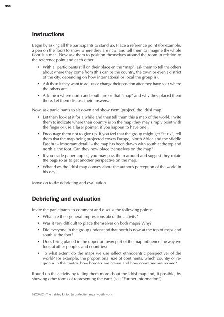
- Page 358 and 359: 3 357 Tips for the facilitator The
- Page 360: 3 359 More maps! Orange Blue
- Page 363 and 364: 362 Instructions Divide people into
- Page 365 and 366: 364 Handouts Guidance notes for the
- Page 367 and 368: 366 Instructions Part 1: Invite peo
- Page 369 and 370: 368 Further information Have a look
- Page 372 and 373: 3 371 Pass it on Be not disturbed a
- Page 374 and 375: 3 373 What information was left ou
- Page 376 and 377: 3 375 Pieces of cake Everyone has t
- Page 378 and 379: 3 377 the average, and would receiv
- Page 380 and 381: 3 379 Rebels and freedom fighters W
- Page 382 and 383: 3 381 Would it be possible to be o
- Page 384 and 385: 3 383 Reshaping racism There is no
- Page 386: 3 385 Tips for the facilitator Depe
- Page 389 and 390: 388 Instructions Ask participants w
- Page 391 and 392: 390 The WTO recommends a number of
- Page 393 and 394: 392 The activity will be more usef
- Page 395 and 396: 394 Suggestions for follow-up Look
- Page 397 and 398: 396 When they have arranged themse
- Page 400 and 401: 3 399 Timeline of history Inter-rel
- Page 402: 3 401 Variations The “personal hi
- Page 405 and 406: 404 Instructions Divide participant
- Page 407 and 408:
406 Handouts Decision cards 1-14 C
- Page 409 and 410:
408 Instructions Begin by asking pa
- Page 411 and 412:
410 Handouts Diamond-ranking diagra
- Page 413 and 414:
412 Instructions Ask participants t
- Page 416 and 417:
4 415 About the editors and contrib
- Page 418 and 419:
4 417 Ellie Keen editor and co-auth
- Page 420 and 421:
419 Extended table of contents List
- Page 422 and 423:
421 5.3 Human rights values _______
- Page 424 and 425:
423 4 Camels go far without water -
- Page 426:
11 Mosaic The training kit for Euro


