Operational Plan for the Restoration of Diadromous Fishes to the ...
Operational Plan for the Restoration of Diadromous Fishes to the ...
Operational Plan for the Restoration of Diadromous Fishes to the ...

You also want an ePaper? Increase the reach of your titles
YUMPU automatically turns print PDFs into web optimized ePapers that Google loves.
Recent surveys in coastal Maine rivers have revealed that large woody debris (LWD)<br />
is at extremely low levels. A study is underway <strong>to</strong> test <strong>the</strong> effectiveness <strong>of</strong> adding<br />
LWD <strong>to</strong> salmon habitat. However, no surveys have been done in <strong>the</strong> Penobscot<br />
basin, nor in more inland Maine rivers. The Penobscot basin contains a wider array<br />
<strong>of</strong> land use activities, <strong>for</strong>est types, and landscape features than does <strong>the</strong> coastal<br />
area where previous surveys were done. There<strong>for</strong>e, per<strong>for</strong>ming LWD surveys<br />
across reaches with different stream sizes, <strong>for</strong>est stands, <strong>to</strong>pography, and land use<br />
his<strong>to</strong>ry would help link LWD loading <strong>to</strong> <strong>the</strong>se variables. Assuming a link is revealed,<br />
we can use this in<strong>for</strong>mation <strong>to</strong> predict LWSD loadings in o<strong>the</strong>r streams. One avenue<br />
that may aid in this is using an LWD loading model based on <strong>for</strong>est stand data,<br />
environmental variables, and s<strong>to</strong>chastic events. Field surveys will help validate <strong>the</strong><br />
model and allow broader inferences <strong>to</strong> be made.<br />
23.13 Use <strong>the</strong> PITS model <strong>to</strong> help set res<strong>to</strong>ration goals and <strong>to</strong> help identify<br />
and prioritize res<strong>to</strong>ration opportunities<br />
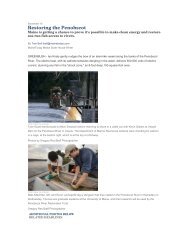
The Penobscot River <strong>Res<strong>to</strong>ration</strong> Project (PRRP) is a multimillion dollar endeavor<br />
that aims <strong>to</strong> res<strong>to</strong>re self-sustaining populations <strong>of</strong> native sea-run fish through <strong>the</strong><br />
removal <strong>of</strong> two mainstem dams and improved fish passage at numerous o<strong>the</strong>r dams<br />
on <strong>the</strong> Penobscot River. While many diadromous species will benefit from <strong>the</strong><br />
PRRP directly, o<strong>the</strong>r species such as endangered Atlantic salmon (Salmo salar),<br />
alewife (Alosa psuedoharengus), and American shad (Alosa sapidissima) may<br />
require additional habitat improvements (barrier removal, fishways, etc.) or s<strong>to</strong>cking.<br />
Thus, additional active res<strong>to</strong>ration measures may be required <strong>to</strong> realize <strong>the</strong> full<br />
potential <strong>of</strong> <strong>the</strong> PRRP. Due <strong>to</strong> <strong>the</strong> high pr<strong>of</strong>ile and high cost <strong>of</strong> <strong>the</strong> project as well as<br />
numerous state, federal and non-governmental organizations involved, <strong>the</strong>re is a<br />
need <strong>to</strong> prioritize res<strong>to</strong>ration ef<strong>for</strong>ts in <strong>the</strong> basin <strong>to</strong> increase <strong>the</strong> probability <strong>for</strong> project<br />
success. To help facilitate this goal, we have created an ecologically-based GIS <strong>to</strong>ol<br />
<strong>to</strong> help set res<strong>to</strong>ration goals and <strong>to</strong> help identify and prioritize res<strong>to</strong>ration<br />
opportunities (s<strong>to</strong>cking options, barrier removal, and fishway improvements). Initial<br />
data inputs <strong>for</strong> <strong>the</strong> model include spawning habitat <strong>for</strong> a shortened list <strong>of</strong> focal<br />
species, a habitat weighting variable, and passage barriers (location and passage<br />
state). The outputs <strong>of</strong> <strong>the</strong> model are ecologically-based targets <strong>for</strong> focal species and<br />
prioritized lists <strong>of</strong> res<strong>to</strong>ration projects based on <strong>the</strong>ir biological merits, ra<strong>the</strong>r than<br />
being selected as opportunities arise. These outputs will help ensure that<br />
res<strong>to</strong>ration ef<strong>for</strong>ts and money are targeted appropriately and that achievable goals<br />
are set.<br />
References<br />
Abbott, A. 2008. Maine Road-Stream Crossing Survey Manual. Gulf <strong>of</strong> Maine<br />
Coastal Program. U. S. Fish and Wildlife Service. Falmouth, Maine. 27 pp.<br />
Hotchkiss, R. H. and C. M. Frei. 2007. Design <strong>for</strong> Fish Passage at Roadway-Stream<br />
Crossings: Syn<strong>the</strong>sis Report. Office <strong>of</strong> Infrastructure Research and<br />
Development. Turner-Fairbank Highway Research Center. Federal Highway<br />
Administration. McLean, VA.<br />
PRFP Page 91