

COMMISSION
4FcEkUnlA
4FcEkUnlA

Create successful ePaper yourself
Turn your PDF publications into a flip-book with our unique Google optimized e-Paper software.
staff to collect local seeds and grow its own plants on site. The program continues to<br />
expand each year and produces thousands of trees, shrubs, and grasses to be used for<br />
projects within the park.<br />
Grazing Program<br />
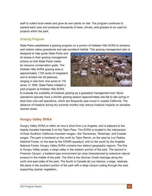
State Parks established a grazing program on a portion of Hollister Hills SVRA to enhance<br />
and restore native grasslands and oak woodland habitat. This grazing management plan is<br />
designed to help guide State Parks and<br />
its lessee in their grazing management<br />
actions so that State Parks meets<br />
its resource conservation goals. The<br />
Hollister Hills SVRA grazing area is<br />
approximately 1,155 acres of rangeland<br />
and is divided into 25 pastures,<br />
ranging in size from nine acres to 119<br />
acres. In 1994, State Parks initiated a<br />
pilot program at Hollister Hills SVRA<br />
to evaluate the suitability of livestock grazing as a grassland management tool. Stock<br />
operations typically have a shorter grazing season (approximately late fall to late spring or<br />
less) than cow-calf operations, which are frequently year-round in coastal California. The<br />
absence of livestock during dry summer months may reduce livestock impacts on sensitive<br />
riparian areas.<br />
Hungry Valley SVRA<br />
Hungry Valley SVRA is within an hour’s drive from Los Angeles, and is adjacent to the<br />
heavily traveled Interstate 5 on the Tejon Pass. The SVRA is located in the intersection<br />
of three Southern California mountain ranges—the Transverse, Tehachapi, and Coastal<br />
ranges. The park is bordered on the north by Tejon Ranch, on the west by Los Padres<br />
National Forest, on the east by the CDWR aqueduct, and on the south by the Angeles<br />
National Forest. Hungry Valley SVRA contains four distinct geographic regions. The first<br />
is Hungry Valley proper, a large valley in the western portion of the park. The second is<br />
Freeman Canyon, a badland-type environment (an area characterized by extensive natural<br />
erosion) in the middle of the park. The third is the Gorman Creek drainage along the<br />
north and east sides of the park. The fourth is Canada de Los Alamos, a large, relatively<br />
flat plane in the southern portion of the park with a deep canyon cutting through the area<br />
supporting riparian vegetation.<br />
2017 Program Report 101