

COMMISSION
4FcEkUnlA
4FcEkUnlA

Create successful ePaper yourself
Turn your PDF publications into a flip-book with our unique Google optimized e-Paper software.
discharges from Carnegie SVRA through the use of site-specific structural and nonstructural<br />
BMPs in order to protect and improve water quality while providing high-quality<br />
OHV recreational opportunities. Elements of the SWMP include public education and<br />
outreach, public involvement and participation, illicit discharge detection and elimination,<br />
construction site storm water management, post-construction storm water management,<br />
and pollution prevention/good housekeeping. The SWMP also included an OHV element<br />
dedicated to discussing management goals and activities for maintaining OHV trails and<br />
facilities as they relate to meeting the water quality objectives.<br />
Since 2012, several elements of the SWMP have been implemented. The following section<br />
describes the Resource Management Area (RMA) rehabilitation and public outreach and<br />
participation elements of the SWMP.<br />
Resource Management Areas<br />
The RMAs are discrete zones established to better plan and implement management<br />
activities of areas that share common characteristics. For the most part, the RMAs were<br />
divided by sub-watersheds and cover the entire SVRA. The RMAs are connected to each<br />
other through a trails network and is part of the overall Carnegie SVRA Trails Management<br />
Program.<br />
Each RMA restoration project starts<br />
with a planning process that considers<br />
several items including trail layout,<br />
connectivity, emergency access, user<br />
interest, enforcement strategy, education<br />
methods, buffer zones, and a timeline<br />
for completion of the project. The<br />
on-the-ground restoration work begins<br />
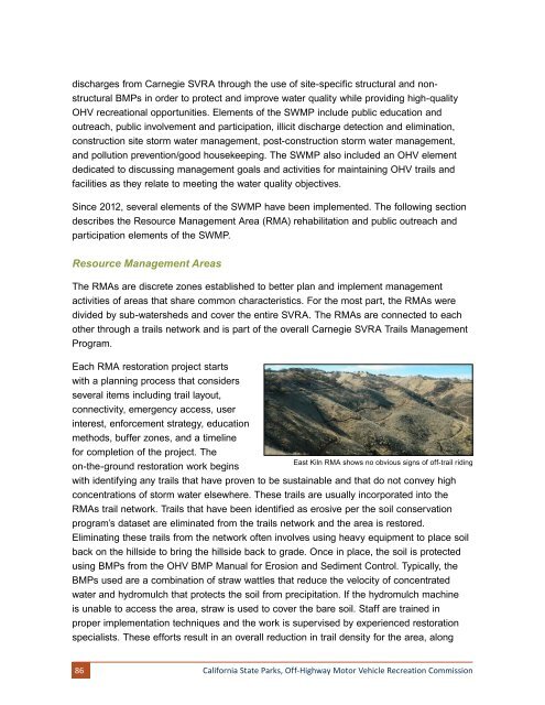
East Kiln RMA shows no obvious signs of off-trail riding<br />
with identifying any trails that have proven to be sustainable and that do not convey high<br />
concentrations of storm water elsewhere. These trails are usually incorporated into the<br />
RMAs trail network. Trails that have been identified as erosive per the soil conservation<br />
program’s dataset are eliminated from the trails network and the area is restored.<br />
Eliminating these trails from the network often involves using heavy equipment to place soil<br />
back on the hillside to bring the hillside back to grade. Once in place, the soil is protected<br />
using BMPs from the OHV BMP Manual for Erosion and Sediment Control. Typically, the<br />
BMPs used are a combination of straw wattles that reduce the velocity of concentrated<br />
water and hydromulch that protects the soil from precipitation. If the hydromulch machine<br />
is unable to access the area, straw is used to cover the bare soil. Staff are trained in<br />
proper implementation techniques and the work is supervised by experienced restoration<br />
specialists. These efforts result in an overall reduction in trail density for the area, along<br />
86<br />
California State Parks, Off-Highway Motor Vehicle Recreation Commission