

COMMISSION
4FcEkUnlA
4FcEkUnlA

Create successful ePaper yourself
Turn your PDF publications into a flip-book with our unique Google optimized e-Paper software.
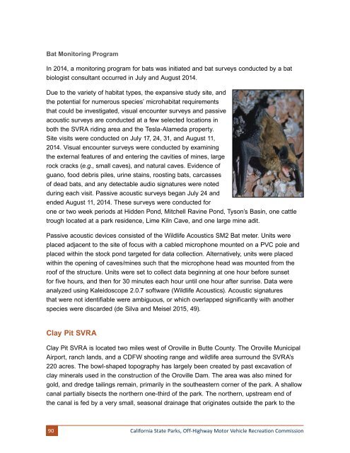
Bat Monitoring Program<br />
In 2014, a monitoring program for bats was initiated and bat surveys conducted by a bat<br />
biologist consultant occurred in July and August 2014.<br />
Due to the variety of habitat types, the expansive study site, and<br />
the potential for numerous species’ microhabitat requirements<br />
that could be investigated, visual encounter surveys and passive<br />
acoustic surveys are conducted at a few selected locations in<br />
both the SVRA riding area and the Tesla-Alameda property.<br />
Site visits were conducted on July 17, 24, 31, and August 11,<br />
2014. Visual encounter surveys were conducted by examining<br />
the external features of and entering the cavities of mines, large<br />
rock cracks (e.g., small caves), and natural caves. Evidence of<br />
guano, food debris piles, urine stains, roosting bats, carcasses<br />
of dead bats, and any detectable audio signatures were noted<br />
during each visit. Passive acoustic surveys began July 24 and<br />
ended August 11, 2014. These surveys were conducted for<br />
one or two week periods at Hidden Pond, Mitchell Ravine Pond, Tyson’s Basin, one cattle<br />
trough located at a park residence, Lime Kiln Cave, and one large mine adit.<br />
Passive acoustic devices consisted of the Wildlife Acoustics SM2 Bat meter. Units were<br />
placed adjacent to the site of focus with a cabled microphone mounted on a PVC pole and<br />
placed within the stock pond targeted for data collection. Alternatively, units were placed<br />
within the opening of caves/mines such that the microphone head was mounted from the<br />
roof of the structure. Units were set to collect data beginning at one hour before sunset<br />
for five hours, and then for 30 minutes each hour until one hour after sunrise. Data were<br />
analyzed using Kaleidoscope 2.0.7 software (Wildlife Acoustics). Acoustic signatures<br />
that were not identifiable were ambiguous, or which overlapped significantly with another<br />
species were discarded (de Silva and Meisel 2015, 49).<br />
Clay Pit SVRA<br />
Clay Pit SVRA is located two miles west of Oroville in Butte County. The Oroville Municipal<br />
Airport, ranch lands, and a CDFW shooting range and wildlife area surround the SVRA’s<br />
220 acres. The bowl-shaped topography has largely been created by past excavation of<br />
clay minerals used in the construction of the Oroville Dam. The area was also mined for<br />
gold, and dredge tailings remain, primarily in the southeastern corner of the park. A shallow<br />
canal partially bisects the northern one-third of the park. The northern, upstream end of<br />
the canal is fed by a very small, seasonal drainage that originates outside the park to the<br />
90<br />
California State Parks, Off-Highway Motor Vehicle Recreation Commission