ordinary meeting of council to be held on tuesday, 18 july 2006
ordinary meeting of council to be held on tuesday, 18 july 2006
ordinary meeting of council to be held on tuesday, 18 july 2006
You also want an ePaper? Increase the reach of your titles
YUMPU automatically turns print PDFs into web optimized ePapers that Google loves.
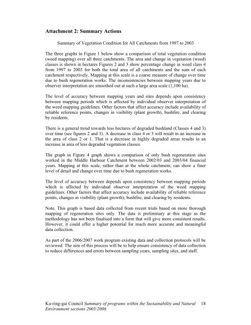
Attachment 2: Summary Acti<strong>on</strong>s<br />
Summary <str<strong>on</strong>g>of</str<strong>on</strong>g> Vegetati<strong>on</strong> C<strong>on</strong>diti<strong>on</strong> for All Catchments from 1997 <str<strong>on</strong>g>to</str<strong>on</strong>g> 2003<br />
The three graphs in Figure 1 <str<strong>on</strong>g>be</str<strong>on</strong>g>low show a comparis<strong>on</strong> <str<strong>on</strong>g>of</str<strong>on</strong>g> <str<strong>on</strong>g>to</str<strong>on</strong>g>tal vegetati<strong>on</strong> c<strong>on</strong>diti<strong>on</strong><br />
(weed mapping) over all three catchments. The area and change in vegetati<strong>on</strong> (weed)<br />
classes is shown in hectares Figures 2 and 3 show percentage change in weed class 4<br />
from 1997 <str<strong>on</strong>g>to</str<strong>on</strong>g> 2003 for both the <str<strong>on</strong>g>to</str<strong>on</strong>g>tal area <str<strong>on</strong>g>of</str<strong>on</strong>g> all catchments and the sum <str<strong>on</strong>g>of</str<strong>on</strong>g> each<br />
catchment respectively. Mapping at this scale is a coarse measure <str<strong>on</strong>g>of</str<strong>on</strong>g> change over time<br />
due <str<strong>on</strong>g>to</str<strong>on</strong>g> bush regenerati<strong>on</strong> works. The inc<strong>on</strong>sistencies <str<strong>on</strong>g>be</str<strong>on</strong>g>tween mapping years due <str<strong>on</strong>g>to</str<strong>on</strong>g><br />
observer interpretati<strong>on</strong> are smoothed out at such a large area scale (1,100 ha).<br />
The level <str<strong>on</strong>g>of</str<strong>on</strong>g> accuracy <str<strong>on</strong>g>be</str<strong>on</strong>g>tween mapping years and sites depends up<strong>on</strong> c<strong>on</strong>sistency<br />
<str<strong>on</strong>g>be</str<strong>on</strong>g>tween mapping periods which is affected by individual observer interpretati<strong>on</strong> <str<strong>on</strong>g>of</str<strong>on</strong>g><br />
the weed mapping guidelines. Other fac<str<strong>on</strong>g>to</str<strong>on</strong>g>rs that affect accuracy include availability <str<strong>on</strong>g>of</str<strong>on</strong>g><br />
reliable reference points, changes in visibility (plant growth), bushfire, and clearing<br />
by residents.<br />
There is a general trend <str<strong>on</strong>g>to</str<strong>on</strong>g>wards less hectares <str<strong>on</strong>g>of</str<strong>on</strong>g> degraded bushland (Classes 4 and 3)<br />
over time (see figures 2 and 3). A decrease in class 4 or 3 will result in an increase in<br />
the area <str<strong>on</strong>g>of</str<strong>on</strong>g> class 2 or 1. That is a decrease in highly degraded areas results in an<br />
increase in area <str<strong>on</strong>g>of</str<strong>on</strong>g> less degraded vegetati<strong>on</strong> classes.<br />
The graph in Figure 4 graph shows a comparis<strong>on</strong> <str<strong>on</strong>g>of</str<strong>on</strong>g> <strong>on</strong>ly bush regenerati<strong>on</strong> sites<br />
worked in the Middle Harbour Catchment <str<strong>on</strong>g>be</str<strong>on</strong>g>tween 2002/03 and 2003/04 financial<br />
years. Mapping at this scale, rather than at the whole catchment, can show a finer<br />
level <str<strong>on</strong>g>of</str<strong>on</strong>g> detail and change over time due <str<strong>on</strong>g>to</str<strong>on</strong>g> bush regenerati<strong>on</strong> works.<br />
The level <str<strong>on</strong>g>of</str<strong>on</strong>g> accuracy <str<strong>on</strong>g>be</str<strong>on</strong>g>tween depends up<strong>on</strong> c<strong>on</strong>sistency <str<strong>on</strong>g>be</str<strong>on</strong>g>tween mapping periods<br />
which is affected by individual observer interpretati<strong>on</strong> <str<strong>on</strong>g>of</str<strong>on</strong>g> the weed mapping<br />
guidelines. Other fac<str<strong>on</strong>g>to</str<strong>on</strong>g>rs that affect accuracy include availability <str<strong>on</strong>g>of</str<strong>on</strong>g> reliable reference<br />
points, changes in visibility (plant growth), bushfire, and clearing by residents.<br />
Note. This graph is based data collected from recent trials based <strong>on</strong> more thorough<br />
mapping <str<strong>on</strong>g>of</str<strong>on</strong>g> regenerati<strong>on</strong> sites <strong>on</strong>ly. The data is preliminary at this stage as the<br />
methodology has not <str<strong>on</strong>g>be</str<strong>on</strong>g>en finalised in<str<strong>on</strong>g>to</str<strong>on</strong>g> a form that will give more c<strong>on</strong>sistent results.<br />
However, it could <str<strong>on</strong>g>of</str<strong>on</strong>g>fer a higher potential for much more accurate and meaningful<br />
data collecti<strong>on</strong>.<br />
As part <str<strong>on</strong>g>of</str<strong>on</strong>g> the <strong>2006</strong>/2007 work program existing data and collecti<strong>on</strong> pro<str<strong>on</strong>g>to</str<strong>on</strong>g>cols will <str<strong>on</strong>g>be</str<strong>on</strong>g><br />
reviewed. The aim <str<strong>on</strong>g>of</str<strong>on</strong>g> this process will <str<strong>on</strong>g>be</str<strong>on</strong>g> <str<strong>on</strong>g>to</str<strong>on</strong>g> help ensure c<strong>on</strong>sistency <str<strong>on</strong>g>of</str<strong>on</strong>g> data collecti<strong>on</strong><br />
<str<strong>on</strong>g>to</str<strong>on</strong>g> reduce differences and errors <str<strong>on</strong>g>be</str<strong>on</strong>g>tween sampling years, sampling sites, and staff.<br />
Ku-ring-gai Council Summary <str<strong>on</strong>g>of</str<strong>on</strong>g> programs within the Sustainability and Natural<br />
Envir<strong>on</strong>ment secti<strong>on</strong>s 2005/<strong>2006</strong><br />
<strong>18</strong>


