Academic Calendar - Fisheries and Marine Institute - Memorial ...
Academic Calendar - Fisheries and Marine Institute - Memorial ...
Academic Calendar - Fisheries and Marine Institute - Memorial ...
You also want an ePaper? Increase the reach of your titles
YUMPU automatically turns print PDFs into web optimized ePapers that Google loves.
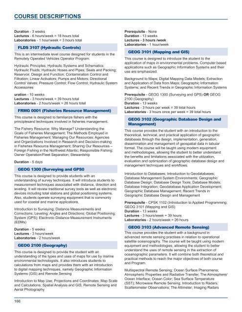
COURSE DESCRIPTIONS<br />
Duration - 3 weeks<br />
Lectures - 6 hours/week = 18 hours total<br />
Laboratories - 1 hour/week = 3 hours total<br />
FLDS 3107 (Hydraulic Controls)<br />
This is an intermediate level course designed for students in the<br />
Remotely Operated Vehicles Operator Program.<br />
Hydraulic Principles; Hydraulic Systems <strong>and</strong> Schematics;<br />
Hydraulic Fluids; Hydraulic Hoses <strong>and</strong> Pipes; Seals <strong>and</strong> Packing;<br />
Reservoir, Design <strong>and</strong> Function; Contamination Control <strong>and</strong><br />
Filtration; Linear Activators; Pumps <strong>and</strong> Motors; Directional<br />
Control Valves; Pressure Control; Flow Control; Hydraulic System<br />
Accessories<br />
uration - 10 weeks<br />
Lectures - 3 hours/week = 39 hours total<br />
Laboratories - 2 hours/week = 26 hours total<br />
FRMG 0001 (<strong>Fisheries</strong> Resource Management)<br />
This course is designed to familiarize fishers with the<br />
principles<strong>and</strong> techniques involved in fisheries management.<br />
The Fishery Resource; Why Manage Underst<strong>and</strong>ing the<br />
Goals of <strong>Fisheries</strong> Management; The Methods Employed in<br />
<strong>Fisheries</strong> Management; Managing Our Resources; Agencies<br />
<strong>and</strong> Organizations Involved in Research <strong>and</strong> Decision-making<br />
in <strong>Fisheries</strong> Resource Management; Sharing Our Resources –<br />
Foreign Fishing in the Northwest Atlantic; Responsible Fishing;<br />
Owner Operation/Fleet Separation; Stewardship<br />
Duration - 5 days<br />
GEOG 1300 (Surveying <strong>and</strong> GPS0<br />
This course is designed to provide students with an<br />
underst<strong>and</strong>ing of survey techniques. It will introduce students to<br />
measurement techniques associated with distance, direction <strong>and</strong><br />
leveling. It will review traditional survey tools as well as electronic<br />
devices including total stations <strong>and</strong> global positioning systems.<br />
Also, students operate surveying equipment that is commonly<br />
used for coastal <strong>and</strong> marine applications.<br />
Introduction to Surveying; Distance Measurements <strong>and</strong><br />
Corrections; Leveling; Angles <strong>and</strong> Directions; Global Positioning;<br />
System (GPS); Electronic Distance Measurement Instruments<br />
(EDMs)<br />
Duration - 5 weeks<br />
Lectures - 3 hours/week<br />
Laboratories - 2 hours/week<br />
GEOG 2100 (Geography)<br />
This course is designed to provide the student with an<br />
underst<strong>and</strong>ing of the types <strong>and</strong> uses of maps for use by marine<br />
environmental technologists. It also introduces students to<br />
calculations from maps <strong>and</strong> provides them with an introduction<br />
to digital mapping techniques, namely Geographic Information<br />
Systems (GIS) <strong>and</strong> Remote Sensing<br />
Introduction to Map Use; Projections <strong>and</strong> Coordinates; Map Scale<br />
<strong>and</strong> Calculations; Spatial Analysis <strong>and</strong> GIS; Remote Sensing <strong>and</strong><br />
Aerial Photography<br />
Prerequisite - None<br />
Duration - 13 weeks<br />
Lectures - 3 hours /week<br />
Laboratories - 1 hour/week<br />
GEOG 3101 (Mapping <strong>and</strong> GIS)<br />
This course is designed to introduce the student to the<br />
application of maps in environmental problems. Computer based<br />
applications such as Geographic Information Systems <strong>and</strong> their<br />
use are emphasized.<br />
Background to Maps; Digital Mapping Data Models; Extraction<br />
<strong>and</strong> Application of Data from Maps; Geographic Information<br />
Systems; <strong>and</strong> Recent Trends in Geographic Information Systems<br />
Prerequisite - GEOG 1300 (Surveying <strong>and</strong> GPS) OR GEOG<br />
2100 (Geography)<br />
Duration - 13 weeks<br />
Lectures - 3 hours per week = 39 total hours<br />
Laboratories - 3 hours once per week = 39 total hours<br />
GEOG 3102 (Geographic Database Design <strong>and</strong><br />
Management)<br />
This course provides the student with an introduction to the<br />
theoretical, technical, <strong>and</strong> practical application of geographic<br />
databases through the design, implementation, generation,<br />
dissemination <strong>and</strong> management of geospatial data in tabular<br />
format. The course will be taught using modern equipment<br />
<strong>and</strong> methodologies, allowing the student to better underst<strong>and</strong><br />
the benefits <strong>and</strong> limitations associated with the utilization,<br />
evaluation <strong>and</strong> optimization of geographic database design <strong>and</strong><br />
management techniques <strong>and</strong> workflows.<br />
Introduction to Databases; Introduction to Geodatabases;<br />
Database Management System Environments; Geographic<br />
Database Design; Database Design Tools; Database Models;<br />
Database Integration; Geodatabase Application Development;<br />
Geographic Database Management; Recent Trends in<br />
Geographic Database Design <strong>and</strong> Management<br />
Prerequisite - CPSK 1102 (Introduction to Applied Programming;<br />
GEOG 3101 (Mapping <strong>and</strong> GIS)<br />
Duration - 13 weeks<br />
Lectures - 3 hours/week = 39 hours<br />
Laboratories - 2 hours/week = 26 hours<br />
GEOG 3103 (Advanced Remote Sensing)<br />
This course provides the student with a background in<br />
advanced remote sensing practises in relation to operational<br />
satellite oceanography. The course will be taught using modern<br />
equipment <strong>and</strong> methodologies, allowing the student to better<br />
underst<strong>and</strong> the uses of remote sensing in the extraction of<br />
oceanographic parameters. It will combine both theoretical <strong>and</strong><br />
practical methods to reach the major objectives of both course<br />
<strong>and</strong> Program.<br />
Multispectral Remote Sensing; Ocean Surface Phenomena;<br />
Atmospheric Properties <strong>and</strong> Radiative Transfer; The Atmosphere/<br />
Ocean Interface; Ocean Color; Sea Surface Temperature<br />
(SST); Microwave Remote Sensing; Introduction to Radars;<br />
Scatterometer Observations; The Altimeter; Imaging Radars<br />
166


