Academic Calendar - Fisheries and Marine Institute - Memorial ...
Academic Calendar - Fisheries and Marine Institute - Memorial ...
Academic Calendar - Fisheries and Marine Institute - Memorial ...

Create successful ePaper yourself
Turn your PDF publications into a flip-book with our unique Google optimized e-Paper software.
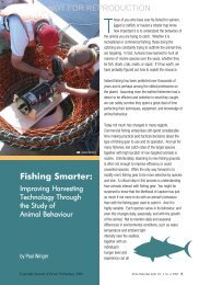
JOINT DIPLOMA OF TECHNOLOGY/BACHELOR OF TECHNOLOGY-OCEAN<br />
MAPPING<br />
SAMPLE JOB DESCRIPTION<br />
• Typical activities for an Ocean Mapper graduate are as follows:<br />
Spatial Database Administrator<br />
• Experience with Oracle or SQL Server installation,<br />
configuration <strong>and</strong> administration, with strong abilities<br />
using either Oracle Spatial or SQL Server Geography <strong>and</strong><br />
Geometry data types.<br />
• Spatial Database Backup <strong>and</strong> Recovery<br />
• Archive Log Management<br />
• ESRI ArcSDE tuning <strong>and</strong> configuration<br />
• Strong underst<strong>and</strong>ing of the geodatabase, including the<br />
types <strong>and</strong> their usage<br />
• Experience with raster <strong>and</strong> vector data loading with<br />
change control <strong>and</strong> optimization<br />
• Ability to install <strong>and</strong> configure a Windows environment<br />
• Ability to design, configure <strong>and</strong> maintain a spatial data<br />
warehouse<br />
• Ability to h<strong>and</strong>le large quantities of data in a seamless<br />
environment.<br />
Remote Sensing Specialist<br />
• Competence in using ArcGIS Desktop <strong>and</strong> Server<br />
including processing <strong>and</strong> manipulation of a wide<br />
• variety of spatial data, building databases, spatial analysis,<br />
3D visualisations & map production;<br />
• Experience in Remote Sensing techniques, such as<br />
classification, feature extraction <strong>and</strong> image analysis using<br />
Idrisi Taiga software or equivalent;<br />
• Competence in digital Photogrammetry <strong>and</strong> orthophoto<br />
production, preferably using PCI Geomatica or equivalent<br />
• Familiarity with sub-metre GPS applications, including<br />
data acquisition <strong>and</strong> post-processing;<br />
• Abilities in a relevant language such as C++, Python etc<br />
an advantage;<br />
• Experience with web approaches, interfaces, & protocols<br />
such as html, xml, css, php, etc;<br />
• Familiarity with implementation of OGC compliant<br />
st<strong>and</strong>ards such as WMS, WFS, etc;<br />
• Sound underst<strong>and</strong>ing of computer networking, clientserver<br />
<strong>and</strong> database technologies.<br />
GIS Technician / Specialist<br />
• Work with the project management team to plan <strong>and</strong><br />
implement new systems within a marine environment<br />
• Deploy marine applications onto web servers <strong>and</strong><br />
configure systems based on identified requirements.<br />
• Maintain a high implementation quality st<strong>and</strong>ard through<br />
attention to detail <strong>and</strong> thorough review <strong>and</strong> testing<br />
procedures.<br />
• Deliver written material as need to summarize<br />
implementations, report on status or provide clients with<br />
how-to instructions<br />
• Support existing client implementations by troubleshooting<br />
<strong>and</strong> diagnosing issues, providing clients with guidance <strong>and</strong><br />
feedback <strong>and</strong> applying hot fixes where necessary.<br />
• Provide technical guidance regarding the implementation<br />
of ArcGIS Server <strong>and</strong> integration requirements within<br />
marine-based solutions<br />
• Install <strong>and</strong> manage ArcGIS Server systems<br />
• Work with clients on the configuration of Map Services,<br />
layer definitions, cartography, thematic map definitions,<br />
<strong>and</strong> map server performance tuning.<br />
• Process/prepare data for web sites, configure map server<br />
settings, <strong>and</strong> create static HTML content.<br />
82