Academic Calendar - Fisheries and Marine Institute - Memorial ...
Academic Calendar - Fisheries and Marine Institute - Memorial ...
Academic Calendar - Fisheries and Marine Institute - Memorial ...

You also want an ePaper? Increase the reach of your titles
YUMPU automatically turns print PDFs into web optimized ePapers that Google loves.
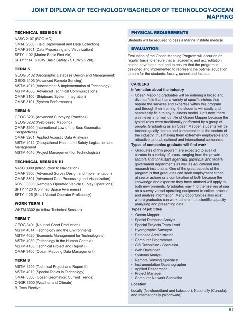
JOINT DIPLOMA OF TECHNOLOGY/BACHELOR OF TECHNOLOGY-OCEAN<br />
MAPPING<br />
TECHNICAL SESSION II<br />
NASC 2107 (ROC-MC)<br />
OMAP 2300 (Field Deployment <strong>and</strong> Data Collection)<br />
OMAP 2301 (Data Processing <strong>and</strong> Visualization)<br />
SFTY 1102 (<strong>Marine</strong> Basic First Aid)<br />
SFTY 1114 (STCW Basic Safety - STCW’95 VI/I))<br />
TERM 5<br />
GEOG 3102 (Geographic Database Design <strong>and</strong> Management)<br />
GEOG 3103 (Advanced Remote Sensing)<br />
MSTM 4010 (Assessment & Implementation of Technology)<br />
MSTM 4060 (Advanced Technical Communications)<br />
OMAP 3100 (Shipboard System Integration)<br />
OMAP 3101 (System Performance)<br />
TERM 6<br />
GEOG 3201 (Advanced Surveying Practices)<br />
GEOG 3202 (Web-based Mapping)<br />
OMAP 3200 (International Law of the Sea: Geomatics<br />
Perspectives)<br />
OMAP 3201 (Applied Acoustic Data Analysis)<br />
MSTM 4012 (Occupational Health <strong>and</strong> Safety Legislation <strong>and</strong><br />
Management<br />
MSTM 4040 (Project Management for Technologists)<br />
TECHNICAL SESSION III<br />
NASC 3309 (Introduction to Navigation)<br />
OMAP 3300 (Advanced Survey Design <strong>and</strong> Implementation)<br />
OMAP 3301 (Advanced Data Processing <strong>and</strong> Visualization)<br />
ROVO 3300 (Remotely Operated Vehicle Survey Operations)<br />
SFTY 1120 (Confined Space Awareness)<br />
SFTY 1125 (Small Vessel Operator Proficiency)<br />
WORK TERM 1<br />
WKTM 3302 (to follow Technical Session)<br />
TERM 7<br />
GEOG 3401 (Nautical Chart Production)<br />
MSTM 4014 (Technology <strong>and</strong> the Environment)<br />
MSTM 4020 (Economic Management for Technologists)<br />
MSTM 4030 (Technology in the Human Context)<br />
MSTM 4100 (Technical Project <strong>and</strong> Report I)<br />
OMAP 3400 (Ocean Mapping Data Management)<br />
TERM 8<br />
MSTM 4200 (Technical Project <strong>and</strong> Report II)<br />
MSTM 4070 (Special Topics in Technology)<br />
OMAP 3500 (Ocean Geomatics: Current Trends)<br />
ONGR 3500 (Weather <strong>and</strong> Climate)<br />
B. Tech Elective<br />
PHYSICAL REQUIREMENTS<br />
Students will be required to pass a <strong>Marine</strong> <strong>Institute</strong> medical.<br />
EVALUATION<br />
Evaluation of the Ocean Mapping Program will occur on an<br />
regular basis to ensure that all academic <strong>and</strong> accreditation<br />
criteria have been met <strong>and</strong> to ensure that the program is<br />
designed <strong>and</strong> implemented to represent the optimal education<br />
stream for the students, faculty, school <strong>and</strong> <strong>Institute</strong>.<br />
CAREERS<br />
Information about the industry<br />
• Ocean Mapping graduates will be entering a broad <strong>and</strong><br />
diverse field that has a variety of specific niches that<br />
require the services <strong>and</strong> expertise within this program<br />
<strong>and</strong> through their training, the students will easily <strong>and</strong><br />
seamlessly fit in to any business model. Until now, there<br />
was never a formal job title of Ocean Mapper because the<br />
typical roles were traditionally performed by a group of<br />
people. Graduating as an Ocean Mapper, students will be<br />
technologically literate <strong>and</strong> competent in all the sectors of<br />
the industry, thus making them extremely employable <strong>and</strong><br />
attractive to local, national <strong>and</strong> international companies.<br />
Types of companies graduate will find work<br />
• Graduates of this program are expected to avail of<br />
careers in a variety of areas, ranging from the private<br />
sectors <strong>and</strong> consultant agencies, provincial <strong>and</strong> federal<br />
government departments as well as educational <strong>and</strong><br />
research institutions, One of the great aspects of the<br />
program is that graduates can seek employment either<br />
at sea or ashore or a combination of both because the<br />
knowledge <strong>and</strong> expertise they have attained will apply to<br />
both environments. Graduates may find themselves at sea<br />
on a survey vessel operating equipment to collect process<br />
<strong>and</strong> analyze information. Many opportunities also exist<br />
where graduates can work ashore in a scientific capacity,<br />
analyzing <strong>and</strong> presenting data<br />
Types of job titles<br />
• Ocean Mapper<br />
• Spatial Database Analyst<br />
• Special Projects Team Lead<br />
• Hydrographic Surveyor<br />
• Database Administrator<br />
• Computer Programmer<br />
• GIS Technician / Specialist<br />
• Web Developer<br />
• Systems Analyst<br />
• Remote Sensing Specialist<br />
• Instrumentation Oceanographer<br />
• Applied Researcher<br />
• Project Manager<br />
• Computer Network Specialist<br />
Location<br />
Locally (Newfoundl<strong>and</strong> <strong>and</strong> Labrador), Nationally (Canada),<br />
<strong>and</strong> Internationally (Worldwide)<br />
81