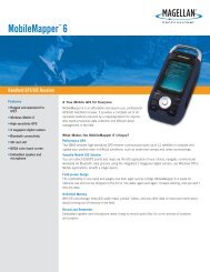
Humminbird - Fish Finders and GPS
Humminbird - Fish Finders and GPS
Humminbird - Fish Finders and GPS

You also want an ePaper? Increase the reach of your titles
YUMPU automatically turns print PDFs into web optimized ePapers that Google loves.
Glossary<br />
Cold Start: Cold Start refers to the procedure that a <strong>GPS</strong> receiver must perform<br />
when it does not have historical information regarding its current location. This<br />
procedure typically lasts for several minutes, <strong>and</strong> may be experienced upon first<br />
power up of the receiver, or if the receiver has been moved a great distance.<br />
Course Over Ground (COG): Course Over Ground is the current direction the<br />
boat is traveling measured in degrees from North (i.e. 321°, where 000° is North,<br />
090° East, 180° is South, 270° is West). When the Course Over Ground is equal<br />
to Bearing, the boat is said to be “On Course” <strong>and</strong> will arrive at the destination<br />
in the most efficient manner. COG is often confused with Heading. See Heading.<br />
Cross Track Error (XTE): Cross Track Error is the straight-line distance of the boat<br />
from the intended Track. XTE measures how far the boat is off course, <strong>and</strong> also<br />
triggers the Off Course Alarm. See Track.<br />
Differential <strong>GPS</strong> (D<strong>GPS</strong>): Differential <strong>GPS</strong> is a system to improve the position<br />
accuracy of the Department of Defense <strong>GPS</strong> through the use of secondary<br />
“correction signals” broadcast from ground stations around the coastal United<br />
States <strong>and</strong> on some inl<strong>and</strong> waterways. These correction signals are provided by<br />
the USCG <strong>and</strong> received by an auxiliary Differential Beacon Receiver (DBR) that<br />
connects to the <strong>GPS</strong> receiver. The advent of WAAS has largely negated the need<br />
for the added expense of a DBR in the United States.<br />
Distance To Go: Distance To Go is the straight-line distance between Present<br />
Position <strong>and</strong> the Destination Waypoint. DTG <strong>and</strong> SOG (Speed Over Ground) are<br />
used to calculate Time To Go. See Time to Go <strong>and</strong> Speed Over Ground.<br />
<strong>GPS</strong> & Navigation Terms<br />
Estimated Position Error (EPE): Estimated Position Error is a calculation that<br />
indicates the potential position inaccuracy the user may experience due to a<br />
variety of <strong>GPS</strong> factors which include satellite position in the sky, signal strength<br />
<strong>and</strong> others factors.<br />
Fix Type: Fix Type indicates whether the <strong>GPS</strong> receiver is providing 2D fix or 3D<br />
fix. A 2D fix requires only three satellites <strong>and</strong> provides only latitude <strong>and</strong><br />
longitude. A 3D fix requires four or more satellites, <strong>and</strong> provides latitude,<br />
longitude <strong>and</strong> altitude.<br />
<strong>GPS</strong>: <strong>GPS</strong> is an acronym for Global Positioning System. <strong>GPS</strong> provides accurate<br />
position (latitude, longitude, altitude) information virtually anywhere on the<br />
earth through satellite technology <strong>and</strong> personal receivers on the ground. A series<br />
of geosynchronous satellites broadcast a unique signal toward the earth once<br />
per second. A <strong>GPS</strong> receiver, such as that included with many <strong>Humminbird</strong>®<br />
products, receives the signals from these satellites <strong>and</strong> is able to determine<br />
position based on very slight differences in the time each signal is received <strong>and</strong><br />
the receiver’s knowledge of the location of each of the satellites.<br />
Heading: Heading describes the direction the boat is pointing <strong>and</strong> is measured<br />
in degrees (i.e. 321°, where 000° is North, 090° East, 180° is South, 270° is<br />
West). Due to wind <strong>and</strong> waves, the boat is often traveling in a slightly different<br />
direction than it is heading, <strong>and</strong> therefore Heading is often confused with Course<br />
Over Ground. See Course Over Ground.<br />
Map Datum: A Map Datum refers to a particular survey of the earth’s surface<br />
that was referenced when creating a chart (i.e. WGS84). Since the earth is not<br />
flat, <strong>and</strong> not even consistently round, a mathematical model must be used to<br />
translate coordinates from the sphere of the earth to the flat surface of a chart.<br />
135