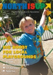
Development Plan - City of Playford - SA.Gov.au
Development Plan - City of Playford - SA.Gov.au
Development Plan - City of Playford - SA.Gov.au

Create successful ePaper yourself
Turn your PDF publications into a flip-book with our unique Google optimized e-Paper software.
overall terms are well-recognised - especially in the context <strong>of</strong> delivering mixed use<br />
development where a minimum housing density is required to sustain non-residential uses.<br />
Some people continue to equate higher densities with poor urban quality, such as overcrowding<br />
and reduced space standards. This misses a fundamental point. Density is only a measure. It<br />
is a product <strong>of</strong> design, not a determinant <strong>of</strong> it. The aim should therefore be not to achieve a<br />
given residential density, but to generate a critical mass <strong>of</strong> people able to support urban<br />
services such as public transport, local shops and schools.<br />
3.2.7 Open Space Connectivity<br />
The Urban Design Compendium outlines the following benefits <strong>of</strong> connecting the open space<br />
network.<br />
Open space networks are <strong>of</strong>ten more useful for visual amenity, recreational use and wildlife<br />
corridors than isolated and unrelated landscape elements. They not only serve to organise<br />
larger projects but also create linkages to existing urban areas, other sites and the wider<br />
landscape.<br />
Networks may join up linear parks, road reserves, playing fields, parks, allotments, private<br />
gardens, buffer planting and surface drainage corridors. Greenways can be created to run<br />
through or alongside linear elements such as natural streams, wooded belts or canals and<br />
connect with parks and footpaths in nearby neighbourhoods. These can plug into<br />
neighbourhood streets that have cycle routes, reduced car levels and mature tree planting -<br />
creating a network <strong>of</strong> what the <strong>City</strong> <strong>of</strong> Vancouver calls ‘Green Ways - Public Ways.’<br />
.<br />
The 400m walkable catchment radii focussed on neighbourhood focal points forms the starting<br />
principle for network design. Aim for major open spaces to adjoin at least one quadrant <strong>of</strong> the<br />
circle, but never more than two. This avoids isolation between developments and allows linear<br />
networks to be provided that are no more than 1.2 km (15 minutes walk) away from the majority<br />
<strong>of</strong> people.<br />
3.2.8 Dual Footpaths<br />
One <strong>of</strong> the key aims for the development <strong>of</strong> the Area Affected is to create a community that is<br />
sustainable and an improvement upon what has been delivered in outer suburban developments<br />
over the past few decades. This means some aspects <strong>of</strong> the physical infrastructure that creates the<br />
public realm will be different from residential estates that have been developed in recent times.<br />
The public realm <strong>of</strong> estates such as nearby Andrews Farm, Munno Para West and Blakeview is<br />
quite poor with few street trees and limited footpaths. This is accompanied by dwellings that do not<br />
really engage with the street (most houses orient towards the rear yards) and needing to get in cars<br />
to access most shops and other facilities/services. This formula does not create a community.<br />
In order to create healthy and vibrant communities there is a need to encourage more walking.<br />
This is based on well founded research:<br />
“Not surprisingly, people walk more when there are sidewalks and less if they are forced to<br />
walk in a street or a ditch.” p 142 Charter <strong>of</strong> the New Urbanism. Douglas Farr Congress for<br />
the New Urbanism 2000<br />
“while pedestrian and bike friendly streets are more expensive to build at the outset, each<br />
street will be viewed as an extension <strong>of</strong> “the village” – and will command price premiums to<br />
match.” p 25 The New Shape <strong>of</strong> Suburbia – Trends in Residential <strong>Development</strong>. Urban<br />
Land Institute 2003<br />
“Upto 75% <strong>of</strong> all household trips are non-job related. Many <strong>of</strong> these trips can be captured<br />
within the TOD or within short transit connection… Interruptions in the path and<br />
inconvenient walking routes discourage pedestrian travel for these types <strong>of</strong> trips. p 101<br />
The Next American Metropolis: Ecology, Community and the American Dream. Peter<br />
Calthorpe 1993<br />
<strong>Playford</strong> North DPA -35-<br />
Jul 08<br />
Final DPA 20 August 08.doc Version 3