- Page 3 and 4:
African Folklore
- Page 5 and 6:
African Folklore An Encyclopedia Ph
- Page 7 and 8:
To Our Teachers: William Bascom, Ri
- Page 10 and 11:
INTRODUCTION The Continent of Afric
- Page 12 and 13:
limited to ancient myths and animal
- Page 14 and 15:
“In the beginning was the Word…
- Page 16 and 17:
contemporary Africanists and Africa
- Page 18 and 19:
We give special thanks to our Advis
- Page 21 and 22:
LIST OF CONTRIBUTORS David Adu-Aman
- Page 23 and 24:
University of Delaware David A.Brin
- Page 25 and 26:
Department of Pan-African Studies U
- Page 27 and 28:
School of Oriental and African Stud
- Page 29 and 30:
Daniel Mato Department of Art Histo
- Page 31 and 32:
University of Washington Oyekan Owo
- Page 33 and 34:
State University of New York at Buf
- Page 35 and 36:
LIST OF ENTRIES Algeria Ancestors A
- Page 37 and 38:
Djibouti (Republic of Djibouti) Dol
- Page 39 and 40:
Legends: East Africa Lesotho (Kingd
- Page 41 and 42:
The Oxford Library of African Liter
- Page 43 and 44:
Surrogate Languages: Alternative Co
- Page 45 and 46:
Africa
- Page 47 and 48:
Northeast Africa: The Horn
- Page 49 and 50:
Southern Africa
- Page 51 and 52:
See Diaspora A AFRICAN AMERICANS AK
- Page 53 and 54:
African Americans 3 Ancestors form
- Page 55 and 56:
African Americans 5 Ephirim-Donkor,
- Page 57 and 58:
African Americans 7 put it. Accordi
- Page 59 and 60:
African Americans 9 beast, just “
- Page 61 and 62:
African Americans 11 archaisms, cli
- Page 63 and 64:
African Americans 13 With syntax, c
- Page 65 and 66:
African Americans 15 Zimbabwe On a
- Page 67 and 68:
African Americans 17 dug out about
- Page 69 and 70:
African Americans 19 towerlike unit
- Page 71 and 72:
African Americans 21 media formats
- Page 73 and 74:
African Americans 23 Astrology and
- Page 75 and 76:
African Americans 25 architect over
- Page 77 and 78:
African Americans 27 The fishermen
- Page 79 and 80:
See Joking Relationships African Am
- Page 81 and 82:
African Americans 31 The Engeley ma
- Page 83 and 84:
African Americans 33 Southern music
- Page 85 and 86: African Americans 35 Levine, Lawren
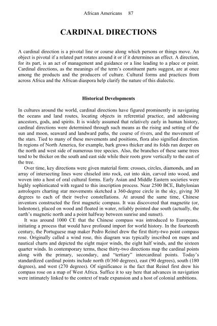
- Page 87 and 88: African Americans 37 This involved
- Page 89 and 90: African Americans 39 References Bas
- Page 91 and 92: African Americans 41 characteristic
- Page 93 and 94: African Americans 43 Specialization
- Page 95 and 96: Trowell, Margaret. 1960. African De
- Page 97 and 98: African Americans 47 are shown as w
- Page 99 and 100: African Americans 49 admires a part
- Page 101 and 102: African Americans 51 “dug out of
- Page 103 and 104: African Americans 53 BIRTH AND DEAT
- Page 105 and 106: African Americans 55 It centered up
- Page 107 and 108: African Americans 57 their homestea
- Page 109 and 110: African Americans 59 raising of fun
- Page 111 and 112: African Americans 61 prejudice agai
- Page 113 and 114: African Americans 63 submerging in
- Page 115 and 116: African Americans 65 supreme milita
- Page 117 and 118: African Americans 67 Goldwork and G
- Page 119 and 120: African Americans 69 From the fifte
- Page 121 and 122: African Americans 71 chiefdoms and
- Page 123 and 124: African Americans 73 See also Beadw
- Page 125 and 126: African Americans 75 Europe, it fel
- Page 127 and 128: African Americans 77 BODY ARTS: HAI
- Page 129 and 130: African Americans 79 Sahel region,
- Page 131 and 132: African Americans 81 BRAZIL See Dia
- Page 133 and 134: African Americans 83 C CALL-AND-RES
- Page 135: African Americans 85 References Ben
- Page 139 and 140: African Americans 89 Little has bee
- Page 141 and 142: African Americans 91 northwestern a
- Page 143 and 144: African Americans 93 social levelin
- Page 145 and 146: African Americans 95 and Trinidad.
- Page 147 and 148: African Americans 97 the Bahamas, a
- Page 149 and 150: African Americans 99 A participant
- Page 151 and 152: African Americans 101 their music a
- Page 153 and 154: African Americans 103 published in
- Page 155 and 156: African Americans 105 Amin’s reig
- Page 157 and 158: African Americans 107 dispenser tha
- Page 159 and 160: African Americans 109 cultures of t
- Page 161 and 162: African Americans 111 formulae, whi
- Page 163 and 164: African Americans 113 may be sung,
- Page 165 and 166: African Americans 115 Van Caeneghem
- Page 167 and 168: African Americans 117 degrees Centi
- Page 169 and 170: African Americans 119 Kwahu, Anyi,
- Page 171 and 172: African Americans 121 occasionally,
- Page 173 and 174: African Americans 123 variety of tr
- Page 175 and 176: See also Okyeame; Queen Mothers Afr
- Page 177 and 178: African Americans 127 that which is
- Page 179 and 180: African Americans 129 References Mw
- Page 181 and 182: African Americans 131 Folktales One
- Page 183 and 184: African Americans 133 (There was an
- Page 185 and 186: African Americans 135 Twenty-eight
- Page 187 and 188:
African Americans 137 usage serves
- Page 189 and 190:
African Americans 139 In the past t
- Page 191 and 192:
African Americans 141 CONCERT PARTI
- Page 193 and 194:
African Americans 143 The plays, pa
- Page 195 and 196:
African Americans 145 CONTEMPORARY
- Page 197 and 198:
African Americans 147 COSMOLOGY The
- Page 199 and 200:
African Americans 149 Achieving Per
- Page 201 and 202:
African Americans 151 Agni, Kru, Se
- Page 203 and 204:
African Americans 153 See also Cari
- Page 205 and 206:
African Americans 155 societal stru
- Page 207 and 208:
African Americans 157 place mainly
- Page 209 and 210:
African Americans 159 demonstrate h
- Page 211 and 212:
African Americans 161 3. Oluwa ni o
- Page 213 and 214:
African Americans 163 Mobutu’s po
- Page 215 and 216:
African Americans 165 cannot admire
- Page 217 and 218:
African Americans 167 Not only do a
- Page 219 and 220:
African Americans 169 There are two
- Page 221 and 222:
African Americans 171 Pastor Matthe
- Page 223 and 224:
African Americans 173 young girls a
- Page 225 and 226:
African Americans 175 N’Diaye, Di
- Page 227 and 228:
African Americans 177 Samba and Car
- Page 229 and 230:
African Americans 179 Folklore Char
- Page 231 and 232:
African Americans 181 designs in si
- Page 233 and 234:
African Americans 183 A Luba (Congo
- Page 235 and 236:
African Americans 185 registers cha
- Page 237 and 238:
African Americans 187 relatives in
- Page 239 and 240:
African Americans 189 Oluguere Ko K
- Page 241 and 242:
African Americans 191 Anonymous, n.
- Page 243 and 244:
African Americans 193 Congo, for ex
- Page 245 and 246:
African Americans 195 References Ca
- Page 247 and 248:
African Americans 197 legal redress
- Page 249 and 250:
African Americans 199 The French an
- Page 251 and 252:
African Americans 201 is not forced
- Page 253 and 254:
African Americans 203 include the t
- Page 255 and 256:
African Americans 205 Curley, R. 19
- Page 257 and 258:
African Americans 207 throughout Af
- Page 259 and 260:
African Americans 209 E EAST AFRICA
- Page 261 and 262:
African Americans 211 done without
- Page 263 and 264:
African Americans 213 are considere
- Page 265 and 266:
African Americans 215 Education and
- Page 267 and 268:
African Americans 217 Osofisan, Bab
- Page 269 and 270:
African Americans 219 Shona, Tonga,
- Page 271 and 272:
African Americans 221 annually cele
- Page 273 and 274:
African Americans 223 formats. The
- Page 275 and 276:
African Americans 225 Mytton, Graha
- Page 277 and 278:
African Americans 227 The tradition
- Page 279 and 280:
African Americans 229 incurred the
- Page 281 and 282:
African Americans 231 place assigne
- Page 283 and 284:
African Americans 233 events he is
- Page 285 and 286:
African Americans 235 Dumestre, Gé
- Page 287 and 288:
African Americans 237 conflict grew
- Page 289 and 290:
works in all media display a consis
- Page 291 and 292:
African Americans 241 Christian Cop
- Page 293 and 294:
African Americans 243 Influenced by
- Page 295 and 296:
See Music African Americans 245 EWE
- Page 297 and 298:
African Americans 247 usually sever
- Page 299 and 300:
African Americans 249 sport coats.
- Page 301 and 302:
African Americans 251 FILMS ON AFRI
- Page 303 and 304:
African Americans 253 and respectfu
- Page 305 and 306:
African Americans 255 itinerant cer
- Page 307 and 308:
African Americans 257 Some films fo
- Page 309 and 310:
African Americans 259 Robert Gessai
- Page 311 and 312:
African Americans 261 Medicine Many
- Page 313 and 314:
African Americans 263 initiates sin
- Page 315 and 316:
African Americans 265 also fascinat
- Page 317 and 318:
African Americans 267 “system of
- Page 319 and 320:
African Americans 269 Even though t
- Page 321 and 322:
African Americans 271 song, which i
- Page 323 and 324:
African Americans 273 Performance W
- Page 325 and 326:
African Americans 275 borders of Na
- Page 327 and 328:
African Americans 277 For Pounded Y
- Page 329 and 330:
African Americans 279 undertook the
- Page 331 and 332:
African Americans 281 other, someti
- Page 333 and 334:
African Americans 283 orality from
- Page 335 and 336:
See Epics; Prose and Poetry of the
- Page 337 and 338:
African Americans 287 GAMBIA, THE (
- Page 339 and 340:
African Americans 289 preserve in t
- Page 341 and 342:
African Americans 291 (long tongue)
- Page 343 and 344:
African Americans 293 Seitel, Peter
- Page 345 and 346:
African Americans 295 Hermann Bauma
- Page 347 and 348:
African Americans 297 interpretatio
- Page 349 and 350:
African Americans 299 Hand Gestures
- Page 351 and 352:
African Americans 301 a chopping mo
- Page 353 and 354:
African Americans 303 twentieth-cen
- Page 355 and 356:
African Americans 305 Legon’s Sch
- Page 357 and 358:
African Americans 307 as “the pop
- Page 359 and 360:
African Americans 309 Waja women us
- Page 361 and 362:
African Americans 311 The importanc
- Page 363 and 364:
African Americans 313 fretless harp
- Page 365 and 366:
African Americans 315 neighbors as
- Page 367 and 368:
African Americans 317 Kusuzya: The
- Page 369 and 370:
African Americans 319 Chart 3: Man
- Page 371 and 372:
African Americans 321 Greeting an U
- Page 373 and 374:
African Americans 323 There are two
- Page 375 and 376:
African Americans 325 GRIAULE, MARC
- Page 377 and 378:
African Americans 327 Sold into Spa
- Page 379 and 380:
African Americans 329 griot or grio
- Page 381 and 382:
African Americans 331 GUINEA-BISSAU
- Page 383 and 384:
African Americans 333 differences,
- Page 385 and 386:
African Americans 335 often trouble
- Page 387 and 388:
African Americans 337 singers tend
- Page 389 and 390:
African Americans 339 Proverbs in A
- Page 391 and 392:
African Americans 341 Archival Sour
- Page 393 and 394:
African Americans 343 following peo
- Page 395 and 396:
African Americans 345 doubt, will c
- Page 397 and 398:
African Americans 347 One particula
- Page 399 and 400:
African Americans 349 HISTORY AND R
- Page 401 and 402:
African Americans 351 References Co
- Page 403 and 404:
African Americans 353 provided with
- Page 405 and 406:
African Americans 355 The leader ma
- Page 407 and 408:
creation of national parks. Game po
- Page 409 and 410:
African Americans 359 one’s own l
- Page 411 and 412:
African Americans 361 Ideophones ar
- Page 413 and 414:
African Americans 363 Four green vo
- Page 415 and 416:
African Americans 365 As would be e
- Page 417 and 418:
African Americans 367 A relatively
- Page 419 and 420:
African Americans 369 INSTITUTIONAL
- Page 421 and 422:
African Americans 371 graduate cour
- Page 423 and 424:
African Americans 373 renamed the E
- Page 425 and 426:
African Americans 375 as part of th
- Page 427 and 428:
African Americans 377 The center ha
- Page 429 and 430:
African Americans 379 Nearly three
- Page 431 and 432:
African Americans 381 ISLAMIC BROTH
- Page 433 and 434:
African Americans 383 Today Touba
- Page 435 and 436:
African Americans 385 rosary and th
- Page 437 and 438:
African Americans 387 J JAPANESE ST
- Page 439 and 440:
African Americans 389 Sofue, Takao.
- Page 441 and 442:
African Americans 391 during daytim
- Page 443 and 444:
African Americans 393 illustrates,
- Page 445 and 446:
African Americans 395 Radcliffe-Bro
- Page 447 and 448:
African Americans 397 At a funeral
- Page 449 and 450:
African Americans 399 they avoid re
- Page 451 and 452:
See Tourism and Tourist Arts Africa
- Page 453 and 454:
African Americans 403 Using these e
- Page 455 and 456:
African Americans 405 References As
- Page 457 and 458:
African Americans 407 Apart from th
- Page 459 and 460:
spoken in Madagascar. Due to coloni
- Page 461 and 462:
African Americans 411 The first lev
- Page 463 and 464:
African Americans 413 Creole langua
- Page 465 and 466:
African Americans 415 (yes) and zun
- Page 467 and 468:
African Americans 417 common cultur
- Page 469 and 470:
African Americans 419 Political Leg
- Page 471 and 472:
African Americans 421 Warfare Legen
- Page 473 and 474:
African Americans 423 Christians ac
- Page 475 and 476:
African Americans 425 between the h
- Page 477 and 478:
African Americans 427 are successfu
- Page 479 and 480:
African Americans 429 Odak, O. 1995
- Page 481 and 482:
African Americans 431 creativity an
- Page 483 and 484:
African Americans 433 were both des
- Page 485 and 486:
African Americans 435 organizations
- Page 487 and 488:
African Americans 437 LINGUISTICS A
- Page 489 and 490:
convey hypocrisy. Its power can and
- Page 491 and 492:
See Prose Narratives African Americ
- Page 493 and 494:
African Americans 443 A corn market
- Page 495 and 496:
African Americans 445 frequent, hol
- Page 497 and 498:
African Americans 447 The world tha
- Page 499 and 500:
African Americans 449 (transl. from
- Page 501 and 502:
African Americans 451 History From
- Page 503 and 504:
African Americans 453 It is true th
- Page 505 and 506:
African Americans 455 Mention shoul
- Page 507 and 508:
African Americans 457 In many Afric
- Page 509 and 510:
African Americans 459 circles, tria
- Page 511 and 512:
African Americans 461 MALAGASY See
- Page 513 and 514:
African Americans 463 generally, bu
- Page 515 and 516:
African Americans 465 emerges fully
- Page 517 and 518:
African Americans 467 ——2000. W
- Page 519 and 520:
On September 22, 1960, Mali gained
- Page 521 and 522:
African Americans 471 “sleeping
- Page 523 and 524:
African Americans 473 Janzen, J.M.
- Page 525 and 526:
African Americans 475 objects were
- Page 527 and 528:
African Americans 477 The Muslim-Ar
- Page 529 and 530:
African Americans 479 Herzfeld, Mic
- Page 531 and 532:
African Americans 481 horns, or tee
- Page 533 and 534:
African Americans 483 Preparation a
- Page 535 and 536:
African Americans 485 Regardless of
- Page 537 and 538:
African Americans 487 that female p
- Page 539 and 540:
African Americans 489 expression. M
- Page 541 and 542:
African Americans 491 Tonkin, Eliza
- Page 543 and 544:
African Americans 493 environments.
- Page 545 and 546:
African Americans 495 The perceived
- Page 547 and 548:
African Americans 497 decrease of t
- Page 549 and 550:
African Americans 499 pious Muslim
- Page 551 and 552:
African Americans 501 social groups
- Page 553 and 554:
African Americans 503 easily treate
- Page 555 and 556:
African Americans 505 The other str
- Page 557 and 558:
African Americans 507 METALLURGY AN
- Page 559 and 560:
African Americans 509 Women were oc
- Page 561 and 562:
African Americans 511 which still s
- Page 563 and 564:
African Americans 513 MUSIC IN AFRI
- Page 565 and 566:
African Americans 515 African music
- Page 567 and 568:
African Americans 517 reflects the
- Page 569 and 570:
African Americans 519 vitality of t
- Page 571 and 572:
African Americans 521 can sound qui
- Page 573 and 574:
African Americans 523 In the realm
- Page 575 and 576:
African Americans 525 Those musicia
- Page 577 and 578:
African Americans 527 MUSIC: ATALAK
- Page 579 and 580:
African Americans 529 Lonoh, M.B. 1
- Page 581 and 582:
African Americans 531 questions of
- Page 583 and 584:
African Americans 533 Idiophones: T
- Page 585 and 586:
African Americans 535 References Ku
- Page 587 and 588:
African Americans 537 Musicians are
- Page 589 and 590:
African Americans 539 spontaneity a
- Page 591 and 592:
African Americans 541 configuration
- Page 593 and 594:
African Americans 543 Collins, John
- Page 595 and 596:
African Americans 545 only to the c
- Page 597 and 598:
African Americans 547 cases bears a
- Page 599 and 600:
African Americans 549 Despite its i
- Page 601 and 602:
African Americans 551 Collins/Bokoo
- Page 603 and 604:
African Americans 553 MUSICAL INSTR
- Page 605 and 606:
African Americans 555 their values
- Page 607 and 608:
African Americans 557 bow, or the e
- Page 609 and 610:
African Americans 559 The five-stri
- Page 611 and 612:
African Americans 561 guide: the ne
- Page 613 and 614:
African Americans 563 to have accep
- Page 615 and 616:
African Americans 565 Koto the Bird
- Page 617 and 618:
African Americans 567 A procession
- Page 619 and 620:
African Americans 569 Cosmic Dualis
- Page 621 and 622:
African Americans 571 universal pow
- Page 623 and 624:
African Americans 573 two of whom d
- Page 625 and 626:
African Americans 575 NAMING CUSTOM
- Page 627 and 628:
African Americans 577 NAMING CUSTOM
- Page 629 and 630:
African Americans 579 after the dea
- Page 631 and 632:
African Americans 581 (Evans-Pritch
- Page 633 and 634:
African Americans 583 ——. 1969.
- Page 635 and 636:
African Americans 585 abandoned and
- Page 637 and 638:
African Americans 587 The Northeast
- Page 639 and 640:
African Americans 589 the introduct
- Page 641 and 642:
African Americans 591 with his cult
- Page 643 and 644:
African Americans 593 The Aarne-Tho
- Page 645 and 646:
African Americans 595 Maspero, Gast
- Page 647 and 648:
African Americans 597 Animals endow
- Page 649 and 650:
African Americans 599 Kennedy, John
- Page 651 and 652:
African Americans 601 this writing
- Page 653 and 654:
African Americans 603 O OKYEAME Oky
- Page 655 and 656:
African Americans 605 to the royal
- Page 657 and 658:
African Americans 607 married life
- Page 659 and 660:
African Americans 609 exotica that
- Page 661 and 662:
African Americans 611 beginning to
- Page 663 and 664:
African Americans 613 Olatunji’s
- Page 665 and 666:
African Americans 615 Igbo dramatic
- Page 667 and 668:
African Americans 617 deconstruct t
- Page 669 and 670:
African Americans 619 Jackson, Mich
- Page 671 and 672:
African Americans 621 ORAL LITERATU
- Page 673 and 674:
African Americans 623 The term oral
- Page 675 and 676:
African Americans 625 focus into va
- Page 677 and 678:
African Americans 627 None of the t
- Page 679 and 680:
African Americans 629 types of tale
- Page 681 and 682:
African Americans 631 were based in
- Page 683 and 684:
African Americans 633 based on past
- Page 685 and 686:
African Americans 635 considered to
- Page 687 and 688:
African Americans 637 wherever they
- Page 689 and 690:
African Americans 639 memorabilia o
- Page 691 and 692:
African Americans 641 There are app
- Page 693 and 694:
African Americans 643 Finally, anot
- Page 695 and 696:
African Americans 645 Gender Rhetor
- Page 697 and 698:
African Americans 647 Political ora
- Page 699 and 700:
African Americans 649 Songs Songs a
- Page 701 and 702:
African Americans 651 to illus-trat
- Page 703 and 704:
African Americans 653 pan-human dil
- Page 705 and 706:
African Americans 655 See also Dias
- Page 707 and 708:
African Americans 657 There are mul
- Page 709 and 710:
African Americans 659 and imaginati
- Page 711 and 712:
African Americans 661 A very large
- Page 713 and 714:
African Americans 663 P PALAVER (KI
- Page 715 and 716:
African Americans 665 References La
- Page 717 and 718:
African Americans 667 Orally transm
- Page 719 and 720:
African Americans 669 PERFORMANCE S
- Page 721 and 722:
African Americans 671 painting; it
- Page 723 and 724:
African Americans 673 restore or re
- Page 725 and 726:
African Americans 675 performing mu
- Page 727 and 728:
African Americans 677 unconditional
- Page 729 and 730:
African Americans 679 Hale, Thomas
- Page 731 and 732:
African Americans 681 blacks. Becau
- Page 733 and 734:
African Americans 683 tradition, me
- Page 735 and 736:
African Americans 685 admiral Balã
- Page 737 and 738:
African Americans 687 Espirito Sant
- Page 739 and 740:
African Americans 689 PERFORMING AR
- Page 741 and 742:
African Americans 691 imagery. Gene
- Page 743 and 744:
African Americans 693 seasonal cele
- Page 745 and 746:
African Americans 695 people’s li
- Page 747 and 748:
African Americans 697 given to a li
- Page 749 and 750:
African Americans 699 Lingala Linga
- Page 751 and 752:
African Americans 701 POLYRHYTHM Po
- Page 753 and 754:
African Americans 703 term is that
- Page 755 and 756:
African Americans 705 customers fol
- Page 757 and 758:
African Americans 707 The 1950s saw
- Page 759 and 760:
African Americans 709 money, limiti
- Page 761 and 762:
African Americans 711 Little occurr
- Page 763 and 764:
African Americans 713 such as the s
- Page 765 and 766:
African Americans 715 warfare techn
- Page 767 and 768:
African Americans 717 ——. 1964c
- Page 769 and 770:
African Americans 719 incorporate p
- Page 771 and 772:
African Americans 721 San Praises S
- Page 773 and 774:
African Americans 723 advances in t
- Page 775 and 776:
Translation: Translation: African A
- Page 777 and 778:
Translation: African Americans 727
- Page 779 and 780:
African Americans 729 Worker poets
- Page 781 and 782:
Translation: African Americans 731
- Page 783 and 784:
African Americans 733 Opland, Jeff.
- Page 785 and 786:
African Americans 735 abundant. The
- Page 787 and 788:
African Americans 737 Genres of Son
- Page 789 and 790:
African Americans 739 PROSE NARRATI
- Page 791 and 792:
African Americans 741 associated wi
- Page 793 and 794:
African Americans 743 which they di
- Page 795 and 796:
African Americans 745 of this type
- Page 797 and 798:
African Americans 747 personal iden
- Page 799 and 800:
African Americans 749 holidays. The
- Page 801 and 802:
African Americans 751 according to
- Page 803 and 804:
African Americans 753 Rasmussen, Su
- Page 805 and 806:
African Americans 755 function of t
- Page 807 and 808:
African Americans 757 accepted soci
- Page 809 and 810:
African Americans 759 In northern T
- Page 811 and 812:
African Americans 761 The Kwagh-hir
- Page 813 and 814:
African Americans 763 Q QUEEN MOTHE
- Page 815 and 816:
African Americans 765 Political Rol
- Page 817 and 818:
African Americans 767 relations to
- Page 819 and 820:
African Americans 769 the hierarchi
- Page 821 and 822:
African Americans 771 O’Barr, Jea
- Page 823 and 824:
African Americans 773 women’s ret
- Page 825 and 826:
African Americans 775 RASTAFARI: A
- Page 827 and 828:
African Americans 777 harbored. Ove
- Page 829 and 830:
African Americans 779 Chevannes, Ba
- Page 831 and 832:
African Americans 781 how was the w
- Page 833 and 834:
African Americans 783 ancient scrip
- Page 835 and 836:
African Americans 785 RELIGIONS: AF
- Page 837 and 838:
African Americans 787 Oxumara is re
- Page 839 and 840:
African Americans 789 Bastide, Roge
- Page 841 and 842:
African Americans 791 Catholic brot
- Page 843 and 844:
African Americans 793 frequently th
- Page 845 and 846:
RIDDLES: SESOTHO RIDDLES The Basoth
- Page 847 and 848:
African Americans 797 themselves in
- Page 849 and 850:
African Americans 799 Herero women
- Page 851 and 852:
African Americans 801 the Okiek peo
- Page 853 and 854:
African Americans 803 Africanists:
- Page 855 and 856:
African Americans 805 Rwandan poet
- Page 857 and 858:
African Americans 807 individuals a
- Page 859 and 860:
African Americans 809 invocations t
- Page 861 and 862:
African Americans 811 A plate plast
- Page 863 and 864:
African Americans 813 History Membe
- Page 865 and 866:
African Americans 815 calendrical f
- Page 867 and 868:
African Americans 817 Pichardo, Ern
- Page 869 and 870:
African Americans 819 Frequently, i
- Page 871 and 872:
African Americans 821 References ,
- Page 873 and 874:
African Americans 823 SEYCHELLES Lo
- Page 875 and 876:
African Americans 825 Aitin, Davide
- Page 877 and 878:
African Americans 827 Among the Men
- Page 879 and 880:
African Americans 829 A Narrative G
- Page 881 and 882:
African Americans 831 triumphs over
- Page 883 and 884:
the proverb says, “Knead your own
- Page 885 and 886:
problem for its people for centurie
- Page 887 and 888:
usually characterized by a more phi
- Page 889 and 890:
African Americans 839 longan, and p
- Page 891 and 892:
African Americans 841 The little pa
- Page 893 and 894:
African Americans 843 South Africa
- Page 895 and 896:
African Americans 845 poem interact
- Page 897 and 898:
African Americans 847 coordinates t
- Page 899 and 900:
African Americans 849 original and
- Page 901 and 902:
African Americans 851 customs the w
- Page 903 and 904:
African Americans 853 “ownership,
- Page 905 and 906:
African Americans 855 SOUTHERN AFRI
- Page 907 and 908:
African Americans 857 would continu
- Page 909 and 910:
African Americans 859 the nation, h
- Page 911 and 912:
African Americans 861 heard the gun
- Page 913 and 914:
African Americans 863 There are als
- Page 915 and 916:
African Americans 865 Jones, A.M.,
- Page 917 and 918:
African Americans 867 prescriptive
- Page 919 and 920:
African Americans 869 the 1980s. In
- Page 921 and 922:
African Americans 871 Those seminal
- Page 923 and 924:
African Americans 873 Studies of Sh
- Page 925 and 926:
African Americans 875 Bourdillon, M
- Page 927 and 928:
African Americans 877 The hunter to
- Page 929 and 930:
African Americans 879 are designate
- Page 931 and 932:
African Americans 881 See also Dias
- Page 933 and 934:
African Americans 883 Strickland, B
- Page 935 and 936:
African Americans 885 wear the face
- Page 937 and 938:
African Americans 887 central state
- Page 939 and 940:
African Americans 889 trade. It has
- Page 941 and 942:
African Americans 891 collected by
- Page 943 and 944:
African Americans 893 ——. 1970.
- Page 945 and 946:
African Americans 895 A Xhosa woman
- Page 947 and 948:
African Americans 897 Nokavala, a X
- Page 949 and 950:
African Americans 899 but they can
- Page 951 and 952:
African Americans 901 Arabic is the
- Page 953 and 954:
African Americans 903 differ in voc
- Page 955 and 956:
African Americans 905 disappearance
- Page 957 and 958:
African Americans 907 People, Anima
- Page 959 and 960:
African Americans 909 Surrogate lan
- Page 961 and 962:
Nketia, J.H.Kwabena. 1971. Surrogat
- Page 963 and 964:
African Americans 913 T TABWA See A
- Page 965 and 966:
African Americans 915 smoothness or
- Page 967 and 968:
African Americans 917 crucial momen
- Page 969 and 970:
African Americans 919 Domowitz note
- Page 971 and 972:
African Americans 921 Technological
- Page 973 and 974:
African Americans 923 Multiple Patt
- Page 975 and 976:
African Americans 925 Central Afric
- Page 977 and 978:
African Americans 927 Contemporary
- Page 979 and 980:
African Americans 929 pillows. They
- Page 981 and 982:
African Americans 931 References Be
- Page 983 and 984:
African Americans 933 considered mu
- Page 985 and 986:
African Americans 935 more popular
- Page 987 and 988:
African Americans 937 Jeyifo, Biodu
- Page 989 and 990:
African Americans 939 thunderous ex
- Page 991 and 992:
African Americans 941 References Co
- Page 993 and 994:
African Americans 943 being perform
- Page 995 and 996:
African Americans 945 The first Yor
- Page 997 and 998:
African Americans 947 TIV See Perfo
- Page 999 and 1000:
African Americans 949 Olakhalaka ak
- Page 1001 and 1002:
African Americans 951 identity and
- Page 1003 and 1004:
African Americans 953 TOURISM AND T
- Page 1005 and 1006:
African Americans 955 markets, novi
- Page 1007 and 1008:
African Americans 957 longer be pos
- Page 1009 and 1010:
African Americans 959 Povey, John.
- Page 1011 and 1012:
African Americans 961 References Ab
- Page 1013 and 1014:
African Americans 963 Hare talks a
- Page 1015 and 1016:
African Americans 965 TRICKSTERS: E
- Page 1017 and 1018:
African Americans 967 They know ver
- Page 1019 and 1020:
See Central African Folklore; Rwand
- Page 1021 and 1022:
African Americans 971 material of t
- Page 1023 and 1024:
African Americans 973 (in the Propp
- Page 1025 and 1026:
African Americans 975 ——. 1988.
- Page 1027 and 1028:
African Americans 977 A number of t
- Page 1029 and 1030:
African Americans 979 performed, so
- Page 1031 and 1032:
African Americans 981 The third fac
- Page 1033 and 1034:
African Americans 983 References Kn
- Page 1035 and 1036:
African Americans 985 sparked a sch
- Page 1037 and 1038:
African Americans 987 institutional
- Page 1039 and 1040:
African Americans 989 characteristi
- Page 1041 and 1042:
African Americans 991 See also Cari
- Page 1043 and 1044:
African Americans 993 She walks umi
- Page 1045 and 1046:
African Americans 995 it to life. T
- Page 1047 and 1048:
African Americans 997 Conclusion Ib
- Page 1049 and 1050:
African Americans 999 Members of a
- Page 1051 and 1052:
African Americans 1001 ruling elite
- Page 1053 and 1054:
African Americans 1003 adornment an
- Page 1055 and 1056:
African Americans 1005 Murray, K.C.
- Page 1057 and 1058:
African Americans 1007 known about
- Page 1059 and 1060:
African Americans 1009 externalize
- Page 1061 and 1062:
African Americans 1011 References B
- Page 1063 and 1064:
African Americans 1013 W WARI Wari
- Page 1065 and 1066:
African Americans 1015 In the twent
- Page 1067 and 1068:
African Americans 1017 tales by say
- Page 1069 and 1070:
African Americans 1019 I’have pre
- Page 1071 and 1072:
African Americans 1021 comfortable
- Page 1073 and 1074:
African Americans 1023 Haiti. And,
- Page 1075 and 1076:
African Americans 1025 WITCHCRAFT,
- Page 1077 and 1078:
African Americans 1027 powerful in
- Page 1079 and 1080:
African Americans 1029 spread by wi
- Page 1081 and 1082:
African Americans 1031 fertility an
- Page 1083 and 1084:
African Americans 1033 WOMEN’S EX
- Page 1085 and 1086:
African Americans 1035 equally intr
- Page 1087 and 1088:
African Americans 1037 WOMEN’S FO
- Page 1089 and 1090:
African Americans 1039 Goodbye kitc
- Page 1091 and 1092:
African Americans 1041 There are ot
- Page 1093 and 1094:
African Americans 1043 internationa
- Page 1095 and 1096:
African Americans 1045 the social s
- Page 1097 and 1098:
African Americans 1047 organized an
- Page 1099 and 1100:
African Americans 1049 intonations,
- Page 1101 and 1102:
African Americans 1051 over the con
- Page 1103 and 1104:
African Americans 1053 farming comm
- Page 1105 and 1106:
African Americans 1055 specialized
- Page 1107 and 1108:
African Americans 1057 Y YARDS AND
- Page 1109 and 1110:
African Americans 1059 Westmacott,
- Page 1111 and 1112:
African Americans 1061 ZAR: SPIRIT
- Page 1113 and 1114:
African Americans 1063 Zar is of re
- Page 1115 and 1116:
African Americans 1065
- Page 1117 and 1118:
Appendix 1067 • The Primary Insti
- Page 1119 and 1120:
Appendix 1069 This appendix identif
- Page 1121 and 1122:
Appendix 1071 Chad Chad and Central
- Page 1123 and 1124:
Appendix 1073 Gambia and Senegal, W
- Page 1125 and 1126:
Appendix 1075 Liberia Liberia and S
- Page 1127 and 1128:
Appendix 1077 Mozambique Mozambique
- Page 1129 and 1130:
Appendix 1079 Nigeria, Sierra Leone
- Page 1131 and 1132:
Appendix 1081 Sierra Leone, Norther
- Page 1133 and 1134:
Appendix 1083 Uganda, Bugembe, vari
- Page 1135 and 1136:
Appendix 1085 United States, Indian
- Page 1137 and 1138:
Appendix 1087 Various and Unknown L
- Page 1139:
Appendix 1089 Zaire, Luba, 1972. St
- Page 1142 and 1143:
Appendix 1092 Bambara of Mali (The)
- Page 1144 and 1145:
Appendix 1094 From the Village of t
- Page 1146 and 1147:
Appendix 1096 Mami Wata. The Spirit
- Page 1148 and 1149:
Appendix 1098 Senufo, The (West Afr
- Page 1150 and 1151:
Appendix 1100 We Jive Like This. 19
- Page 1152 and 1153:
Appendix 1102 Ayodele Ogundipe, An
- Page 1154 and 1155:
INDEX Note: Main encyclopedia entri
- Page 1156 and 1157:
Index 1106 akyeame. See okyeame ALA
- Page 1158 and 1159:
Index 1108 theater and, 466 aphoris
- Page 1160 and 1161:
Index 1110 Bâ, Âmadou Hampâte, 3
- Page 1162 and 1163:
Belgian Congo, 538 Belgium Lugbara
- Page 1164 and 1165:
superstitions about, 448, 449 body
- Page 1166 and 1167:
urials animals’ positions at, 44
- Page 1168 and 1169:
Index 1118 celestial names, 11 cele
- Page 1170 and 1171:
Index 1120 childwitches, 510 Chimer
- Page 1172 and 1173:
See also administrators, colonial;
- Page 1174 and 1175:
creolization, of Indian Ocean Islan
- Page 1176 and 1177:
Index 1126 de Conti, Nicolas, 14 de
- Page 1178 and 1179:
Index 1128 diseases. See illness di
- Page 1180 and 1181:
Index 1130 EACROTANAL. See East Afr
- Page 1182 and 1183:
Index 1132 of deserts, 413-414 Fula
- Page 1184 and 1185:
Index 1134 Fanta Maa people, 117 fa
- Page 1186 and 1187:
Index 1136 huja, 240 jokes and, 196
- Page 1188 and 1189:
wakes ancestors and, 2 clothing at,
- Page 1190 and 1191:
Index 1140 See also body language n
- Page 1192 and 1193:
Index 1142 Les Ballets Africains of
- Page 1194 and 1195:
Index 1144 theater for, 466 Henige,
- Page 1196 and 1197:
Hunde society, 54 Hunt, George, 121
- Page 1198 and 1199:
Index 1148 See also Comoros; Madaga
- Page 1200 and 1201:
See also Comoros; marabouts; Muslim
- Page 1202 and 1203:
Jung, Carl Gustav, 148 on dreams, 1
- Page 1204 and 1205:
Index 1154 for Kunda people, 179 as
- Page 1206 and 1207:
Index 1156 unification through, 107
- Page 1208 and 1209:
Index 1158 oral literature Arabic/J
- Page 1210 and 1211:
Index 1160 oratory in, 322 Malagasy
- Page 1212 and 1213:
and masquerades, 241-244, 332 songs
- Page 1214 and 1215:
Index 1164 as potters, 59 as sculpt
- Page 1216 and 1217:
Index 1166 in electronic media, 110
- Page 1218 and 1219:
Mutsiya wa Munge, 473 Mutwa, Credo
- Page 1220 and 1221:
Index 1170 N’diaye, Felix Samba,
- Page 1222 and 1223:
Nyerere, Julius, 19, 84, 158, 453 N
- Page 1224 and 1225:
Index 1174 Yoruba, 72, 325-326, 405
- Page 1226 and 1227:
picong (coded remark said in jest),
- Page 1228 and 1229:
Index 1178 of southern Africa, 422-
- Page 1230 and 1231:
queens. See specific individuals Qu
- Page 1232 and 1233:
y universities, 184-188, 231, 504-5
- Page 1234 and 1235:
umor gossip and, 152-153 legend v.,
- Page 1236 and 1237:
Index 1186 See also loueds (channel
- Page 1238 and 1239:
Index 1188 Sigd (pilgrimage holiday
- Page 1240 and 1241:
Index 1190 in epics, 113-114 for fa
- Page 1242 and 1243:
Index 1192 and healing in São Tom
- Page 1244 and 1245:
Sutherland, Efua, 333 Sutherland-Ar
- Page 1246 and 1247:
Index 1196 in southern Africa, 465-
- Page 1248 and 1249:
in oral narrative, 314 Rabbit as, 4
- Page 1250 and 1251:
Index 1200 theater programs, 464, 4
- Page 1252 and 1253:
Wari, 501-502, 502 Bao v., 19 as ma
- Page 1254 and 1255:
Index 1204 Ba Aka, 520, 520, 521, 5
- Page 1256 and 1257:
Santeria religion animal invectives
- Page 1258:
REVELATION