- Page 1:
Understanding Earth’s Polar Chall
- Page 4 and 5:
Understanding Earth’s Polar Chall
- Page 6 and 7:
iv IPY 20 07-20 08 Table of Content
- Page 8 and 9:
vi IPY 20 07-20 08 Preface This sum
- Page 10 and 11:
viii IPY 20 07-20 08 Acknowledgemen
- Page 12 and 13:
x IPY 20 07-20 08 JC Members, IPO s
- Page 14 and 15:
xii IPY 20 07-20 08 Culp, Joseph 3.
- Page 16 and 17:
xiv IPY 20 07-20 08 Larsen, Joan Ny
- Page 18 and 19:
xvi IPY 20 07-20 08 Virtue, Patti 5
- Page 20 and 21:
xviii IPY 20 07-20 08 I N T R O D U
- Page 22 and 23:
xx IPY 20 07-20 08 As the polar reg
- Page 24 and 25:
xxii IPY 20 07-20 08 from many of t
- Page 26 and 27:
xxiv IPY 20 07-20 08
- Page 28 and 29:
2 IPY 20 07-20 08 PA R T O N E : PL
- Page 30 and 31:
4 IPY 20 07-20 08 References Andree
- Page 32 and 33:
Fig. 1.1-1 Carl Weyprecht (1838-188
- Page 34 and 35:
8 IPY 20 07-20 08 Box 2 Programme o
- Page 36 and 37:
10 IPY 20 07-20 08 Fig. 1.1-4 Globa
- Page 38 and 39:
Fig. 1.1-6 First meeting of the Com
- Page 40 and 41:
14 IPY 20 07-20 08 at the same Dani
- Page 42 and 43:
Fig. 1.1-8 U.S. Navy and constructi
- Page 44 and 45:
18 IPY 20 07-20 08 Cooperation.’
- Page 46 and 47:
20 IPY 20 07-20 08 decades (1950-19
- Page 48 and 49:
22 IPY 20 07-20 08 References Andre
- Page 50 and 51:
24 IPY 20 07-20 08 World Data Cente
- Page 52 and 53:
26 IPY 20 07-20 08 Placing the Firs
- Page 54 and 55:
28 IPY 20 07-20 08 23 Berkner’s l
- Page 56 and 57:
Fig. 1.2-1. Report on the forthcomi
- Page 58 and 59:
Fig. 1.2-3.First online publication
- Page 60 and 61:
34 IPY 20 07-20 08 Box 1 Neumayer D
- Page 62 and 63:
Fig. 1.2-7. Fragment from the minut
- Page 64 and 65:
38 Box 2 Proposal to Establish an I
- Page 66 and 67:
40 IPY 20 07-20 08 the IPY Planning
- Page 68 and 69:
42 Box 3 Extract from the Proceedin
- Page 70 and 71:
44 Box 4 IPY 20 07-20 08 Resolution
- Page 72 and 73:
46 IPY 20 07-20 08 1-12. Paris. IAG
- Page 74 and 75:
48 IPY 20 07-20 08 Notes 1 Andreev
- Page 76 and 77:
50 IPY 20 07-20 08 nations needed t
- Page 78 and 79:
52 IPY 20 07-20 08 ICSU and WMO Pro
- Page 80 and 81:
54 IPY 20 07-20 08 Thiede for SCAR,
- Page 82 and 83:
56 IPY 20 07-20 08 PG-3, First Disc
- Page 84 and 85:
Fig. 1.3-7 (right). Cover page of t
- Page 86 and 87:
60 IPY 20 07-20 08 established by 1
- Page 88 and 89:
62 IPY 20 07-20 08 Box 3 The develo
- Page 90 and 91:
Fig. 1.3-21 (left). Cover page of t
- Page 92 and 93:
Fig. 1.3-24. “A Vision for the In
- Page 94 and 95:
68 IPY 20 07-20 08 3 To the nine me
- Page 96 and 97:
70 IPY 20 07-20 08 multi-disciplina
- Page 98 and 99:
Fig. 1.4-2. SCAR Executive Committe
- Page 100 and 101:
74 IPY 20 07-20 08 to understand th
- Page 102 and 103:
Fig. 1.4-6. Front page of the AOSB
- Page 104 and 105:
78 IPY 20 07-20 08 International Po
- Page 106 and 107:
80 IPY 20 07-20 08 experts who atte
- Page 108 and 109:
82 IPY 20 07-20 08 and recognized I
- Page 110 and 111:
84 IPY 20 07-20 08 References IASC
- Page 112 and 113:
86 IPY 20 07-20 08 ATCM References
- Page 114 and 115:
88 IPY 20 07-20 08 best expertise f
- Page 116 and 117:
90 IPY 20 07-20 08 The EoI database
- Page 118 and 119:
92 IPY 20 07-20 08 support from Nor
- Page 120 and 121:
94 IPY 20 07-20 08 Box 3 Formal est
- Page 122 and 123:
96 IPY 20 07-20 08 Fig. 1.5-7. JC C
- Page 124 and 125:
98 IPY 20 07-20 08 Fig. 1.5-9. Fahr
- Page 126 and 127:
100 IPY 20 07-20 08 Box 7 Global la
- Page 128 and 129:
Fig.1.5-16. JC-8 Meeting in St. Pet
- Page 130 and 131:
104 IPY 20 07-20 08 Box 8 “The St
- Page 132 and 133:
106 IPY 20 07-20 08 A somewhat cont
- Page 134 and 135:
Fig.1.5-20 Jerónimo López-Martín
- Page 136 and 137:
Fig.1.5-21 IPY 2007-2008 was offici
- Page 138 and 139:
112 IPY 20 07-20 08 References Alli
- Page 140 and 141:
114 IPY 20 07-20 08 Portugal, Russi
- Page 142 and 143:
116 IPY 20 07-20 08 limited success
- Page 144 and 145:
118 IPY 20 07-20 08 Fig. 1.6-1. IPO
- Page 146 and 147:
120 Box 1 Meetings and conferences
- Page 148 and 149:
122 IPY 20 07-20 08 lished under IP
- Page 150 and 151:
Fig.1.6-3. IPO staff members Nicola
- Page 152 and 153:
126 IPY 20 07-20 08 References Kais
- Page 154 and 155:
128 IPY 20 07-20 08 not sufficient
- Page 156 and 157:
130 IPY 20 07-20 08 the IPY Observi
- Page 158 and 159:
132 IPY 20 07-20 08 and data manage
- Page 160 and 161:
134 IPY 20 07-20 08 PA R T T WO: IP
- Page 162 and 163:
136 IPY 20 07-20 08 of which have g
- Page 164 and 165:
Fig. 2.1-1. The new building of Tik
- Page 166 and 167:
140 IPY 20 07-20 08 instruments on
- Page 168 and 169:
Fig. 2.1-4. Time-patterns of the da
- Page 170 and 171:
Fig. 2.1-6. Ozone loss rates (parts
- Page 172 and 173:
146 IPY 20 07-20 08 fractional sea
- Page 174 and 175:
148 IPY 20 07-20 08 Fig. 2.1-9. Sea
- Page 176 and 177:
150 IPY 20 07-20 08 vations obtaine
- Page 178 and 179:
152 IPY 20 07-20 08 pre-dating the
- Page 180 and 181:
154 IPY 20 07-20 08 Sensing, 48(4):
- Page 182 and 183:
Table 2.2-1. Estimates of volume, h
- Page 184 and 185:
Fig. 2.2-3. Track of the NABOS Crui
- Page 186 and 187:
Fig. 2.2-4. Distribution of the oce
- Page 188 and 189:
162 IPY 20 07-20 08 quality of the
- Page 190 and 191:
164 IPY 20 07-20 08 much of the ozo
- Page 192 and 193:
166 IPY 20 07-20 08 concentration m
- Page 194 and 195:
168 IPY 20 07-20 08 Jackson et al.,
- Page 196 and 197:
170 IPY 20 07-20 08 developed or pr
- Page 198 and 199:
172 IPY 20 07-20 08 decrease in the
- Page 200 and 201:
Fig. 2.2-11. The acoustic data from
- Page 202 and 203:
176 IPY 20 07-20 08 providing plent
- Page 204 and 205:
178 IPY 20 07-20 08 Sampling of the
- Page 206 and 207:
Fig. 2.2-15 The position of the ice
- Page 208 and 209:
Fig. 2.2-17. Schematic of the scien
- Page 210 and 211:
184 IPY 20 07-20 08 48(1): 5-21. Di
- Page 212 and 213:
186 IPY 20 07-20 08 doi:10.1029/200
- Page 214 and 215:
Table 2.3-1. IPY projects in the So
- Page 216 and 217:
Fig. 2.3-1b. Hydrographic sections
- Page 218 and 219:
Fig. 2.3-2a. A total of 61,965 prof
- Page 220 and 221:
194 IPY 20 07-20 08 period. These p
- Page 222 and 223: Fig.e 2.3-5. The Weddell gyre flow
- Page 224 and 225: Fig. 2.3-7. Dissolved iron, salinit
- Page 226 and 227: 200 IPY 20 07-20 08 Fig. 2.3-8. Ver
- Page 228 and 229: Fig. 2.3-9. CAML ship sampling duri
- Page 230 and 231: 204 IPY 20 07-20 08 the theory that
- Page 232 and 233: Fig. 2.3-12. Dead krill on the beac
- Page 234 and 235: Fig. 2.3-14. Laser altimeter swath
- Page 236 and 237: 210 IPY 20 07-20 08 tions and Infor
- Page 238 and 239: 212 IPY 20 07-20 08 solved iron in
- Page 240 and 241: 214 IPY 20 07-20 08 Antarctic ice s
- Page 242 and 243: 216 IPY 20 07-20 08 so-called Dansg
- Page 244 and 245: 218 IPY 20 07-20 08 other Greenland
- Page 246 and 247: Fig. 2.4-3. The newly completed NEE
- Page 248 and 249: 222 IPY 20 07-20 08 In July-August
- Page 250 and 251: Fig. 2.4-7. Bed topography map for
- Page 252 and 253: Fig. 2.4-9. The grid over which dat
- Page 254 and 255: 228 IPY 20 07-20 08 Fig. 2.4-10. Ta
- Page 256 and 257: Fig. 2.4-12. Airborne lidar and gro
- Page 258 and 259: 232 IPY 20 07-20 08 tic and Antarct
- Page 260 and 261: 234 IPY 20 07-20 08 Fig. 2.5-1. Sch
- Page 262 and 263: 236 IPY 20 07-20 08 our planet: the
- Page 264 and 265: 238 IPY 20 07-20 08 base Syowa via
- Page 266 and 267: 240 IPY 20 07-20 08 possible to add
- Page 268 and 269: 242 IPY 20 07-20 08 sary environmen
- Page 270 and 271: Fig. 2.6-1. An artist’s cross-sec
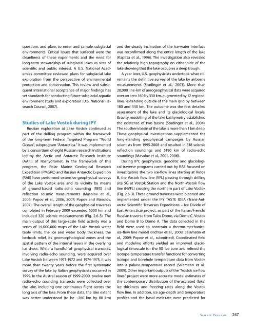
- Page 274 and 275: Fig. 2.6-3. Russian scientific trav
- Page 276 and 277: 250 IPY 20 07-20 08 Fig. 2.6-5a. Co
- Page 278 and 279: 252 IPY 20 07-20 08 Emerging Subgla
- Page 280 and 281: 254 IPY 20 07-20 08 Masolov V.N., S
- Page 282 and 283: Fig. 2.7-1. Permafrost extent in th
- Page 284 and 285: 258 IPY 20 07-20 08 contributed to
- Page 286 and 287: Table 2.7-1. Inventory of Northern
- Page 288 and 289: Table 2.7-2. Inventory of Antarctic
- Page 290 and 291: 264 IPY 20 07-20 08 Arctic Circum-P
- Page 292 and 293: 266 IPY 20 07-20 08 Northern Circum
- Page 294 and 295: 268 IPY 20 07-20 08 Permafrost in t
- Page 296 and 297: 270 IPY 20 07-20 08 Engineers Offic
- Page 298 and 299: 272 IPY 20 07-20 08 Valcárcel-Día
- Page 300 and 301: Fig. 2.8-1. Antarctica’s Gamburts
- Page 302 and 303: 276 IPY 20 07-20 08 sampling at rel
- Page 304 and 305: 278 IPY 20 07-20 08 Fig. 2.8-5. PLA
- Page 306 and 307: Fig. 2.8-6. POLENET autonomous, col
- Page 308 and 309: Fig. 2.8-7. Continuouslyrecording G
- Page 310 and 311: 284 IPY 20 07-20 08 Seismic imaging
- Page 312 and 313: 286 IPY 20 07-20 08 expectations of
- Page 314 and 315: 288 IPY 20 07-20 08 Willis, 2009b.
- Page 316 and 317: 290 IPY 20 07-20 08 Meet. Suppl., A
- Page 318 and 319: 292 IPY 20 07-20 08 mantle beneath
- Page 320 and 321: Table 2.9-1. Terrestrial Projects u
- Page 322 and 323:
296 IPY 20 07-20 08 future. For thi
- Page 324 and 325:
Fig. 2.9-2. A small moving drill wa
- Page 326 and 327:
300 IPY 20 07-20 08 2.9-4. Field si
- Page 328 and 329:
302 IPY 20 07-20 08 line zones have
- Page 330 and 331:
304 IPY 20 07-20 08 that the Arctic
- Page 332 and 333:
Fig. 2.9-7. Olga Bohuslavova, Ph.D.
- Page 334 and 335:
308 IPY 20 07-20 08 Acknowledgement
- Page 336 and 337:
310 IPY 20 07-20 08 arctic polar se
- Page 338 and 339:
Table 2.10-1. List of active projec
- Page 340 and 341:
314 IPY 20 07-20 08 Fig. 2.10-1. IP
- Page 342 and 343:
316 IPY 20 07-20 08 Box 1. The ‘f
- Page 344 and 345:
318 IPY 20 07-20 08 The field of th
- Page 346 and 347:
Table 2.10-2. Recommended ‘Small
- Page 348 and 349:
322 IPY 20 07-20 08 as a research a
- Page 350 and 351:
Fig. 2.10-7. Participants of the
- Page 352 and 353:
Fig. 2.10-9. 6th International Cong
- Page 354 and 355:
328 IPY 20 07-20 08 eral models. Th
- Page 356 and 357:
330 IPY 20 07-20 08 popularity duri
- Page 358 and 359:
332 IPY 20 07-20 08 in an Arctic Re
- Page 360 and 361:
334 IPY 20 07-20 08 Vairo, C., R. C
- Page 362 and 363:
Fig. 2.11-1. The circumpolar Arctic
- Page 364 and 365:
338 IPY 20 07-20 08 and the Danish
- Page 366 and 367:
340 IPY 20 07-20 08 Canadian traini
- Page 368 and 369:
342 IPY 20 07-20 08 Fig. 2.11-3. Th
- Page 370 and 371:
344 IPY 20 07-20 08 logical studies
- Page 372 and 373:
Fig. 2.11-5. Salmon drying on the Y
- Page 374 and 375:
348 IPY 20 07-20 08 health status (
- Page 376 and 377:
350 IPY 20 07-20 08 communication,
- Page 378 and 379:
352 IPY 20 07-20 08 play an importa
- Page 380 and 381:
354 IPY 20 07-20 08 References Alle
- Page 382 and 383:
356 IPY 20 07-20 08 D are associate
- Page 384 and 385:
358 IPY 20 07-20 08 PA R T T H R E
- Page 386 and 387:
360 IPY 20 07-20 08 during IPY (Cha
- Page 388 and 389:
Fig. 3.1-1. Antarctica mosaic image
- Page 390 and 391:
Fig. 3.1-3. Evolution of the Wilkin
- Page 392 and 393:
Fig. 3.1-5. Threedimensional mappin
- Page 394 and 395:
Fig. 3.1-8. Time series of monthly
- Page 396 and 397:
370 IPY 20 07-20 08 References Alli
- Page 398 and 399:
Fig. 3.2-1. Potential temperature/
- Page 400 and 401:
Fig. 3.2-3. A Distributed Biologica
- Page 402 and 403:
Fig. 3.2-4. Fresh water content (FW
- Page 404 and 405:
Fig. 3.2-6. Composite changes in th
- Page 406 and 407:
Fig. 3.2-7. Mooring components (lef
- Page 408 and 409:
382 IPY 20 07-20 08 observing syste
- Page 410 and 411:
384 IPY 20 07-20 08 with the recent
- Page 412 and 413:
386 IPY 20 07-20 08 ocean circulati
- Page 414 and 415:
388 IPY 20 07-20 08 for sustained o
- Page 416 and 417:
Fig. 3.3-5. Map showing the locatio
- Page 418 and 419:
392 IPY 20 07-20 08 Fig. 3.4-1. Map
- Page 420 and 421:
Top left - Fig. 3.4-3: Screen shot
- Page 422 and 423:
396 IPY 20 07-20 08 including how t
- Page 424 and 425:
Fig. 3.5-1. Antarctic stations at t
- Page 426 and 427:
Fig. 3.5-3. Servicing the AWS at Bu
- Page 428 and 429:
Fig. 3.5-6. Sonde launch at Halley
- Page 430 and 431:
404 IPY 20 07-20 08 Fig. 3.5-8. Bre
- Page 432 and 433:
406 IPY 20 07-20 08 Fig. 3.6-1. Ave
- Page 434 and 435:
408 IPY 20 07-20 08 forecast ranges
- Page 436 and 437:
Fig.3.6-5. Sea Ice Outlook: 2009 Su
- Page 438 and 439:
Fig. 3.7-1. Examples of the cryosph
- Page 440 and 441:
414 IPY 20 07-20 08 Global Cryosphe
- Page 442 and 443:
416 IPY 20 07-20 08 and build on ex
- Page 444 and 445:
Fig. 3.8-1. SAON website - www. arc
- Page 446 and 447:
420 IPY 20 07-20 08 be necessary to
- Page 448 and 449:
422 IPY 20 07-20 08 on data sharing
- Page 450 and 451:
424 IPY 20 07-20 08 Fig. 3.9-1. CBM
- Page 452 and 453:
Fig. 3.9-3. Screenshots of the CBMP
- Page 454 and 455:
Fig. 3.9-5. (left) Data Coverage by
- Page 456 and 457:
Table 3.9-2. Current status, trends
- Page 458 and 459:
Fig. 3.9-9. The components of a com
- Page 460 and 461:
434 IPY 20 07-20 08 CAFF CBMP Repor
- Page 462 and 463:
436 IPY 20 07-20 08 polar communiti
- Page 464 and 465:
438 IPY 20 07-20 08 Fig. 3.10-3. Mo
- Page 466 and 467:
Fig. 3.10-5. Combining data on trad
- Page 468 and 469:
Fig. 3.10-6. NOMAD Expedition camp
- Page 470 and 471:
444 IPY 20 07-20 08 and visual form
- Page 472 and 473:
Fig. 3.10-10. Group of hunters camp
- Page 474 and 475:
Fig. 3.10-12. BSSN Research Assista
- Page 476 and 477:
Fig. 3.10-15. The Siku- Inuit-Hila
- Page 478 and 479:
Fig. 3.10-17. Meeting with officers
- Page 480 and 481:
454 IPY 20 07-20 08 monitoring prod
- Page 482 and 483:
456 IPY 20 07-20 08 Edited by I. Kr
- Page 484 and 485:
458 IPY 20 07-20 08 the World Ocean
- Page 486 and 487:
460 IPY 20 07-20 08 In the period l
- Page 488 and 489:
Table 3.11-1. National IPY Data Coo
- Page 490 and 491:
464 IPY 20 07-20 08 on basic data m
- Page 492 and 493:
466 IPY 20 07-20 08 handling commun
- Page 494 and 495:
468 IPY 20 07-20 08 funding agencie
- Page 496 and 497:
470 IPY 20 07-20 08 metadata. • M
- Page 498 and 499:
472 IPY 20 07-20 08 A major initial
- Page 500 and 501:
Table 3.11-2. Summary assessment of
- Page 502 and 503:
476 IPY 20 07-20 08 tion and Data.F
- Page 504 and 505:
478 IPY 20 07-20 08 PA R T F O U R
- Page 506 and 507:
480 IPY 20 07-20 08 Fig. 4.0-2. A w
- Page 508 and 509:
482 IPY 20 07-20 08 Historical back
- Page 510 and 511:
Fig. 4.1-1. Participants at the Str
- Page 512 and 513:
486 IPY 20 07-20 08 students throug
- Page 514 and 515:
488 IPY 20 07-20 08 Officers from m
- Page 516 and 517:
Fig. 4.1-2. Students in Portugal to
- Page 518 and 519:
492 IPY 20 07-20 08 Two internation
- Page 520 and 521:
494 IPY 20 07-20 08 the submissions
- Page 522 and 523:
Fig. 4.1-4. (left) Teachers partici
- Page 524 and 525:
498 IPY 20 07-20 08 conference, ‘
- Page 526 and 527:
500 Fig. 4.2-1. IPYPD Basic search
- Page 528 and 529:
Table 4.2-2. Distribution of public
- Page 530 and 531:
504 IPY 20 07-20 08 Google Groups t
- Page 532 and 533:
506 IPY 20 07-20 08 tative/liaison
- Page 534 and 535:
508 IPY 20 07-20 08 material had to
- Page 536 and 537:
510 IPY 20 07-20 08 References Arct
- Page 538 and 539:
512 IPY 20 07-20 08 Highlights from
- Page 540 and 541:
514 IPY 20 07-20 08 students throug
- Page 542 and 543:
Fig. 4.3-1. Participants of the mee
- Page 544 and 545:
Fig. 4.3-3. Early career scientists
- Page 546 and 547:
520 IPY 20 07-20 08 management. The
- Page 548 and 549:
Fig. 4.3-4. During IPY early career
- Page 550 and 551:
524 IPY 20 07-20 08 PA R T FI V E :
- Page 552 and 553:
526 IPY 20 07-20 08 ‘legacies’)
- Page 554 and 555:
528 IPY 20 07-20 08 sciences_for_ip
- Page 556 and 557:
530 IPY 20 07-20 08 of multidiscipl
- Page 558 and 559:
Fig. 5.1-2 In situ platforms, inclu
- Page 560 and 561:
534 IPY 20 07-20 08 tion documented
- Page 562 and 563:
536 IPY 20 07-20 08 warming over th
- Page 564 and 565:
538 IPY 20 07-20 08 the Russian Ant
- Page 566 and 567:
540 IPY 20 07-20 08 Background with
- Page 568 and 569:
542 IPY 20 07-20 08 achievements al
- Page 570 and 571:
544 IPY 20 07-20 08 with a Sunyaev-
- Page 572 and 573:
546 IPY 20 07-20 08 doing will cont
- Page 574 and 575:
548 IPY 20 07-20 08 IPY 2007-2008 (
- Page 576 and 577:
Fig.5.2-4. Proposed structure of th
- Page 578 and 579:
552 IPY 20 07-20 08 from April 2010
- Page 580 and 581:
554 IPY 20 07-20 08 References ACIA
- Page 582 and 583:
556 IPY 20 07-20 08 and China agree
- Page 584 and 585:
Fig.5.3-1. Routine CTD profiling du
- Page 586 and 587:
560 IPY 20 07-20 08 Svalbard, Norwa
- Page 588 and 589:
Fig.5.3-7. Comparison of geostrophi
- Page 590 and 591:
Fig.5.3-9. Participants of the IPY
- Page 592 and 593:
Fig.5.3-11. Japanese- Swedish Antar
- Page 594 and 595:
Fig.5.3-13. Memorial photo after th
- Page 596 and 597:
570 IPY 20 07-20 08 Fig.5.3-15. New
- Page 598 and 599:
Fig.5.3-17. Malaysian biologist Che
- Page 600 and 601:
Fig.5.3-19. Malaysian Arctic sampli
- Page 602 and 603:
576 IPY 20 07-20 08 their role via
- Page 604 and 605:
578 IPY 20 07-20 08 IPY 2007-2008 g
- Page 606 and 607:
Fig. 5.4-3. Community meeting organ
- Page 608 and 609:
582 IPY 20 07-20 08 Krupnik and Jol
- Page 610 and 611:
584 IPY 20 07-20 08 training may be
- Page 612 and 613:
586 IPY 20 07-20 08 of the universi
- Page 614 and 615:
Table 5.4-1: UArctic Members and St
- Page 616 and 617:
Fig. 5.4-11. Inaugural IAI meeting
- Page 618 and 619:
592 IPY 20 07-20 08 References Refe
- Page 620 and 621:
594 IPY 20 07-20 08 Council (AC) in
- Page 622 and 623:
596 IPY 20 07-20 08 established in
- Page 624 and 625:
598 IPY 20 07-20 08 cal cycle, perm
- Page 626 and 627:
600 IPY 20 07-20 08 Fig.5.5-3. In t
- Page 628 and 629:
602 IPY 20 07-20 08 New Role of the
- Page 630 and 631:
604 IPY 20 07-20 08 Fig. 5.5-6. Ice
- Page 632 and 633:
Fig.5.5-8. Paul Berkman, Chair of t
- Page 634 and 635:
608 IPY 20 07-20 08 speakers and pa
- Page 636 and 637:
610 IPY 20 07-20 08 Approach for Br
- Page 638 and 639:
612 IPY 20 07-20 08 promoted since
- Page 640 and 641:
614 IPY 20 07-20 08 states in polar
- Page 642 and 643:
Fig.5.6-2. The IPY Oslo Science Con
- Page 644 and 645:
618 Box 1 Oslo Science Conference P
- Page 646 and 647:
Fig. 5.6-6 The inclusion of early c
- Page 648 and 649:
622 IPY 20 07-20 08 2008 implementa
- Page 650 and 651:
624 IPY 20 07-20 08 capacity buildi
- Page 652 and 653:
626 IPY 20 07-20 08 emissions of me
- Page 654 and 655:
628 IPY 20 07-20 08 Epilogue Lead A
- Page 656 and 657:
Table E-1: What Does It Take to Com
- Page 658 and 659:
632 IPY 20 07-20 08 both ICSU and W
- Page 660 and 661:
634 IPY 20 07-20 08
- Page 662 and 663:
636 IPY 20 07-20 08 Robin Bell is a
- Page 664 and 665:
638 IPY 20 07-20 08 Tillmann Mohr i
- Page 666 and 667:
640 IPY 20 07-20 08 Volker Rachold
- Page 668 and 669:
642 IPY 20 07-20 08 A PPENDIX 2 IPY
- Page 670 and 671:
644 IPY 20 07-20 08 Activity ID Tit
- Page 672 and 673:
646 IPY 20 07-20 08 Activity ID Tit
- Page 674 and 675:
648 IPY 20 07-20 08 Activity ID Tit
- Page 676 and 677:
650 IPY 20 07-20 08 A PPENDIX 3 Joi
- Page 678 and 679:
652 IPY 20 07-20 08 Third Meeting o
- Page 680 and 681:
654 IPY 20 07-20 08 Fifth Meeting o
- Page 682 and 683:
656 IPY 20 07-20 08 Seventh Meeting
- Page 684 and 685:
658 IPY 20 07-20 08 Ninth Meeting o
- Page 686 and 687:
660 IPY 20 07-20 08 A PPENDIX 5 Sub
- Page 688 and 689:
662 A PPENDIX 6 IPY Project Charts,
- Page 690 and 691:
Appendix 6 Fig.3. Version 3.4, Apri
- Page 692 and 693:
Appendix 6 Fig.5. Version 6.4, May
- Page 694 and 695:
668 A PPENDIX 7 List of the Nationa
- Page 696 and 697:
670 IPY 20 07-20 08 Poland IPY Nati
- Page 698 and 699:
672 IPY 20 07-20 08 A PPENDIX 9 IPY
- Page 700 and 701:
674 IPY 20 07-20 08 2002 February.
- Page 702 and 703:
676 IPY 20 07-20 08 January 22. Int
- Page 704 and 705:
678 IPY 20 07-20 08 November 24. Ar
- Page 706 and 707:
680 IPY 20 07-20 08 March 2. IPY Da
- Page 708 and 709:
682 IPY 20 07-20 08 February 16. Sc
- Page 710 and 711:
684 IPY 20 07-20 08 2008 January 20
- Page 712 and 713:
686 IPY 20 07-20 08 February 26. Th
- Page 714 and 715:
688 IPY 20 07-20 08 A PPENDIX 10 Se
- Page 716 and 717:
690 IPY 20 07-20 08 A PPENDIX 11 Li
- Page 718 and 719:
692 IPY 20 07-20 08 FWC Freshwater
- Page 720 and 721:
694 IPY 20 07-20 08 OCH Oscillating
- Page 724:
698 The International Polar Year (I