Hurricanes: Their Nature and Impacts on Society - Climate Science ...
Hurricanes: Their Nature and Impacts on Society - Climate Science ...
Hurricanes: Their Nature and Impacts on Society - Climate Science ...

Create successful ePaper yourself
Turn your PDF publications into a flip-book with our unique Google optimized e-Paper software.
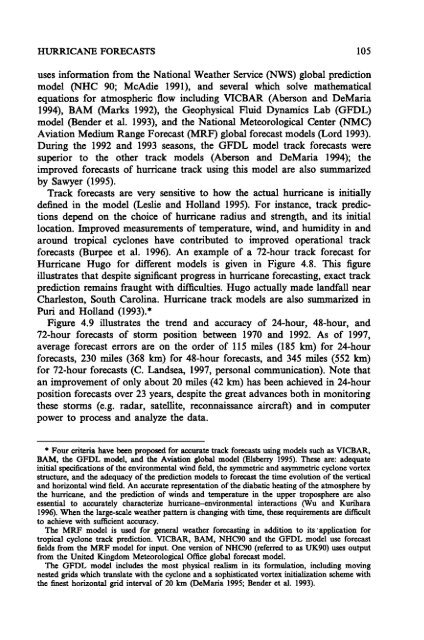
HURRICANE FORECASTS 105<br />
uses informati<strong>on</strong> from the Nati<strong>on</strong>al Weather Service (NWS) global predicti<strong>on</strong><br />
model (NBC 90; McAdie 1991), <str<strong>on</strong>g>and</str<strong>on</strong>g> several which solve mathematical<br />
equati<strong>on</strong>s for atmospheric flow including VICBAR (Abers<strong>on</strong> <str<strong>on</strong>g>and</str<strong>on</strong>g> DeMaria<br />
1994), BAM (Marks 1992), the Geophysical Fluid Dynamics Lab (GFDL)<br />
model (Bender et al. 1993), <str<strong>on</strong>g>and</str<strong>on</strong>g> the Nati<strong>on</strong>al Meteorological Center (NMC)<br />
Aviati<strong>on</strong> Medium Range Forecast (MRF) global forecast models (Lord 1993).<br />
During the 1992 <str<strong>on</strong>g>and</str<strong>on</strong>g> 1993 seas<strong>on</strong>s, the GFDL model track forecasts were<br />
superior to the other track models (Abers<strong>on</strong> <str<strong>on</strong>g>and</str<strong>on</strong>g> DeMaria 1994); the<br />
improved forecasts of hurricane track using this model are also summarized<br />
by Sawyer (1995).<br />
Track forecasts are very sensitive to how the actual hurricane is initially<br />
defined in the model (Leslie <str<strong>on</strong>g>and</str<strong>on</strong>g> Holl<str<strong>on</strong>g>and</str<strong>on</strong>g> 1995). For instance, track predicti<strong>on</strong>s<br />
depend <strong>on</strong> the choice of hurricane radius <str<strong>on</strong>g>and</str<strong>on</strong>g> strength, <str<strong>on</strong>g>and</str<strong>on</strong>g> its initial<br />
locati<strong>on</strong>. Improved measurements of temperature, wind, <str<strong>on</strong>g>and</str<strong>on</strong>g> humidity in <str<strong>on</strong>g>and</str<strong>on</strong>g><br />
around tropical cycl<strong>on</strong>es have c<strong>on</strong>tributed to improved operati<strong>on</strong>al track<br />
forecasts (Burpee et al. 1996). An example of a 72-hour track forecast for<br />
Hurricane Hugo for different models is given in Figure 4.8. This figure<br />
illustrates that despite significant progress in hurricane forecasting, exact track<br />
predicti<strong>on</strong> remains fraught with difficulties. Hugo actually made l<str<strong>on</strong>g>and</str<strong>on</strong>g>fall near<br />
Charlest<strong>on</strong>, South Carolina. Hurricane track models are also summarized in<br />
Puri <str<strong>on</strong>g>and</str<strong>on</strong>g> Holl<str<strong>on</strong>g>and</str<strong>on</strong>g> (1993).*<br />
Figure 4.9 illustrates the trend <str<strong>on</strong>g>and</str<strong>on</strong>g> accuracy of 24-hour, 48-hour, <str<strong>on</strong>g>and</str<strong>on</strong>g><br />
72-hour forecasts of storm positi<strong>on</strong> between 1970 <str<strong>on</strong>g>and</str<strong>on</strong>g> 1992. As of 1997,<br />
average forecast errors are <strong>on</strong> the order of 115 miles (185 kIn) for 24-hour<br />
forecasts, 230 miles (368 kIn) for 48-hour forecasts, <str<strong>on</strong>g>and</str<strong>on</strong>g> 345 miles (552 kIn)<br />
for 72-hour forecasts (C. L<str<strong>on</strong>g>and</str<strong>on</strong>g>sea, 1997, pers<strong>on</strong>al communicati<strong>on</strong>). Note that<br />
an improvement of <strong>on</strong>ly about 20 miles (42 kIn) has been achieved in 24-hour<br />
positi<strong>on</strong> forecasts over 23 years, despite the great advances both in m<strong>on</strong>itoring<br />
these storms (e.g. radar, satellite, rec<strong>on</strong>naissance aircraft) <str<strong>on</strong>g>and</str<strong>on</strong>g> in computer<br />
power to process <str<strong>on</strong>g>and</str<strong>on</strong>g> analyze the data.<br />
.Four criteria have been proposed for accurate track forecasts using models such as VICBAR,<br />
BAM, the GFDL model, <str<strong>on</strong>g>and</str<strong>on</strong>g> the Aviati<strong>on</strong> global model (Elsberry 1995). These are: adequate<br />
initial specificati<strong>on</strong>s of the envir<strong>on</strong>mental wind field, the symmetric <str<strong>on</strong>g>and</str<strong>on</strong>g> asymmetric cycl<strong>on</strong>e vortex<br />
structure, <str<strong>on</strong>g>and</str<strong>on</strong>g> the adequacy of the predicti<strong>on</strong> models to forecast the time evoluti<strong>on</strong> of the vertical<br />
<str<strong>on</strong>g>and</str<strong>on</strong>g> horiz<strong>on</strong>tal wind field. An accurate representati<strong>on</strong> of the diabatic heating of the atmosphere by<br />
the hurricane, <str<strong>on</strong>g>and</str<strong>on</strong>g> the predicti<strong>on</strong> of winds <str<strong>on</strong>g>and</str<strong>on</strong>g> temperature in the upper troposphere are also<br />
essential to accurately characterize hurricane-envir<strong>on</strong>mental interacti<strong>on</strong>s (WU <str<strong>on</strong>g>and</str<strong>on</strong>g> Kurihara<br />
1996). When the large-scale weather pattern is changing with time, these reqnirements are difficult<br />
to achieve with sufficient accuracy.<br />
The MRF model is used for general weather forecasting in additi<strong>on</strong> to its 'applicati<strong>on</strong> for<br />
tropical cycl<strong>on</strong>e track predicti<strong>on</strong>. VICBAR, BAM, NHC90 <str<strong>on</strong>g>and</str<strong>on</strong>g> the GFDL model use forecast<br />
fields from the MRF model for input. One versi<strong>on</strong> of NHC90 (referred to as UK90) uses output<br />
from the United Kingdom Meteorological Office global forecast model.<br />
The GFDL model includes the most physical realism in its formulati<strong>on</strong>, including moving<br />
nested grids which translate with the cycl<strong>on</strong>e <str<strong>on</strong>g>and</str<strong>on</strong>g> a sophisticated vortex initializati<strong>on</strong> scheme with<br />
the finest horiz<strong>on</strong>tal grid interval of 20 km (DeMaria 1995; Bender et aI. 1993).