Hurricanes: Their Nature and Impacts on Society - Climate Science ...
Hurricanes: Their Nature and Impacts on Society - Climate Science ...
Hurricanes: Their Nature and Impacts on Society - Climate Science ...
You also want an ePaper? Increase the reach of your titles
YUMPU automatically turns print PDFs into web optimized ePapers that Google loves.
SOCIETAL RESPONSES<br />
149<br />
warning changes every year due to advances <str<strong>on</strong>g>and</str<strong>on</strong>g> refinements in the process.<br />
Thus the following discussi<strong>on</strong> overviews the producti<strong>on</strong> <str<strong>on</strong>g>and</str<strong>on</strong>g> disseminati<strong>on</strong> of<br />
forecast products as it existed in the early 1990s in order to provide a general<br />
sense of short-term hurricane resp<strong>on</strong>se.<br />
A number of models are used to forecast hurricane tracks because experience<br />
has shown that each has particular strengths <str<strong>on</strong>g>and</str<strong>on</strong>g> weaknesses that have been<br />
systematically documented <str<strong>on</strong>g>and</str<strong>on</strong>g> can be compensated for in the development of<br />
an official forecast. The forecaster's subjective judgment is necessary because<br />
"these models often provide c<strong>on</strong>flicting informati<strong>on</strong>" (DeMaria, Lawrence <str<strong>on</strong>g>and</str<strong>on</strong>g><br />
Kroll 1990). The result of the marriage of forecaster judgment <str<strong>on</strong>g>and</str<strong>on</strong>g> the various<br />
models' output is an "Official Forecast" for public disseminati<strong>on</strong>.<br />
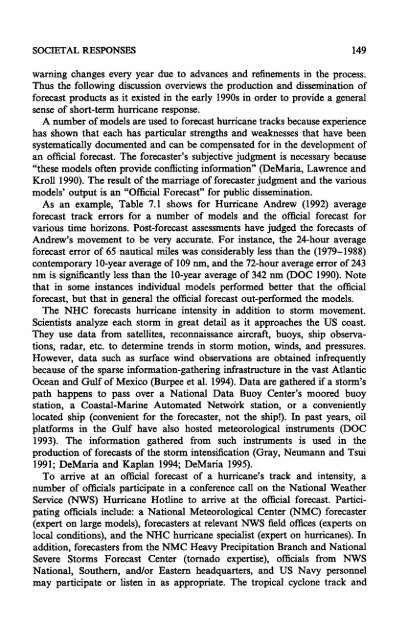
As an example, Table 7.1 shows for Hurricane Andrew (1992) average<br />
forecast track errors for a number of models <str<strong>on</strong>g>and</str<strong>on</strong>g> the official forecast for<br />
various time horiz<strong>on</strong>s. Post-forecast assessments have judged the forecasts of<br />
Andrew's movement to be very accurate. For instance, the 24-hour average<br />
forecast error of 65 nautical miles was c<strong>on</strong>siderably less than the (1979-1988)<br />
c<strong>on</strong>temporary 10-year average of 109 nm, <str<strong>on</strong>g>and</str<strong>on</strong>g> the 72-hour average error of 243<br />
nm is significantly less than the 10-year average of 342 nm (DOC 1990). Note<br />
that in some instances individual models performed better that the official<br />
forecast, but that in general the official forecast out-performed the models.<br />
The NHC forecasts hurricane intensity in additi<strong>on</strong> to storm movement.<br />
Scientists analyze each storm in great detail as it approaches the US coast.<br />
They use data from satellites, rec<strong>on</strong>naissance aircraft, buoys, ship observati<strong>on</strong>s,<br />
radar, etc. to determine trends in storm moti<strong>on</strong>, winds, <str<strong>on</strong>g>and</str<strong>on</strong>g> pressures.<br />
However, data such as surface wind observati<strong>on</strong>s are obtained infrequently<br />
because of the sparse informati<strong>on</strong>-gathering infrastructure in the vast Atlantic<br />
Ocean <str<strong>on</strong>g>and</str<strong>on</strong>g> Gulf of Mexico (Burpee et al. 1994). Data are gathered if a storm's<br />
path happens to pass over a Nati<strong>on</strong>al Data Buoy Center's moored buoy<br />
stati<strong>on</strong>, a Coastal-Marine Automated Network stati<strong>on</strong>, or a c<strong>on</strong>veniently<br />
located ship (c<strong>on</strong>venient for the forecaster, not the ship!). In past years, oil<br />
platforms in the Gulf have also hosted meteorological instruments (DOC<br />
1993). The informati<strong>on</strong> gathered from such instruments is used in the<br />
producti<strong>on</strong> of forecasts of the storm intensificati<strong>on</strong> (Gray, Neumann <str<strong>on</strong>g>and</str<strong>on</strong>g> Tsui<br />
1991; DeMaria <str<strong>on</strong>g>and</str<strong>on</strong>g> Kaplan 1994; DeMaria 1995).<br />
To arrive at an official forecast of a hurricane's track <str<strong>on</strong>g>and</str<strong>on</strong>g> intensity, a<br />
number of officials participate in a c<strong>on</strong>ference call <strong>on</strong> the Nati<strong>on</strong>al Weather<br />
Service (NWS) Hurricane Hotline to arrive at the official forecast. Participating<br />
officials include: a Nati<strong>on</strong>al Meteorological Center (NMC) forecaster<br />
(expert <strong>on</strong> large models), forecasters at relevant NWS field offices (experts <strong>on</strong><br />
local c<strong>on</strong>diti<strong>on</strong>s), <str<strong>on</strong>g>and</str<strong>on</strong>g> the NHC hurricane specialist (expert <strong>on</strong> hurricanes). In<br />
additi<strong>on</strong>, forecasters from the NMC Heavy Precipitati<strong>on</strong> Branch <str<strong>on</strong>g>and</str<strong>on</strong>g> Nati<strong>on</strong>al<br />
Severe Storms Forecast Center (tornado expertise), officials from NWS<br />
Nati<strong>on</strong>al, Southern, <str<strong>on</strong>g>and</str<strong>on</strong>g>/or Eastern headquarters, <str<strong>on</strong>g>and</str<strong>on</strong>g> US Navy pers<strong>on</strong>nel<br />
may participate or listen in as appropriate. The tropical cycl<strong>on</strong>e track <str<strong>on</strong>g>and</str<strong>on</strong>g>


