

Dealing with salinity in Wheatbelt Valleys - Department of Water
Dealing with salinity in Wheatbelt Valleys - Department of Water
Dealing with salinity in Wheatbelt Valleys - Department of Water

You also want an ePaper? Increase the reach of your titles
YUMPU automatically turns print PDFs into web optimized ePapers that Google loves.
CASE STUDY - TOOLIBIN LAKE AND CATCHMENT<br />
INTRODUCTION<br />
In 1996 a group <strong>of</strong> scientists and land managers met<br />
to discuss “A Vision for a Susta<strong>in</strong>able Future: A<br />
Greenpr<strong>in</strong>t for the <strong>Wheatbelt</strong>”. The key head<strong>in</strong>gs<br />
used below, <strong>in</strong>clud<strong>in</strong>g those for guid<strong>in</strong>g pr<strong>in</strong>ciples,<br />
were developed at that workshop. This case study<br />
was <strong>in</strong>tended as one <strong>of</strong> several to be <strong>in</strong>cluded <strong>in</strong> a<br />
book aris<strong>in</strong>g from the workshop. The book was<br />
never published, and this case study has not been<br />
updated s<strong>in</strong>ce 1998. While we have learnt much<br />
s<strong>in</strong>ce then – <strong>in</strong>clud<strong>in</strong>g that the period over which we<br />
thought eng<strong>in</strong>eer<strong>in</strong>g <strong>in</strong>tervention would be required<br />
was much too optimistic – the ideas and comments<br />
aris<strong>in</strong>g from the case study are still relevant today.<br />
Therefore, the paper has been published here <strong>with</strong><br />
only m<strong>in</strong>or amendments.<br />
Ken Wallace 1<br />
PERTH<br />
WESTERN<br />
AUSTRALIA<br />
Toolib<strong>in</strong><br />
Lake<br />
Wallace<br />
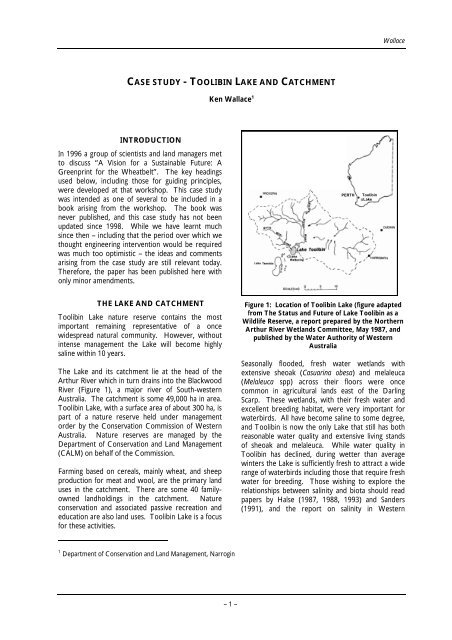
THE LAKE AND CATCHMENT Figure 1: Location <strong>of</strong> Toolib<strong>in</strong> Lake (figure adapted<br />
Toolib<strong>in</strong> Lake nature reserve conta<strong>in</strong>s the most<br />
important rema<strong>in</strong><strong>in</strong>g representative <strong>of</strong> a once<br />
widespread natural community. However, <strong>with</strong>out<br />
<strong>in</strong>tense management the Lake will become highly<br />
sal<strong>in</strong>e <strong>with</strong><strong>in</strong> 10 years.<br />
The Lake and its catchment lie at the head <strong>of</strong> the<br />
Arthur River which <strong>in</strong> turn dra<strong>in</strong>s <strong>in</strong>to the Blackwood<br />
River (Figure 1), a major river <strong>of</strong> South-western<br />
Australia. The catchment is some 49,000 ha <strong>in</strong> area.<br />
Toolib<strong>in</strong> Lake, <strong>with</strong> a surface area <strong>of</strong> about 300 ha, is<br />
part <strong>of</strong> a nature reserve held under management<br />
order by the Conservation Commission <strong>of</strong> Western<br />
Australia. Nature reserves are managed by the<br />
<strong>Department</strong> <strong>of</strong> Conservation and Land Management<br />
(CALM) on behalf <strong>of</strong> the Commission.<br />
Farm<strong>in</strong>g based on cereals, ma<strong>in</strong>ly wheat, and sheep<br />
production for meat and wool, are the primary land<br />
uses <strong>in</strong> the catchment. There are some 40 familyowned<br />
landhold<strong>in</strong>gs <strong>in</strong> the catchment. Nature<br />
conservation and associated passive recreation and<br />
education are also land uses. Toolib<strong>in</strong> Lake is a focus<br />
for these activities.<br />
1 <strong>Department</strong> <strong>of</strong> Conservation and Land Management, Narrog<strong>in</strong><br />
– 1 –<br />
from The Status and Future <strong>of</strong> Lake Toolib<strong>in</strong> as a<br />
Wildlife Reserve, a report prepared by the Northern<br />
Arthur River Wetlands Committee, May 1987, and<br />
published by the <strong>Water</strong> Authority <strong>of</strong> Western<br />
Australia<br />
Seasonally flooded, fresh water wetlands <strong>with</strong><br />
extensive sheoak (Casuar<strong>in</strong>a obesa) and melaleuca<br />
(Melaleuca spp) across their floors were once<br />
common <strong>in</strong> agricultural lands east <strong>of</strong> the Darl<strong>in</strong>g<br />
Scarp. These wetlands, <strong>with</strong> their fresh water and<br />
excellent breed<strong>in</strong>g habitat, were very important for<br />
waterbirds. All have become sal<strong>in</strong>e to some degree,<br />
and Toolib<strong>in</strong> is now the only Lake that still has both<br />
reasonable water quality and extensive liv<strong>in</strong>g stands<br />
<strong>of</strong> sheoak and melaleuca. While water quality <strong>in</strong><br />
Toolib<strong>in</strong> has decl<strong>in</strong>ed, dur<strong>in</strong>g wetter than average<br />
w<strong>in</strong>ters the Lake is sufficiently fresh to attract a wide<br />
range <strong>of</strong> waterbirds <strong>in</strong>clud<strong>in</strong>g those that require fresh<br />
water for breed<strong>in</strong>g. Those wish<strong>in</strong>g to explore the<br />
relationships between <strong>sal<strong>in</strong>ity</strong> and biota should read<br />
papers by Halse (1987, 1988, 1993) and Sanders<br />
(1991), and the report on <strong>sal<strong>in</strong>ity</strong> <strong>in</strong> Western


