OSC 2007 Evaluation Report
OSC 2007 Evaluation Report
OSC 2007 Evaluation Report

You also want an ePaper? Increase the reach of your titles
YUMPU automatically turns print PDFs into web optimized ePapers that Google loves.
<strong>2007</strong> <strong>OSC</strong> Readiness Training Program <strong>Evaluation</strong> <strong>Report</strong><br />
The Rapid Assessment Tools (RAT)<br />
Instructors: John Bing-Canar, EPA Region 5<br />
Abbey Brake, EPA Region 5<br />
Brian Cooper, EPA Region 5<br />
Patrick Hamblin, EPA Region 5<br />
James Mitchell, EPA Region 5<br />
Charles Roth, EPA Region 5<br />
The RAT were developed to aid <strong>OSC</strong>s, RPM, and other support personnel in real-time continuous field<br />
data collection and assessment. The tools have integrated data retrieval, GPS, GIS, mapping, and analysis<br />
through an elementary but powerful and robust interface that requires no post-processing of GPS and GIS<br />
data. All data produced from the system can be exported and used in most other GIS mapping<br />
applications and database packages. All screen outputs can be printed or saved to a standard output file<br />
type. This system is unique because it has been developed in-house by EPA, is stand-alone, and requires<br />
no software licensing or purchasing. RAT also allows for mapping and recording of continuous streams<br />
of external data merged with GPS locations. The data streams are processed internally, saved directly to a<br />
database-compatible format such as SCRIBE, and can be used in many other modeling applications.<br />
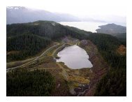
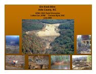
RAT was developed for Superfund-contaminated site assessment using spatial data analysis and 2D<br />
visualization. RAT focuses on tools needed for rapid assessment and mapping in the field. More<br />
complex modeling can be achieved and easily exported to another GIS software tool. RAT includes<br />
modules for spatial data retrieval, data collection and storage, sample designs, data contouring, real-time<br />
data visualization, and non-GPS trend monitoring. By taking the course, participants achieved the<br />
following objectives:<br />
• Learned the basics of how RAT has been used at various Superfund removal, remedial, and<br />
emergency response sites.<br />
• Gained hands-on experience using RAT with GPS for:<br />
o Integration of real-time field sampling equipment, including Multi-RAEs, Multi-warns,<br />
Ludlum radiation monitors, Datarams, and X-ray fluorescence.<br />
o Sample design generation and navigation.<br />
o Single point and multiple point data collection.<br />
o Data contouring.<br />
o Data export to SCRIBE and ESRI GIS packages.<br />
• Learned the basics of wireless hardware and software configurations for data sharing, export, and<br />
remote desktop sharing applications.<br />
The instructional methodology for this course included lecture, case studies, and group exercises. A<br />
hands-on, in-field practicum was emphasized in this training. The target audience for this course was<br />
<strong>OSC</strong>s, RPMs, and others who plan, direct, or implement in-field sampling using real-time data collection<br />
sensors.<br />
This course was offered twice and evaluation comments from each course offering are presented<br />
separately.<br />
C-109 Comments about Individual Training Courses