Einsatz von 3D-Stadtmodellen für Partizipationsverfahren - cpe ...
Einsatz von 3D-Stadtmodellen für Partizipationsverfahren - cpe ...
Einsatz von 3D-Stadtmodellen für Partizipationsverfahren - cpe ...

Erfolgreiche ePaper selbst erstellen
Machen Sie aus Ihren PDF Publikationen ein blätterbares Flipbook mit unserer einzigartigen Google optimierten e-Paper Software.
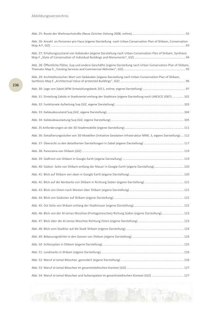
236<br />
Abbildungsverzeichnis<br />
Abb. 25: Route der Weihrauchstraße (Neue Züricher Zeitung 2008, online) ............................................................... 92<br />
Abb. 26: Anzahl an Personen pro Haus (eigene Darstellung nach Urban Conservation Plan of Shibam, Conservation<br />
Map A-F, GIZ) ............................................................................................................................................................... 93<br />
Abb. 27: Erhaltungszustand <strong>von</strong> Gebäuden (eigene Darstellung nach Urban Conservation Plan of Shibam, Synthesis<br />
Map F „State of Conservation of Individual Buildings and Monuments“, GIZ) ............................................................ 94<br />
Abb. 28: Öffentliche Plätze, Suq und andere Geschäfte (eigene Darstellung nach Urban Conservation Plan of Shibam,<br />
Thematic Map 9 „ Existing Services and Commercial Aktivities“, GIZ) ......................................................................... 95<br />
Abb. 29: Architektonischer Wert <strong>von</strong> Gebäuden (eigene Darstellung nach Urban Conservation Plan of Shibam,<br />
Synthesis Map E „Architectual Valus of protected Buildings”, GIZ) ............................................................................. 96<br />
Abb. 30: Lage <strong>von</strong> Zabid (KfW-Entwicklungsbank 2011, online; eigene Darstellung) .................................................. 97<br />
Abb. 31: Einteilung Zabids in Stadtviertel entlang der Stadttore (eigene Darstellung nach UNESCO 2007) .............. 101<br />
Abb. 32: Funktionale Aufteilung Suq (GIZ, eigene Darstellung) ................................................................................. 103<br />
Abb. 33: Gebäudezustand Suq (GIZ, eigene Darstellung)........................................................................................... 104<br />
Abb. 34: Gebäudeauslastung Suq (GIZ, eigene Darstellung) ...................................................................................... 105<br />
Abb. 35 Anforderungen an die <strong>3D</strong>-Stadtmodelle (eigene Darstellung)...................................................................... 111<br />
Abb. 36: Detaillierungsstufen <strong>von</strong> <strong>3D</strong>-Modellen (Initiative Geodaten Infrastruktur NRW, 3, eigene Darstellung) .... 112<br />
Abb. 37: Übersicht zu den detaillierten Darstellungen in Zabid (eigene Darstellung) ............................................... 117<br />
Abb. 38: Panorama <strong>von</strong> Shibam (GIZ) ........................................................................................................................ 119<br />
Abb. 39: Südfront <strong>von</strong> Shibam in Google Earth (eigene Darstellung) ........................................................................ 119<br />
Abb. 40: Südost- Seite <strong>von</strong> Shibam entlang der Mauer in Google Earth (eigene Darstellung) ................................... 120<br />
Abb. 41: Blick auf Shibam <strong>von</strong> oben in Google Earth (eigene Darstellung) ................................................................ 120<br />
Abb. 42: Blick auf die Nordseite <strong>von</strong> Shibam in Richtung Süden (eigene Darstellung) .............................................. 121<br />
Abb. 43: Blick <strong>von</strong> Osten nach Westen über Shibam (eigene Darstellung) ................................................................ 121<br />
Abb. 44: Blick <strong>von</strong> Südosten auf Shibam (eigene Darstellung) ................................................................................... 122<br />
Abb. 45: Ost Seite <strong>von</strong> Shibam entlang der Stadtmauer (eigene Darstellung) ........................................................... 122<br />
Abb. 46: Blick <strong>von</strong> der Al-Jamas Moschee (Freitagsmoschee) Richung Süden (eigene Darstellung).......................... 123<br />
Abb. 47: Blick über die Al-Jamas Moschee Richtung Osten (eigene Darstellung) ...................................................... 123<br />
Abb. 48: Blick vom Stadttor auf die Stadt Shibam (eigene Darstellung) .................................................................... 124<br />
Abb. 49: Bebauungsdichte in den Gassen <strong>von</strong> Shibam (eigene Darstellung) ............................................................. 124<br />
Abb. 50: Schlossplatz in Shibam (eigene Darstellung) ................................................................................................ 125<br />
Abb. 51: Landmarks in Shibam (eigene Darstellung).................................................................................................. 126<br />
Abb. 52: Maruf al-Jamal Moschee ,gerendert (eigene Darstellung) .......................................................................... 126<br />
Abb. 53: Maruf al-Jamal Moschee im gesamtstädtischen Kontext (GIZ) ................................................................... 127<br />
Abb. 54: Maruf al-Jamal Moschee und Sultanspalast im gesamtstädtischen Kontext (GIZ) ...................................... 127