TRD 05: Data Presentation techniques (Mapping) Quantum GIS ...
TRD 05: Data Presentation techniques (Mapping) Quantum GIS ...
TRD 05: Data Presentation techniques (Mapping) Quantum GIS ...
Create successful ePaper yourself
Turn your PDF publications into a flip-book with our unique Google optimized e-Paper software.
4.3 The Vector Properties Dialog<br />
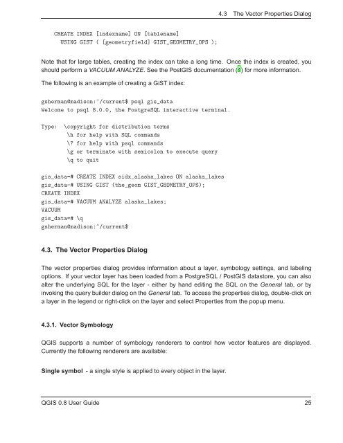
CREATE INDEX [indexname] ON [tablename]<br />
USING <strong>GIS</strong>T ( [geometryfield] <strong>GIS</strong>T_GEOMETRY_OPS );<br />
Note that for large tables, creating the index can take a long time. Once the index is created, you<br />
should perform a VACUUM ANALYZE. See the Post<strong>GIS</strong> documentation (4) for more information.<br />
The following is an example of creating a GiST index:<br />
gsherman@madison:~/current$ psql gis_data<br />
Welcome to psql 8.0.0, the PostgreSQL interactive terminal.<br />
Type: \copyright for distribution terms<br />
\h for help with SQL commands<br />
\? for help with psql commands<br />
\g or terminate with semicolon to execute query<br />
\q to quit<br />
gis_data=# CREATE INDEX sidx_alaska_lakes ON alaska_lakes<br />
gis_data-# USING <strong>GIS</strong>T (the_geom <strong>GIS</strong>T_GEOMETRY_OPS);<br />
CREATE INDEX<br />
gis_data=# VACUUM ANALYZE alaska_lakes;<br />
VACUUM<br />
gis_data=# \q<br />
gsherman@madison:~/current$<br />
4.3. The Vector Properties Dialog<br />
The vector properties dialog provides information about a layer, symbology settings, and labeling<br />
options. If your vector layer has been loaded from a PostgreSQL / Post<strong>GIS</strong> datastore, you can also<br />
alter the underlying SQL for the layer - either by hand editing the SQL on the General tab, or by<br />
invoking the query builder dialog on the General tab. To access the properties dialog, double-click on<br />
a layer in the legend or right-click on the layer and select Properties from the popup menu.<br />
4.3.1. Vector Symbology<br />
Q<strong>GIS</strong> supports a number of symbology renderers to control how vector features are displayed.<br />
Currently the following renderers are available:<br />
Single symbol - a single style is applied to every object in the layer.<br />
Q<strong>GIS</strong> 0.8 User Guide 25


