

TRD 05: Data Presentation techniques (Mapping) Quantum GIS ...
TRD 05: Data Presentation techniques (Mapping) Quantum GIS ...
TRD 05: Data Presentation techniques (Mapping) Quantum GIS ...

You also want an ePaper? Increase the reach of your titles
YUMPU automatically turns print PDFs into web optimized ePapers that Google loves.
7.2 Getting Started<br />
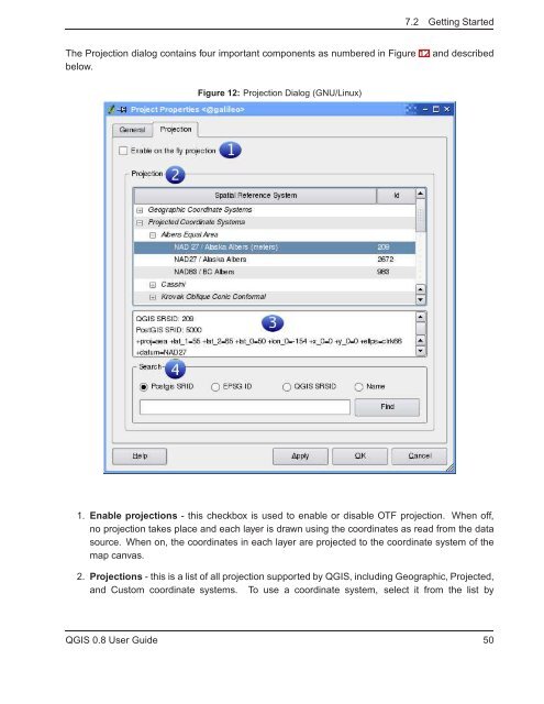
The Projection dialog contains four important components as numbered in Figure 12 and described<br />
below.<br />
Figure 12: Projection Dialog (GNU/Linux)<br />
1. Enable projections - this checkbox is used to enable or disable OTF projection. When off,<br />
no projection takes place and each layer is drawn using the coordinates as read from the data<br />
source. When on, the coordinates in each layer are projected to the coordinate system of the<br />
map canvas.<br />
2. Projections - this is a list of all projection supported by Q<strong>GIS</strong>, including Geographic, Projected,<br />
and Custom coordinate systems. To use a coordinate system, select it from the list by<br />
Q<strong>GIS</strong> 0.8 User Guide 50


