

TRD 05: Data Presentation techniques (Mapping) Quantum GIS ...
TRD 05: Data Presentation techniques (Mapping) Quantum GIS ...
TRD 05: Data Presentation techniques (Mapping) Quantum GIS ...

Create successful ePaper yourself
Turn your PDF publications into a flip-book with our unique Google optimized e-Paper software.
4.6 Query Builder<br />
To complete the creation of the new layer, add the desired attributes by clicking on the Add button and<br />
specifying a name and type for the attribute. Only real, integer, and string attributes are supported.<br />
Once you are happy with the attributes, click Ok and provide a name for the shapefile. Q<strong>GIS</strong> will<br />
automatically add a .shp extension to the name you specify. Once the layer has been created, it will<br />
be added to the map and you can edit it in the same way as described in Section 4.5.1 above.<br />
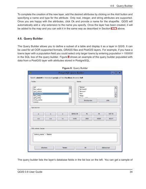
4.6. Query Builder<br />
The Query Builder allows you to define a subset of a table and display it as a layer in Q<strong>GIS</strong>. It can<br />
be used for all OGR supported formats, GRASS files and Post<strong>GIS</strong> layers. For example, if you have a<br />
towns layer with a population field you could select only larger towns by entering population > 100000<br />
in the SQL box of the query builder. Figure 8 shows an example of the query builder populated with<br />
data from a Post<strong>GIS</strong> layer with attributes stored in PostgreSQL.<br />
Figure 8: Query Builder<br />
The query builder lists the layer’s database fields in the list box on the left. You can get a sample of<br />
Q<strong>GIS</strong> 0.8 User Guide 34


