

TRD 05: Data Presentation techniques (Mapping) Quantum GIS ...
TRD 05: Data Presentation techniques (Mapping) Quantum GIS ...
TRD 05: Data Presentation techniques (Mapping) Quantum GIS ...

Create successful ePaper yourself
Turn your PDF publications into a flip-book with our unique Google optimized e-Paper software.
5.3 Loading raster data in Q<strong>GIS</strong><br />
5.3. Loading raster data in Q<strong>GIS</strong><br />
Raster layers are loaded either by clicking on the Load Raster icon or by selecting the View -<br />
> Add Raster Layer menu option. More than one layer can be loaded at the same time by holding<br />
down the Control key and clicking on multiple items in the file dialog.<br />
Please refer to section 8.2 if you intend to load GRASS rasterdata.<br />
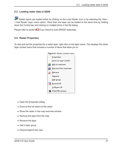
5.4. Raster Properties<br />
To view and set the properties for a raster layer, right click on the layer name. This displays the raster<br />
layer context menu that includes a number of items that allow you to:<br />
Figure 9: Raster context menu<br />
• Open the properties dialog<br />
• Zoom to the full extent of the raster<br />
• Show the raster in the map overview window<br />
• Remove the layer from the map<br />
• Rename the layer<br />
• Add a layer group<br />
• Expand legend tree view<br />
Q<strong>GIS</strong> 0.8 User Guide 37


