

TRD 05: Data Presentation techniques (Mapping) Quantum GIS ...
TRD 05: Data Presentation techniques (Mapping) Quantum GIS ...
TRD 05: Data Presentation techniques (Mapping) Quantum GIS ...

Create successful ePaper yourself
Turn your PDF publications into a flip-book with our unique Google optimized e-Paper software.
10.2 Using the GPS Plugin<br />
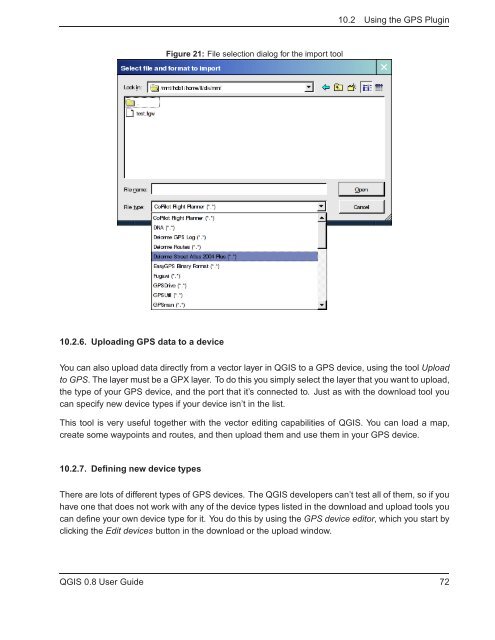
Figure 21: File selection dialog for the import tool<br />
10.2.6. Uploading GPS data to a device<br />
You can also upload data directly from a vector layer in Q<strong>GIS</strong> to a GPS device, using the tool Upload<br />
to GPS. The layer must be a GPX layer. To do this you simply select the layer that you want to upload,<br />
the type of your GPS device, and the port that it’s connected to. Just as with the download tool you<br />
can specify new device types if your device isn’t in the list.<br />
This tool is very useful together with the vector editing capabilities of Q<strong>GIS</strong>. You can load a map,<br />
create some waypoints and routes, and then upload them and use them in your GPS device.<br />
10.2.7. Defining new device types<br />
There are lots of different types of GPS devices. The Q<strong>GIS</strong> developers can’t test all of them, so if you<br />
have one that does not work with any of the device types listed in the download and upload tools you<br />
can define your own device type for it. You do this by using the GPS device editor, which you start by<br />
clicking the Edit devices button in the download or the upload window.<br />
Q<strong>GIS</strong> 0.8 User Guide 72


