

TRD 05: Data Presentation techniques (Mapping) Quantum GIS ...
TRD 05: Data Presentation techniques (Mapping) Quantum GIS ...
TRD 05: Data Presentation techniques (Mapping) Quantum GIS ...

Create successful ePaper yourself
Turn your PDF publications into a flip-book with our unique Google optimized e-Paper software.
4.5 Editing<br />
Snap Mode<br />
Q<strong>GIS</strong> allows digitised vertices to be snapped to other vertices of the same layer. To set the snapping<br />
tolerance, go to Settings->Project Properties->General->Snapping Tolerance. Note that the snapping<br />
tolerance is in map units.<br />
Saving Edited Layers<br />
When a layer is in editing mode, any changes remain in the memory of Q<strong>GIS</strong>. Therefore they are<br />
not committed/saved immediately to the data source or disk. When you turn editing mode off (or quit<br />
Q<strong>GIS</strong> for that matter), you are then asked if you want to save your changes or discard them.<br />
If the changes cannot be saved (e.g. disk full, or the attributes have values that are out of range), the<br />
Q<strong>GIS</strong> in-memory state is preserved. This allows you to adjust your edits and try again.<br />
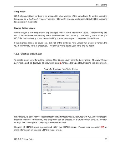
4.5.2. Creating a New Layer<br />
To create a new layer for editing, choose New Vector Layer from the Layer menu. The New Vector<br />
Layer dialog will be displayed as shown in Figure 7. Choose the type of layer (point, line, or polygon).<br />
Figure 7: Creating a New Vector Dialog<br />
Note that Q<strong>GIS</strong> does not yet support creation of 2.5D features (i.e. features with X,Y,Z coordinates) or<br />
measure features. At this time, only shapefiles can be created. In a future version of Q<strong>GIS</strong>, creation<br />
of any OGR or PostgreSQL layer type will be supported.<br />
Creation of GRASS-layers is supported within the GRASS-plugin. Please refer to section 8.7 for<br />
more information on creating GRASS vector layers.<br />
Q<strong>GIS</strong> 0.8 User Guide 33


