PDF 20.134kB - TOBIAS-lib - Universität Tübingen
PDF 20.134kB - TOBIAS-lib - Universität Tübingen
PDF 20.134kB - TOBIAS-lib - Universität Tübingen
Erfolgreiche ePaper selbst erstellen
Machen Sie aus Ihren PDF Publikationen ein blätterbares Flipbook mit unserer einzigartigen Google optimierten e-Paper Software.
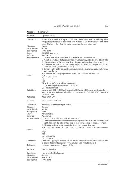
Annex 1. (Continued)<br />
Indicator 7 Openness index<br />
Description Measures the level of integration of new urban areas into the existing urban<br />
compound: percentage of non-urban area within a 1 km buffer zone of new urban<br />
areas. The lower the value, the better integrated the new urban area<br />
Dimension Pattern<br />
Value domain 0–100<br />
Base year(s) 1996–2000<br />
Source CORINE land cover<br />
Software ArcGIS 9.2<br />
Implementation (1) Extract new urban areas from the CORINE land cover data set<br />
(2) Create a new layer that contains the new urban areas, extended by a 1 km buffer<br />
(3) Erase portions of the new layer that intersects with existing urban areas<br />
(4) Calculate the ratio between resulting shapes of (3) and the shapes in (2) as per<br />
formula below (= ‘openness-index’)<br />
(5) Extract centroids for each polygon to avoid double counting of areas that overlap<br />
cell boundaries<br />
(6) Calculate the average openness index for all centroids within a cell<br />
Formula Pn i¼1<br />
P BUAt t1 UA Bt<br />
BUAt t 1<br />
with<br />
BUA: 1 km buffer around new urban area<br />
UA_B: Existing urban area within the buffer<br />
t, t 1: Reference years<br />
Definitions Urban area: CORINE 2000 polygons with CLC code ,200, except mining (code131)<br />
New urban area: Polygons classified as urban area in CORINE 2000, but not in<br />
CORINE 1990<br />
References Angel et al. (2007)<br />
Indicator 8 Share of urbanised land<br />
Description Percentage of urban land per hectare<br />
Dimension Surface<br />
Value domain 0–100<br />
Base year(s) 2004<br />
Source Area statistics<br />
Software ArcGIS 9.2<br />
Implementation (1) Intersect municipalities with 10 · 10 km grid<br />
(2) Apportion urban area attribute to new polygons where municipalities have been<br />
split, based on the ratio of new size of split polygon/size of original polygon<br />
(3) Summarise the urban area statistic for all polygons within a cell<br />
P<br />
(4) Calculate the ratio between the result of (4) and the cell area as per formula below<br />
Formula<br />
UA<br />
CA<br />
with<br />
UA: Urban area<br />
CA: Cell area<br />
Definitions Urban area: aggregate measure for residential, commercial, industrial land and land<br />
in transportation infrastructure (= ‘Siedlungs- und Verkehrsfläche’)<br />
References European Environment Agency (2006a)<br />
Indicator 9 New consumption<br />
Description New urban land in hectares<br />
Dimension Surface<br />
Value domain -600 to 2500<br />
Base year(s) 1996–2004<br />
Journal of Land Use Science 103<br />
(Continued )


