PDF 20.134kB - TOBIAS-lib - Universität Tübingen
PDF 20.134kB - TOBIAS-lib - Universität Tübingen
PDF 20.134kB - TOBIAS-lib - Universität Tübingen
Erfolgreiche ePaper selbst erstellen
Machen Sie aus Ihren PDF Publikationen ein blätterbares Flipbook mit unserer einzigartigen Google optimierten e-Paper Software.
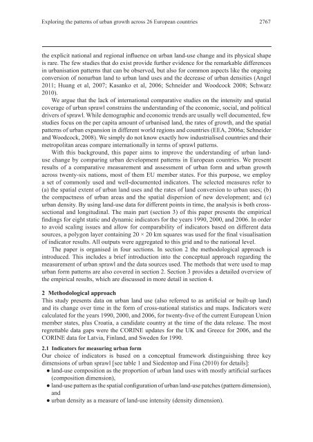
Exploring the patterns of urban growth across 26 European countries 2767<br />
the explicit national and regional in uence on urban land-use change and its physical shape<br />
is rare. The few studies that do exist provide further evidence for the remarkable differences<br />
in urbanisation patterns that can be observed, but also for common aspects like the ongoing<br />
conversion of nonurban land to urban land uses and the decrease of urban densities (Angel<br />
2011; Huang et al, 2007; Kasanko et al, 2006; Schneider and Woodcock 2008; Schwarz<br />
2010).<br />
We argue that the lack of international comparative studies on the intensity and spatial<br />
coverage of urban sprawl constrains the understanding of the economic, social, and political<br />
drivers of sprawl. While demographic and economic trends are usually well documented, few<br />
studies focus on the per capita amount of urbanised land, the rates of growth, and the spatial<br />
patterns of urban expansion in different world regions and countries (EEA, 2006a; Schneider<br />
and Woodcock, 2008). We simply do not know exactly how industrialised countries and their<br />
metropolitan areas compare internationally in terms of sprawl patterns.<br />
With this background, this paper aims to improve the understanding of urban landuse<br />
change by comparing urban development patterns in European countries. We present<br />
results of a comparative measurement and assessment of urban form and urban growth<br />
across twenty-six nations, most of them EU member states. For this purpose, we employ<br />
a set of commonly used and well-documented indicators. The selected measures refer to<br />
(a) the spatial extent of urban land uses and the rates of land conversion to urban uses; (b)<br />
the compactness of urban areas and the spatial dispersion of new development; and (c)<br />
urban density. By using land-use data for different points in time, the analysis is both crosssectional<br />
and longitudinal. The main part (section 3) of this paper presents the empirical<br />
ndings for eight static and dynamic indicators for the years 1990, 2000, and 2006. In order<br />
to avoid scaling issues and allow for comparability of indicators based on different data<br />
sources, a polygon layer containing 20 × 20 km squares was used for the nal visualisation<br />
of indicator results. All outputs were aggregated to this grid and to the national level.<br />
The paper is organised in four sections. In section 2 the methodological approach is<br />
introduced. This includes a brief introduction into the conceptual approach regarding the<br />
measurement of urban sprawl and the data sources used. The methods that were used to map<br />
urban form patterns are also covered in section 2. Section 3 provides a detailed overview of<br />
the empirical results, which are discussed in more detail in section 4.<br />
2 Methodological approach<br />
This study presents data on urban land use (also referred to as arti cial or built-up land)<br />
and its change over time in the form of cross-national statistics and maps. Indicators were<br />
calculated for the years 1990, 2000, and 2006, for twenty- ve of the current European Union<br />
member states, plus Croatia, a candidate country at the time of the data release. The most<br />
regrettable data gaps were the CORINE updates for the UK and Greece for 2006, and the<br />
CORINE data for Latvia, Finland, and Sweden for 1990.<br />
2.1 Indicators for measuring urban form<br />
Our choice of indicators is based on a conceptual framework distinguishing three key<br />
dimensions of urban sprawl [see table 1 and Siedentop and Fina (2010) for details]:<br />
land-use composition as the proportion of urban land uses with mostly arti cial surfaces<br />
(composition dimension),<br />
land-use pattern as the spatial con guration of urban land-use patches (pattern dimension),<br />
and<br />
urban density as a measure of land-use intensity (density dimension).


