Create successful ePaper yourself
Turn your PDF publications into a flip-book with our unique Google optimized e-Paper software.
1693 tephra observed in situ.<br />
[10046] Root mat and topsoil. Moderately compacted very dark brown sandy silt with<br />
occasional natural gravels. Very bioturbated by roots. Munsell: 5YR 2.5/2 Dark<br />
Reddish Brown.<br />
[10047] Turf collapse. Firm mid orangey brown sandy silt mottled with mid reddish<br />
orange and mid greyish brown, with occasional natural gravels and charcoal<br />
flecks. H1693 tephra within turves.<br />
Bioturbated by roots and worms.<br />
Munsell: 2.5YR 3/4 Dark Reddish<br />
Brown.<br />
[10048] Stones of wall.<br />
[10049] Firm mid orangey greyish brown<br />
silt, bioturbated by roots and<br />
worms. Munsell: 7.5YR 4/4<br />
Brown.<br />
[10050] Thick root mat and modern turf<br />
around step of section.<br />
[10051] Topsoil. Firm mid to dark brown<br />
sandy silt with occasional small<br />
natural gravels. Substantial<br />
bioturbation by roots. Same as<br />
[10046]. Munsell: 5YR 2.5/2 Dark<br />
Reddish Brown.<br />
[10052] Firm mid reddish brown silt<br />
bioturbated by roots and worms.<br />
Possibly same as [10049].<br />
Munsell: 7.5YR 2.5/2 Very Dark<br />
Brown.<br />
[10053] Upper horizon of old land surface.<br />
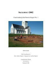
Figure 3. Section of Early Modern ruins in<br />
Trench 38<br />
Firm pale yellowish grey silt with occasional small natural gravels. Munsell:<br />
2.5Y 5/3 Light Olive Brown.<br />
[10054] Lower horizon of old land surface. Firm bright rust orange silt with occasional<br />
natural gravels. Munsell: 5YR 4/6 Yellowish Red.<br />
[10055] Natural old beach terrace. Firm and friable orangey brown sandy silt with very<br />
frequent natural gravels of all sizes. Munsell: 7.5YR 4/3.<br />
Trench 39<br />
Around 15 m south of Trench 37, a small mound approximately 5 m wide by 2 m high was<br />
identified during the GPS contour survey conducted by Óskar Gísli Sveinbjarnarson and<br />
Robert Milek (see map Figure 1). A 1 x 2 m trench was excavated to the western side of<br />
this mound where the sloping side seemed most pronounced. This area also displayed a<br />
distinct change in vegetation from the Field Horsetail (Equisetum arvense) which<br />
dominates this area of the homefield to a patch of Meadow Foxtail (Alopecurus pratensis),<br />
which could potentially indicate a change in soil thickness or drainage, and as such a ruin<br />
or feature. Immediately below the topsoil was an ashy modern midden deposit [10056],<br />
containing charcoal, peat ash and wood ash. This layer produced many finds, including<br />
72